Good morning. Before jumping in to the forecast, which should be a little bit drier in the days ahead before a wet weekend, I wanted to share a couple of housekeeping notes.
- I recently joined the popular Houston Moms blog to discuss hurricane season and preparedness. You can watch parts one and two of the video.
- Michael Hardy wrote a profile of me and Space City Weather for Texas Monthly that was published on Tuesday. It provides a great overview of why I got into this business, and the philosophy Matt and I have toward communicating weather information.
Wednesday
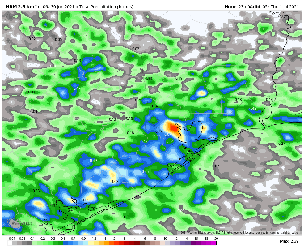
The Houston area radar is more calm this morning, but I still anticipate scattered to widespread shower activity to develop later today. Rain is most likely south of Interstate 10 this morning before spreading further inland this afternoon. With less moisture available, I think most of Houston will see 0 to 0.5 inch of rain today, but we could see a few bullseyes of 1 to 2 inches closer to the coast. Winds will be light out of the east, and with partly sunny skies high temperatures should reach 90 degrees, or the low 90s, later today.

Thursday and Friday
If we’re going to see lots of sunshine, and lower rain chances, these are the days this week. That’s not to say it won’t rain in Houston on Thursday and Friday, but most of us probably won’t see any rain, or if we do, accumulations should not go beyond a tenth of an inch or so. As a result, these days will be warmer, with highs in the low to mid-90s. Enjoy the sunshine, because the pattern will turn stormier this weekend.
Saturday and Sunday
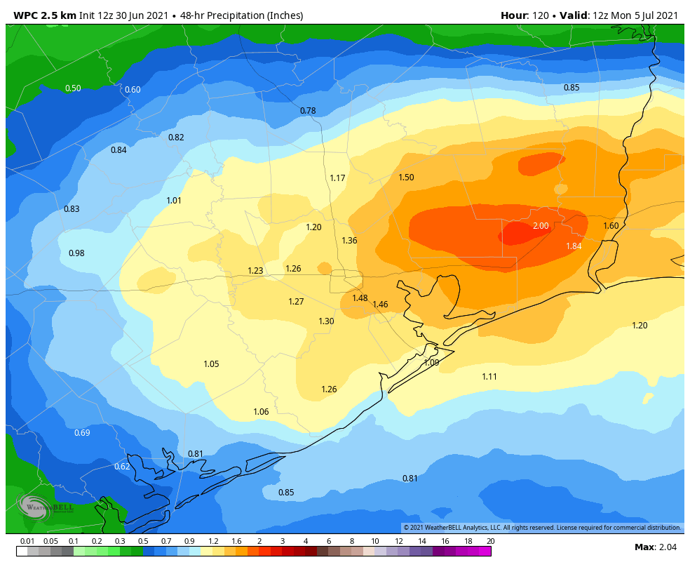
By Friday night or Saturday morning, a weak cool front—no, it won’t bring much in the way of cooling—will approach and likely stall over our region. The effect of this will be to draw moisture from the Gulf of Mexico inland, and set up the potential for slow-moving showers. The details remain to be worked out, but we can probably expect accumulations of 1 to 3 inches this weekend, with higher isolated totals. Rain chances will be decent overnight as well, so I would not feel entirely confident about fireworks chances on July Fourth. Highs will be in the upper 80s to 90 degrees. The bottom line: If you have outdoor plans this weekend, have an indoor backup plan.

Next week
The stalled front should remain in the vicinity of Houston through about Monday, but the atmosphere remains unsettled after this. If anything the potential for rain increases from Monday through about Wednesday, and overall I think our region may see on the order of 5 to 7 inches of rain from now through the middle of next week, if not more. Again, the details on this are to come, but it’s something we’ll be covering closely. Conditions may finally turn sunnier and hotter by Thursday or Friday, but no promises from us.
Tropics
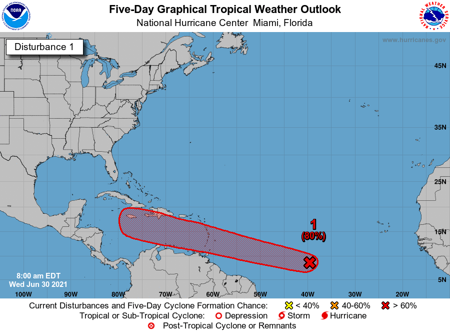
Matt provided a good rundown of the tropics on Tuesday, and we’re continuing to watch the development of Invest 97L. This morning, the National Hurricane Center has upgraded its chance of becoming a tropical storm or depression within the next five days to 80 percent.

The most likely scenario remains that this system eventually succumbs to a hostile environment in the Caribbean Sea this weekend, but we can’t rule out something making it into the Gulf of Mexico next week. For now, my money is on Invest 97L petering out, but we’ll continue to track it for you.
Love your website though the app needs work. No rain percentages just pics are not very helpful.
Forecast isn’t loading in app. Does anyone know the correct setting to save forecast? I’ve tried one week not that. Default same issue. Guess I’ll try two weeks.
If Invest 97L is going to track over the remnants of Invest 95L, does that help or hinder the formation of the potential storm? Or does it not affect it at all?
I still cotton to this website and still love the forecasts. Side benefit: no squinting into a phone needed.
Don’t use the app as all I want from SCW is the webpage. I do appreciate all the hard work that went into the app, though.
Is it possible that 95L would assist the development of 97L by taking the brunt of shear and dry air ahead of it? Marco and Laura of last year come to mind…
Love the Texas Monthly article, Eric! Glad to see you (and Matt) getting well-deserved recognition.
Very nice profile in Texas Monthly!