Good morning. Lows have only fallen into the 60s this morning, and with moisture returning from the Gulf of Mexico we are setting up for the possibility of rain showers for the next few days.
TODAY
With moisture comes clouds, so we’ll see mostly cloudy conditions today, and likely only scattered rain. Highs will climb into the mid- to upper-70s.
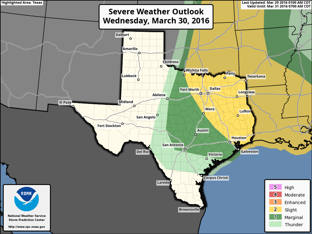
WEDNESDAY
The arrival of an upper-level system on Wednesday could bring more severe weather. The concern isn’t so much heavy rain, as I don’t think most areas will get more than a few tenths of an inch of rain, if that. However there will be enough energy to produce some strong thunderstorms, and Houston has been placed into a “slight” chance of severe weather by NOAA’s Storm Prediction Center. Conditions for storms will likely be most favorable during the afternoon and early evening hours. Highs will be near 80 degrees.
THURSDAY
A cold front arrives on Thursday, likely by or before sunset, and this will allow for a continued chance of rain, and keep our skies mostly cloudy. Highs near 80 degrees will fall to around 60 degrees by late Thursday night.
FRIDAY and SATURDAY
We should see clearing skies for both days, although enough instability will remain in the upper levels of the atmosphere to allow for a stray shower. But for the most part we’ll see mostly sunny skies, highs in the mid- to low-70s, and lows in the 50s. Very nice weather for golf or basketball, depending upon your pleasure.
SUNDAY
The beautiful weather continues, with highs in the 70s and lows in the 50s, and lots of sunshine.
Love, Love, LOVE this weather (except for the thunderstorms, of course). What a glorious time to live in Houston!