It’s a pretty blah morning across the region as mist and light showers and muggy air hang over the region. And that’s just how it’s going to be.
TODAY
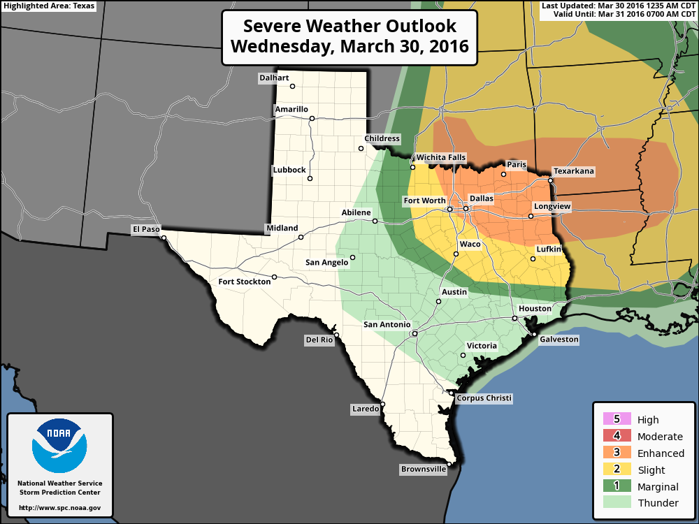
An upper level storm system will move into Texas today, bringing with it a chance of severe weather. Right now the most favorable area of hail and damaging winds is well to the north of Houston, but we can probably still expect to see a few thunderstorms in the metro area during this afternoon and early evening hours. Otherwise we’ll continue to see warm (about 80 degrees) and misty conditions.
THURSDAY
Temperatures will only fall to around 70 degrees on Thursday morning—icky for sure. We’ll continue to see more or less the same warm and misty conditions through the day on Thursday before a cold front finally arrives sometime during the evening or late hours.
FRIDAY
We’ll see some sunshine on Friday, but we can’t rule out a few more showers as well as moisture persists in the upper levels of the atmosphere. Highs will fall into the mid-70s, and lows should reach the 50s.
SATURDAY and SUNDAY
All of this gloomy, muggy weather should at last relent just in time for the weekend. Expect to see a couple of partly to mostly sunny days, with highs in the 70s and lows in the 50s. Conditions will be very, very nice.
NEXT WEEK
The cooler and drier weather should persist for at least the first couple of days next week before a warming trend persists.
There’s nothing showing on my radar app, yet it’s raining outside.