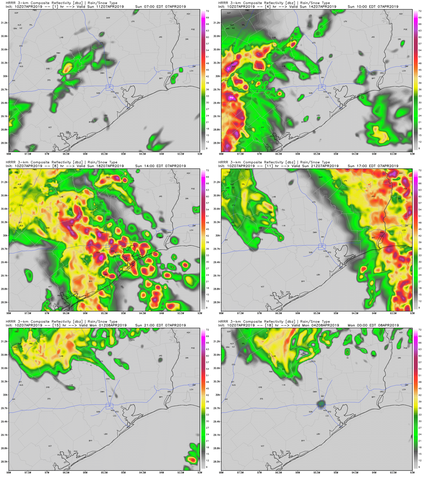
We’ve talked about the potential for storms this weekend for several days—and today that forecast will finally come to pass. A large squall complex of showers and thunderstorms has developed over South Texas, and we can be confident that this will move to the northeast, toward the Houston metro area.
The primary threats from this system will be damaging winds, hail, and the potential for a few tornadoes. Rainfall rates will be high within these thunderstorms, but fortunately the system should be moving fairly rapidly. This will limit rain accumulations for most of the region to 1- 2 inches today. The following forecast, from the HRRR model, indicates the main line of storms should move through between 11am CT and 4pm CT. If you have outdoor plans at that time please have a strategy to take shelter quickly.

After the main line of storms we’ll see some drier air eventually move into the region. However we can’t rule out a chance of showers on Monday before sunny skies dominate our weather for the rest of the work week.

Looks like I will be swimming to the ‘Stros game…..
Our flight is supposed to come in at 310 into Hobby. Do you anticipate the storm warning to continue past 3?
There could be brief delays to flights that back yours up a bit. I don’t think they will last too long, however, due to the fast-moving nature of the storms.
Thanks Eric for the quick heads-up!
I have an outdoor event at 530 p.m. in Bellaire…. think it’ll be okay by then? Not sure what to do.
Abc13 is saying winds up to 60mph. Does that sound Accurate?
I’d love ranges for wind forecasts. Damaging winds is a very vague term. Are we talking widespread hurricane force trees uprooting?