We’ve got some active weather ahead this weekend, so let’s jump in and tell you everything we know right now.
Today
Right off the bat, if you have plans today, we do not foresee any serious issues. But (there’s always a “but”) that said, areas of fog have developed this morning across the entire area.
The fog inland should gradually lift this morning, but it could persist along the coast well into this afternoon. Dense fog advisories are posted until 9 AM inland and until Noon at the coast. We’ll be partly to mostly cloudy and warm otherwise today. Highs should approach at least 80 degrees, if not the low-80s.
Tonight
For Houston, we don’t anticipate anything significant tonight, though a few showers or thunderstorms could develop after midnight, primarily north of I-10 and west of I-45, particularly out toward Sealy or Columbus up through Brenham or College Station. And even then, I really don’t think it would be anything other than very isolated through early Saturday morning. Look for low temperatures to only drop into the upper-60s.
In addition to an isolated shower or storm, fog should redevelop along the coast, possibly spreading inland again, though it shouldn’t be quite as widespread as today.

Saturday and Sunday
Unfortunately, weather modeling remains as befuddled today in terms of specifics for this weekend as it has been the last couple days. However, a few points of increased confidence are slowly emerging. I will try a Q&A method to explain our weekend.
I have outdoor plans. When does the rain look worst? Models have been all over the place on timing and orientation of rain this weekend, but a common theme seems to have emerged now: There are really only modest rain chances during the day Saturday, increasing somewhat as the day progresses, mostly north and west of the Houston area. There are high rain chances late Saturday night into Sunday. And then rain chances begin to steadily drop off later Sunday afternoon and evening. So earlier in the weekend is probably better for outdoor activities. But unfortunately, we cannot guarantee any specific period will be totally void of rain.
Ok, so tell me more about the “where.” Who is going to see the worst of the rain? Again, we have issues in terms of models placing the heaviest rain. But based on everything I’ve looked at, I would say the best chance on Saturday will be outside of Houston along US-290 toward College Station and Brenham, west on I-10 toward Columbus, and north on I-45 toward Huntsville. Generally, the farther south and east you are Saturday, the less your chance of storms and rain. Confidence in this part of the forecast has increased and is now probably “near average.”
On early Sunday morning, those higher rain chances creep more into the Houston metro area. Late Sunday afternoon and evening sees the higher rain chances shift south along the coast and east into Louisiana. Confidence in this part of the forecast has not changed much and would still be considered “low.”
So how much rain are we talking here? In general, all of us will probably see at least a half-inch to an inch of rain between now and Sunday evening.
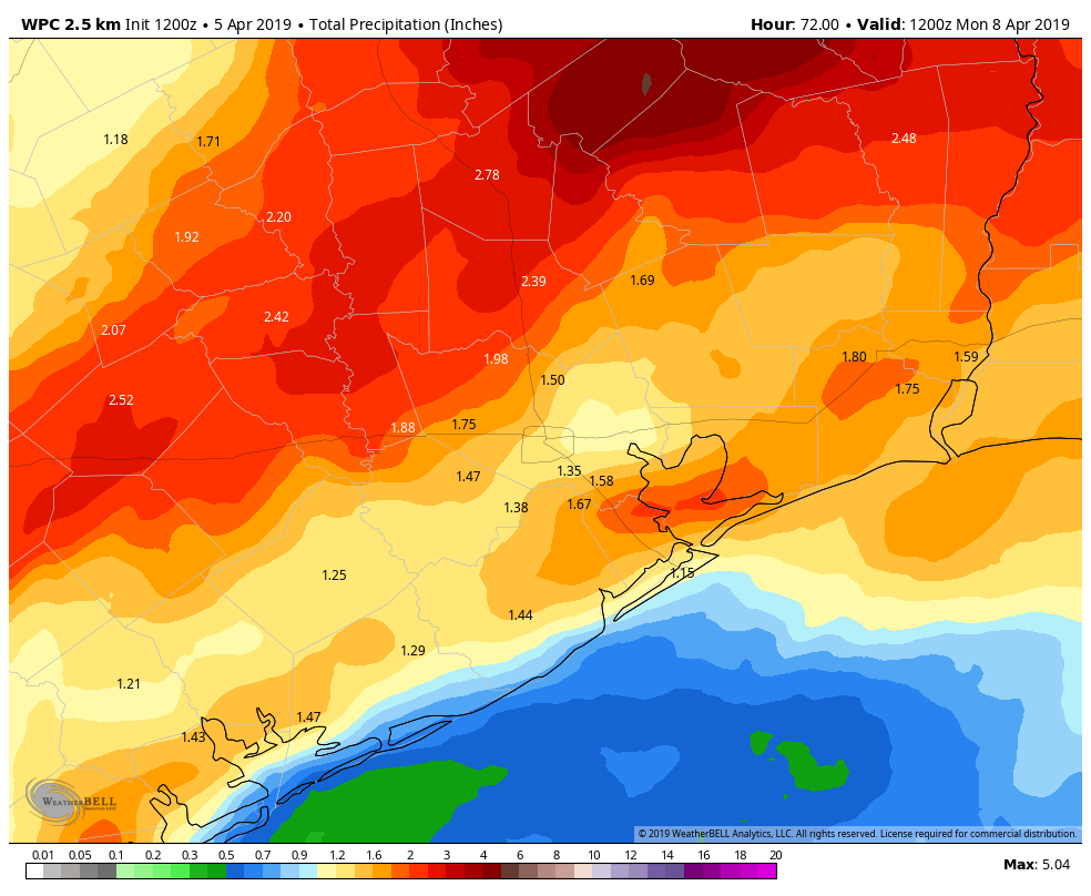
So we will start with that base. A healthy chunk of the region should see in the one to two inch range, as outlined on the map above. But the wild cards are always those isolated pockets where repetitive, training thunderstorms occur. Those locations could see as much as 3-6″ of rainfall, much of it falling in a relatively short time. And those would be the areas most susceptible to street flooding (see below).
You guys sure sound like you’re hedging a lot here. Is that normal? Unfortunately, especially in the spring and summer months, we often know there are days with a good chance of storms. In this case, we know Saturday has a good chance for storms north and west and Sunday has a good chance around Houston, spreading east. But our ability to determine exactly where and when the heaviest will fall is contingent on a number of small-scale features (boundaries that form from thunderstorms, sea breezes, winds, trajectory of upper level “triggers,” etc.) that no weather model can consistently resolve with any degree of accuracy outside of a day or so in advance. We have guidance, but the science is not there yet to consistently give you more than 12-18 hours of lead time on where and when the worst will be. So we’re not overly hedging; we’re just being honest. Southeast Texas thunderstorms are difficult to pin down with specificity more than a day in advance. Unfortunately, it’s just part of the reality of living and forecasting here.
Do I have to worry about flooding? Widespread, significant flooding is not especially likely with this setup. We’ve seen much “juicier” rainfall setups in the past, and as we’ve pointed out in this blog, it has been rather dry of late. But that doesn’t mean we would rule it out. In this scenario, I think areas of street flooding will be the most likely outcome. Some places will just see a little heavy rain. But a few other areas could see repeating, training thunderstorms or multiple rounds of storms Saturday and Sunday. Urban areas and those places hit multiple times this weekend are the ones we will watch closest for potential street flooding. We think bayous and creeks can handle what’s coming without too much issue, but as always in Houston, we will be watching closely just to make sure.
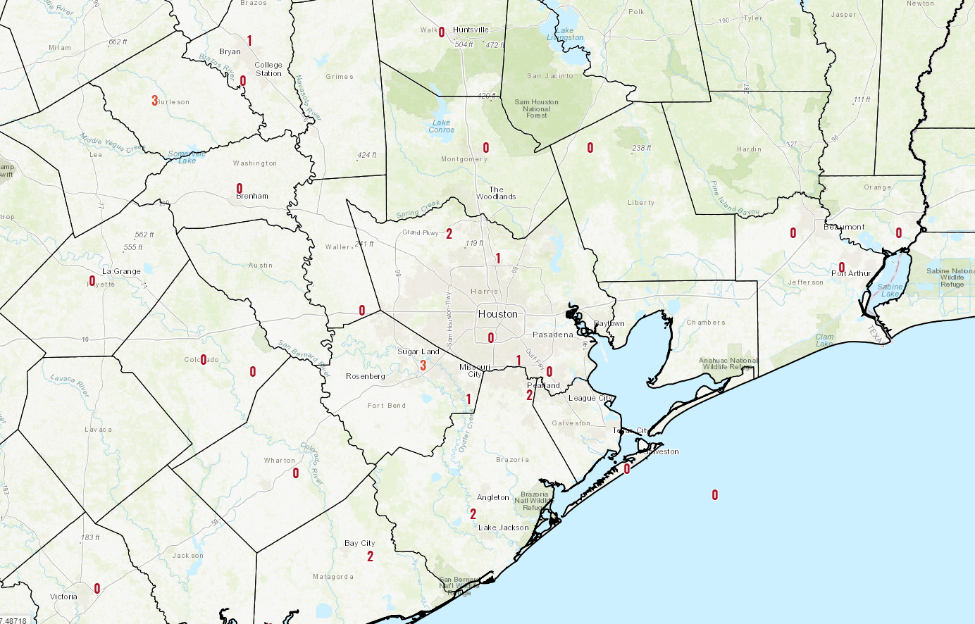
Do I have to worry about tornadoes? All of East Texas is under a “slight risk” (level 2/5) for severe weather on both Saturday and Sunday.

Like rain, the chances are highest north and west Saturday and more into Houston and East Texas Sunday. I personally think that significant severe weather is unlikely, but a few storms Saturday and Sunday will be capable of producing hail and/or damaging winds. The tornado threat is almost never zero in Texas in these types of storms, but the chance of one at any given location is very, very low. Wind is probably the top severe weather concern in this setup, followed by hail, and then tornadoes.
So after all this, should I cancel my outdoor plans? Definitely one of the more popular questions we get (that and airport delays). We can’t make that decision for you, but this Q&A should provide you a guide to work with. Just to summarize: The best chance of storms on Saturday is north and west of Houston and on Sunday in and around Houston and east. But rain chances are not quite zero at any point this weekend anywhere. So you’re going to have to use your best judgment to determine how to proceed. Eric and I will try and update you again tomorrow sometime with fresh information.
Next Week
The weather quiets down Sunday night, though we could see some fog Monday morning. But next week really looks quiet. Temperatures look seasonably warm, with highs generally in the 80s and lows in the upper-50s and low-60s. In general, we will see a slow warming trend as the week progresses. It will be humid, but not oppressively so until at least Thursday. We may have another decent, mostly dry-looking cold front later in the week that could deliver us some rather cool air by the weekend, but details on it remain very much TBD at this time. We will have more on Monday.
Might be an impossible question. Am looking into adding solar panels to my house, south facing slope. These depend on sunlight. Do you think Apr and May will be really cloudy? Trying to calc best installation time, or to do it at all.
Woulndn’t it be best to install in the cool months when the installers will be more comfortable on the roof… and more likely to do it right?
On a similar thought as Thad’s, I track the weather at our offices around the country and it appears that almost all of the US is covered in clouds today. Is this common this time of year or just an anomaly that we are all under a soggy, foggy, cloudy blanket?
Thank you Matt! I hopped on the site from my hotel room this morning in Florida so I could get weather info for my flight home to Houston today. It’ll be good to be home!
Grammar note. “Further” used for process. “Farther” used for distance. Thus, you are “farther south” not “further south.” You are not “additionally south” and you don’t “go fur.”
Ryan, can you help us out with insure vs. ensure vs. assure? Always have a hard time insuring, assuring, ensuring, I use the right word! 😎
Appreciate the info. It’s a grammar rule I am well aware of and have been for years, but every so often it accidentally slips. Just part of being imperfect!
Matt is a wise man.
Proverbs 9:8–9 (ESV):
Do not reprove a fool, or he will hate you;
reprove a wise man, and he will love you.
Give instruction to a wise man, and he will be still wiser; teach a righteous man, and he will increase in learning.
Any forecast on wind speeds?
Is this the sort of setup that could get us one of those mega-godzilla rainfalls, where a few inches are predicted, but after the storms “park” themselves above Houston, we get three times as much (like Tax Day 2016)?
It is around that time of year.
I’ve already tried to account for that by saying some areas could see upwards of 3-6″ in a relatively short time. Max I have seen printed on any given model run has been about 6″ and most likely well north of Houston. So we’re trying to avoid having people be surprised here. But this setup does not appear to be anything remotely like a Tax Day type setup, so I wouldn’t worry about that. As always though, these systems can be fickle, so it’s good to be aware and paying attention to the weather this weekend.
But…but….but… I need to know PRECISELY if it will rain within 3.837 meters of 30° 10′ 39″ N, 95° 30′ 14″ W between 5:01:29 PM and 5:13:02 PM on Saturday!! (pant, pant, pant) If so my life will be ruined becuase my daughter won’t be able to make our BBQ and my wife will be upset. (pant, pant, pant) And do I need to cancel my flight and evacuate to Shreveport? (ARRGHHH!!)
LOVE your snarkey humor Blackhawks Fan!
Any updates today? Trying to figure out if I should move my kids party inside tomorrow morning… we’ll be in the montrose/upper Kirby area 😬