We’ve had a number of really, really nice spring days in recent weeks. And expect us to get another one today. Let’s get to it.
Colorado State Hurricane Outlook
First, I want to just touch on a report released yesterday from the tropical weather research group at Colorado State University. The CSU team produces one of the most widely used and anticipated seasonal hurricane outlooks for the Atlantic. Their forecast for this year calls for below normal activity in the Atlantic basin.
Slightly below-normal Atlantic hurricane season forecast by @ColoradoStateU team: 11 TCs, 4 hurricanes, 2 major. https://t.co/zgmcs8RYSR pic.twitter.com/a65jFVmcBz
— Philip Klotzbach (@philklotzbach) April 6, 2017
They’re going with 11 storms, four hurricanes, and two major hurricanes for the 2017 season. Recall that last year saw 15 named storms, seven hurricanes, and four major (Category 3 or stronger) hurricanes. Last year’s CSU April forecast called for 12/5/2 in that order. This year will be challenging with risks of another El Nino developing and some uncertainty as to what the ocean temperature profiles in the Atlantic Ocean will look like during the peak of the season. We’ve been in an active period of Atlantic hurricanes since 1995, and there are questions as to how much longer that will last. They will monitor these variables and update their forecast in early June.
Klotzbach’s team also helps put together landfall probabilities by county. You can examine the details yourself, but in the interest of ease, they give a 3.7% probability of one or more named storms making landfall in Galveston County, compared to a 4.3% chance historically in any given year. Texas as a whole has a 38.2% chance using their methodology, compared to a climatological average of 43.3% that a named storm will make landfall. In a nutshell: Slightly lower than normal odds for a landfall than in an average season.
Use hurricane outlooks with caution
There’s a BIG caveat here. Remember, seasonal hurricane outlooks are primarily an academic exercise. Operationally and for most of you, they don’t matter. If we have two storms in the Atlantic all season and one is category 4 that plows into Galveston, it was a below normal season but an awfully bad one for a lot of people. They’ve become a curiosity we need to share, and the group at Colorado State does really good and ultimately important research. But you should ignore this forecast and go ahead and think about preparing for hurricane season anyway.
(Space City Weather is sponsored this month by The Mole, a Jonathon Price novel.)
Today through Sunday
On to the forecast. We have no weather issues that will impact your weekend plans. <Applause>. There may be a few extra high clouds floating by at times today, but otherwise, it will be sunny.

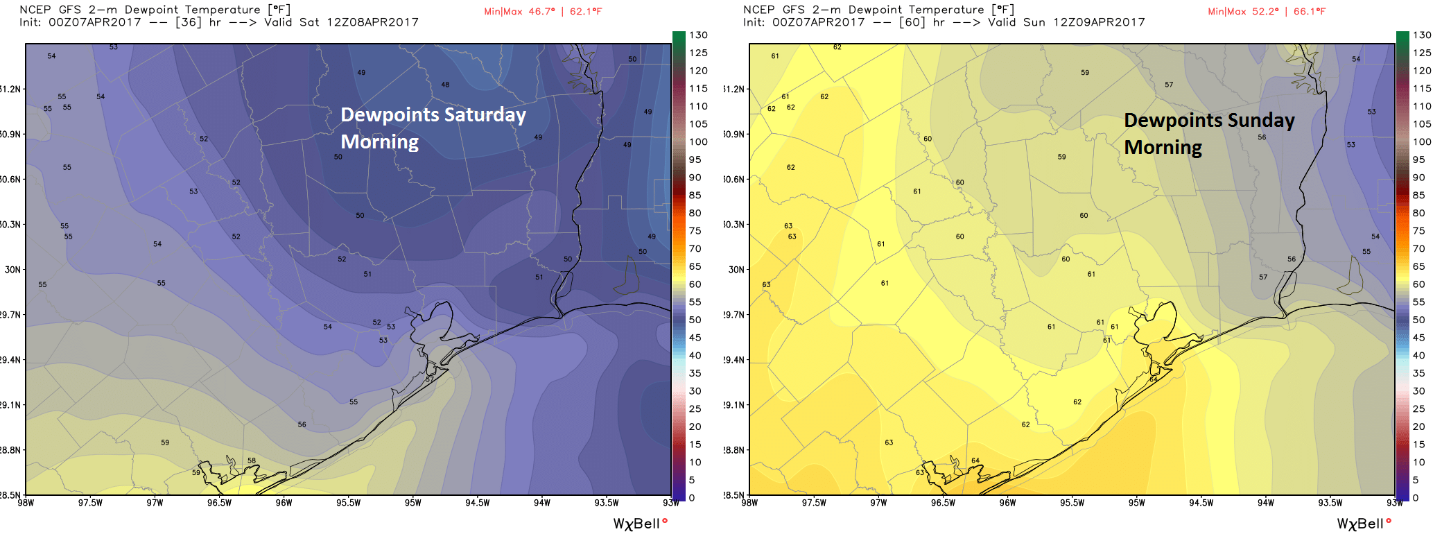
Temperatures will remain pleasant and humidity comfortable. Expect highs in the upper 70s this afternoon. On Saturday, we’ll have a pleasant morning again, though it will be a few degrees warmer than it has been lately. We’ll start in the upper 50s in Houston (cooler outside) and finish in the low 80s. Sunshine dominates once more. You will notice the humidity ticking up Saturday as onshore flow returns. Sunday will feel more like a mid-spring day. Temps will peak in the low to mid 80s after starting in the mid 60s. Sunshine will gradually yield to a few more clouds.

But it’s a fantastic first weekend of Astros baseball, with hopefully an open roof (Sunday may be a bit warm for it). If you’re heading to the Houston Barbecue Festival or the Art Car Parade, it looks fantastic also. This spring has thus far begun on a much better footing than the last two springs.
Next Week
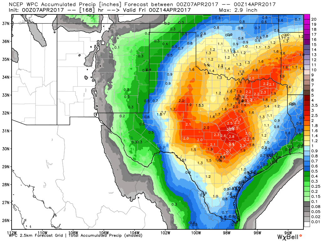
Beautiful weather can’t last forever unfortunately. And it appears we’ll take a step backwards next week with an increasing shower and thunderstorm chance. I think the last two springs have gotten a lot of us anxious whenever there are any storm chances in the forecast. The good news is that what is coming next week looks pretty standard for spring here. The details are still a bit murky this far out, but isolated to scattered thunderstorms will be possible several days next week, with the most persistent storms staying in Central Texas.

Put more simply: The odds of any of us seeing storms on any given day are fairly low. So this isn’t an “everyone is going to get slammed” setup; rather it’s more of a “hit or miss storms each day” type setup. Nothing I’d be too worked up about. We’ll have more on this for you next week. I think temperatures will remain normal to a bit warm for early to mid spring, with highs in the lower 80s and lows in the 60s.
Posted at 6:45 AM by Matt
I would think 3.7% vs. 4.3% is statistically insignificant.
Therefore :
normal hurricane year = don’t worry but be prepared and have a plan.
Texas as a whole has a 38% chance of getting a named storm. Those odds are pretty high. Effects such as flooding rains can be far reaching. So as you said, we must not let down our guard. Think about what you would do without power and ability to go to get food. Keep a box of peanut butter crackers/flashlight/radio handy. Amazing how many people don’t even have battery powered radio.
I mean, I suppose someone in SE Texas could see a strong or severe storm, but it’s going to be very much the exception, not the rule. I’m just not impressed with the setup locally next week.
I have a battery powered radio. It’s called an iPhone.