It’s a beautiful fall-like morning across Houston, with lows in the lower 50s for northern parts of Houston, mid- to upper-50s for much of the rest of the area, and lows even in the upper 60s closer to the coast. Alas, it is not going to last.
Today
We’re going to have one more pretty nice day. Highs today should only reach around 85 degrees, with lows falling into the 60s for most of the Houston area. Drier air will keep humidity levels down. Unfortunately the winds are going to shift back out of the south later today, spelling the return of warmer, more humid weather.
Tuesday
This returning moisture could lead to the development of a few showers on Tuesday, most likely along the coast. Highs under partly cloud skies should remain in the mid-80s, with overnight lows likely back around 70 degrees by Tuesday night.
Wednesday through Friday
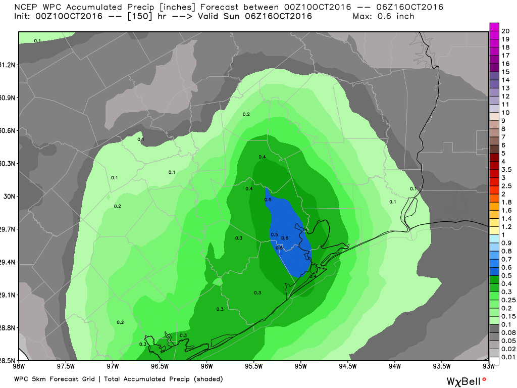
Did you miss summer? Because it’s coming back, sort of, with a southerly flow off the Gulf of Mexico. Unfortunately we’re not going to see a return of the rainfall we saw during much of the summer, because that is something we need.

Expect highs most days during the rest of the work week to be in the upper 80s, and I would not rule out a 90-degree day or two in there, either. There will be some chance of scattered rainfall, but there’s no real forcing mechanism so I’m not expecting widespread showers. Lows should only fall to around 70 degrees, or into the lower 70s.
This weekend and beyond
Conditions aren’t likely to change much by this weekend. Some of the models suggest an upper-level storm system might bring increased rain chances by later on Friday or Saturday, but I’m not buying that scenario just yet. For now it looks like we’ll remain in a summer-lite pattern through the weekend with only scattered showers.
When might we see some more fall-like relief? I hate to say it, but it looks like after today we’re not going to see any more dry air for 7 to 10 days. It may be all the way through the end of next week before the next front, probably a stronger one, arrives. Please don’t kill the messenger, although I’m pretty disappointed myself.
Posted at 6:45am CT on Monday by Eric
All I can say is UHGGG!!!
After a week in Vermont this is painful news
Eric,
Are we looking at La Nina conditions this winter?
Joyce
Hopefully cool, dry, with severe clear for Wings Over Houston the 22nd and 23rd!
But, but, but Eric you said last week we were seeing the last of the 90 degree days. What the heck happened?
I said we were probably done, and climatologically we’re normally beyond them by now. But a fairly strong ridge of high pressure happened.
Thanks for the update. We’ll just have to wait a bit longer. Not unusual.
BTW, from a meteorologist’s point of view, any final thoughts on Matthew?
Terrible hurricane for Cuba and Haiti. Florida really, really got lucky because the storm remained just off shore, and the rains in the Carolinas were historic. (Also there was way way too much hype about the storm making a loop and spinning back up to hit Florida again).