In brief: Sunshine, and more sunshine is in the forecast for Houston with slowly rising temperatures expected through next Monday. By then we’ll be in at least the low-90s before the next cool front pushes through. There is some rain in the forecast, but alas it remains more than a week away.
Thursday and Friday
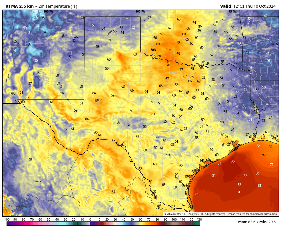
We’ll see a pair of sunny days with high temperatures around 90 degrees for much of the metro area. Winds will be generally light, from the northeast and east. Dewpoints will remain on the lower side, such that the air remains fairly dry on both days, so quite pleasant despite the warmer temperatures. Overnight lows will drop into the mid-60s for much of Houston, with warmer conditions right along the coast and slightly cooler ones for inland areas.
Saturday, Sunday and Monday
As the onshore flow gets rolling, temperatures and humidity levels will go up slightly for the weekend, which includes Columbus Day on Monday. Highs will be around 90 degrees, or a bit higher on Saturday, rising into at least the lower 90s by Monday. A few areas may even see highs in the mid-90s. Overnight lows will rise into the upper 60s for most. We’ll continue to see almost fully sunny skies, with rising humidity levels. So yeah, late summer comes roaring back for a brief appearance.
The rest of next week
A nice front is in the cards for some time on Tuesday, and this should cool our weather down for the rest of next week. I think we’ll probably see highs around 80 degrees, and lows in the 50s for much of the metro area, although the precise details are yet to be determined. There’s no rain in the cards for the front, but forecast models indicate that could finally change by Friday or Saturday of next week, as some clouds return and moisture levels in the atmosphere increase.
Tropics
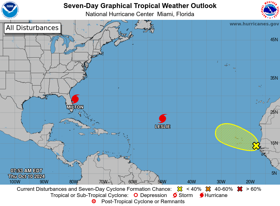
Hurricane Milton struck, and traversed the state of Florida on Wednesday night. The storm’s center passed just far enough south of Tampa Bay to prevent a catastrophic surge there, but the impacts to the Sunshine state will nonetheless be enormous. This is the third hurricane to strike Florida this summer. Beyond Milton there are no threats to land, thankfully.

The GFS keeps showing something trying to form down there in Caribbean. Can you talk about that?
Nothing to discuss. The NHC is not anticipating any development in the Carribean or Gulf over the next seven days.
Thanks Eric!
You’re welcome Bob!
The NHC uses the GFS. We could be seeing something soon.
What I am seeing is some kind of low pressure system in the western Caribbean around the 17th meandering around and eventually moving into the southern Gulf, still meandering.
Mid 90’s this late in October is something to talk about. Hopefully that’s the last of them.
Just like yesterday, another nice cool morning walk here in Magnolia. It was 56°F when we left around 7am.
What we need now is some rain, so hoping it does so next week.
I think that after next week’s “cold snap”, rain is not useful and is more a nuisance. The flora be headed off to bed.
You are a nuisance.
Please don’t get personal on this site. Ok? What I’m saying is I have been hoping for rain since July. Now it seems to be too late. Maybe the palms will like more rain.
We need rain!!! The air is as dry as a bone, the ground is rock hard, the vegetation is reeling and the foundations are groaning. WE NEED RAIN:NOW!!!
Have a Snickers.
That’s incredibly mature.
Thank you for your wonderful work. We voted yesterday! Hope you win ‘Houstanian of the year’
Also, thank you for educating all the ‘Social Media Scientists’ the truth about cloud seeding☺️