In brief: Hot, humid weather stays in Houston through Sunday before a return to a much stormier weather pattern Sunday night through Tuesday. Heavy rain is a good bet, along with the potential for some flash flooding during that time.
Yesterday was 93° here in Houston. Just a reminder to folks, especially with so many added events happening across town due to the World Cup: Stay hydrated (with water) and wear sunscreen. Early season heat is always a bit extra stressful on the body because we have not entirely acclimated to it yet. And with a lot of people doing a lot of not-typical early summer things, it can weigh on you. We just want to add in that note to remind folks of that as summer makes itself comfortable here.
Today & Saturday
Much like we’ve seen the last couple days, you may run into an isolated downpour at any point during the day. Nothing organized is expected to impact the area, but you may want to have an umbrella at the ready, just in case. We’re probably looking at about 91 to 93 degrees both days for highs.
Sunday
Deep tropical moisture will begin to pool over Texas later tomorrow and then especially Sunday and Monday. As these moisture levels increase, so too should the coverage of showers.
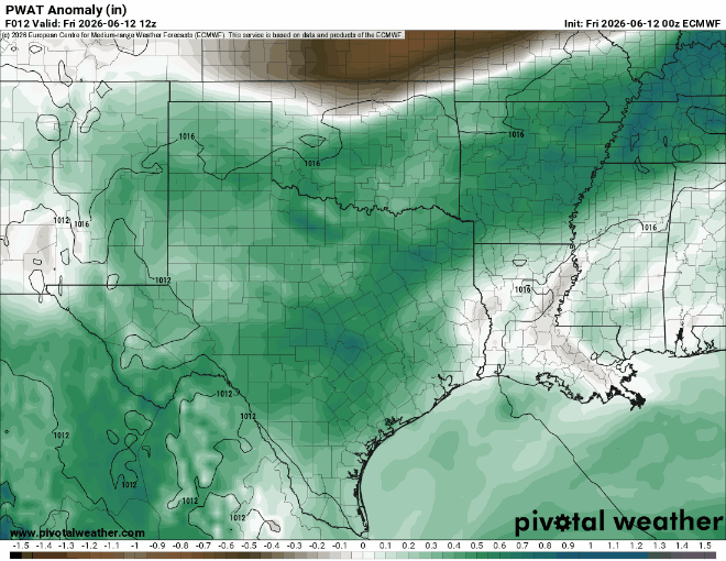
We don’t expect much of anything organized Sunday, but there will probably be somewhat greater coverage of downpours across the area. For those attending Germany vs. Curaçao or taking part in any of the festivities around town, just have an umbrella handy. Highs will be near 90 degrees.
Sunday night through Tuesday
The combination of tropical moisture off the Gulf, as well as an approaching “cool” front is likely going to lead to an outbreak of numerous downpours and thunderstorms across Texas, including in the Houston area. Our region has already been placed under a slight risk (level 2/4) for excessive rainfall and flooding risk for Monday.
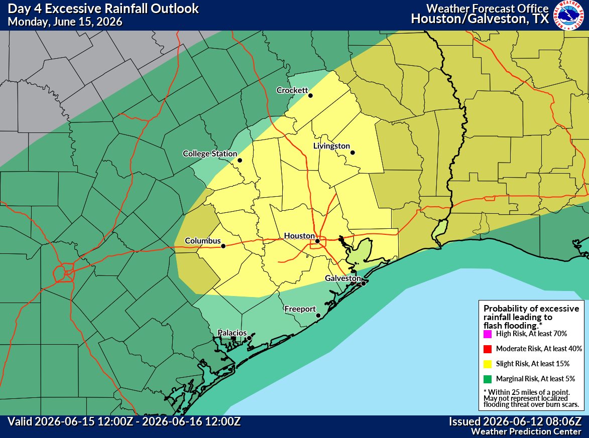
Most areas should pick up a solid 1 to 2 inches of rain from this. We do expect there to be pockets of higher totals right now, above and beyond 3 to 4 inches, but it’s tough to say exactly where those are most likely. (Here? Louisiana? Both?) But this is something we will watch and update you on Sunday about. I would expect us to probably issue a Stage 1 or 2 flood alert, but we’ll see what the data shows through Sunday. Manageable but perhaps an inconvenience at times.
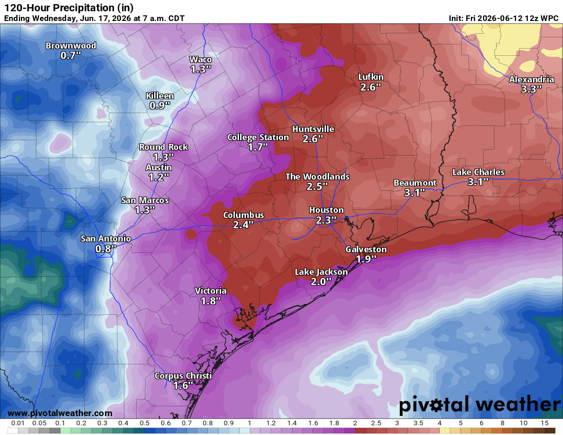
Either way, expect Monday to be close to a washout and perhaps Tuesday as well. Temperatures will struggle mightily as a result, with highs probably only in the mid-80s at best on those days.
Rest of next week
We should begin to dry out from the heavier rains Wednesday and Thursday, but the pattern still looks a bit unsettled. Temperatures should begin to warm up again, back to the low-90s by the weekend.
