Houston had less than an ideal weekend, with storms Friday night and into Saturday morning, a gray day Saturday, and with skies only beginning to clear on Sunday afternoon. I’m sorry to say that next weekend doesn’t look ideal for outdoor activities either—although I wouldn’t bet on a total washout just yet.
Monday
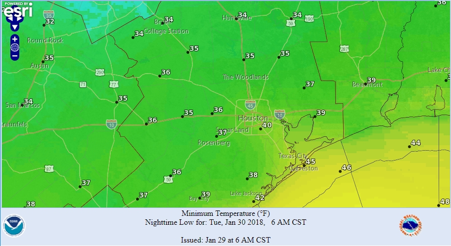
It’s chilly out this morning, with lows ranging from the upper 30s up north to around 50 degrees right along the coast. A reinforcing cold front will move into Houston today, likely before noon, and along with this we’ll see noticeably stronger northerly winds. This will bring drier, cooler air into the region. Expect highs in the mid-60s and sunny skies, with overnight lows tonight in the upper 30s to lower 40s for most of the Houston region. A freeze is possible for far northern Houston.

Tuesday
A cool winter day with a high only of about 60 degrees under sunny skies. Overnight lows Tuesday night will be a few degrees warmer than Monday as winds shift from the northeast to the southeast.
Wednesday
A pretty nice day. Moisture levels begin to return, but we’ll still see mostly sunny skies, and highs should climb to about 70 degrees for most of the area.
Thursday
Ok, confidence is pretty high for the first half of the week. After that? It’s less clear. Thursday morning will be warmer, with lows only falling into the 50s for Houston, and then highs will probably climb into the low 70s before a cold front arrives during the day. Expect some light, perhaps misty rain with or after the front on Thursday evening, but nothing too heavy.
Friday through Sunday
The global forecast models are struggling with how to handle the evolution of some large high and low pressure systems over the Pacific Ocean and Western United States this week, and that in turn leads to uncertainty about conditions over Texas.
Thursday’s front should knock highs back into the 50s for Friday and Saturday, but how cold it gets at night depends on the amount of cloud cover, and it’s possible we never really clear out after the front. (We won’t get near a freeze, regardless). Anyway, I don’t have much confidence in rainfall predictions for the weekend, but I think there’s a good chance of mostly cloudy skies from Friday through the weekend, with anywhere from a smattering of rain to on-again, off-again showers that bring 1 to 2 inches to the area. Hopefully we get some clarity about the forecast in a day or two.

Thank you for reporting the weather with such honesty. I love that you do not try to predict what you are not sure of.
I have never followed weather reports on a regular basis until I found yours.
This weather is sooooooo much nicer and more comfortable than what we suffer through most of the year. I’ll gladly take it and wish for more.
What does the forecast hold for the super blue blood moon on Wednesday night?
So long as you’re certain we’ll have a weekend, I’m willing to wait to learn what the weather will be. 🙂
Any thoughts on freezing/sub freezing weather here in the near future?
Eric, at the end of last week there was some discussion of another brutal arctic blast at the end of the first week of February. Is that still possible?
Love the forecast. You guys should definitely be placed in charge of the weather here. Now, can you do something about the summers?
Is there any tracking/forecasting pressure? Specifically drops in pressure? Or is that something that’s simply collected real time? Is there a resource for this online somewhere?
I’m also curious about the moon mid-week… will cloud cover allow for nice viewing??