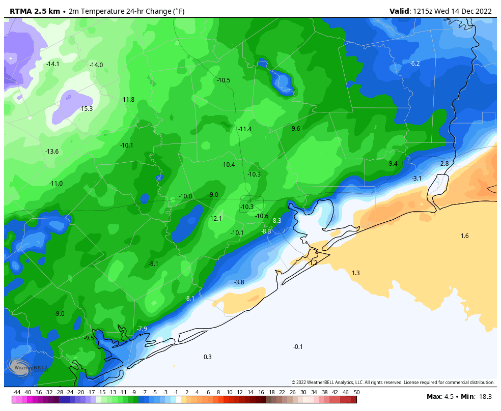
The much-anticipated cool front finally rolled into Houston during the overnight hours. If you live along the coast, hold on, as the drier air is almost there. We’re also seeing some showers this morning as the front passes. They’re now primarily along the Interstate 69/Highway 59 corridor or further south, and they should continue to move down toward the coast. The bulk of this activity will be offshore by around 10 am. And so ends the warmest 10-day period December I can remember living through in Houston.
We’re still wrestling with several questions with the forecast. One of them is how cold it will get this weekend, as I think there’s a chance some far inland areas could see their first freeze of the season on Sunday morning. We’re also tracking the potential for a couple of inches of rainfall on Monday, and of course, just how cold it is going to get in Houston just ahead of the Christmas holiday. I think a light freeze, at least, is in the cards for most of the area. Will it get colder than that? Possibly. Will it snow? I’m still ballparking about a 10 percent chance for that, but ’tis the season.

Wednesday
As showers work their way down to the coast, we’re going to see clearing skies moving into the Houston area. I expect most of us will be seeing sunshine by early this afternoon, allowing high temperatures to remain in the low- to mid-60s. Winds will be out of the northwest at 10 to 15 mph, or so. But temperatures will fall off pretty quickly this evening, as winds die down. With clear skies I think most of Houston will drop into the low- to mid-40s.
Thursday and Friday
As I’ve been writing for awhile, these two days should be splendid examples of wintertime weather in Houston. Look for mostly sunny skies and highs in the low 60s. Overnight lows drop into the low- to mid-40s. Some clouds will start to return Friday afternoon or evening as moisture starts pooling inland from the Gulf of Mexico.
Saturday and Sunday
We’re going to see a chilly weekend, with highs on both days likely in the mid- to upper-50s. Saturday looks to be partly cloudy, but we should see some clearing by Saturday night and on Sunday. Conditions are supportive of temperatures bottoming out on Sunday morning, when I could see much of the Houston metro area dropping into the upper 30s, with colder conditions further inland. Both weekend days will see a slight chance of rainfall, but at this point I’m leaning toward high pressure winning out, and keeping most shower activity offshore.
Monday
Well, kids, I’m sorry. The first official day of Winter Break looks fairly wet as high pressure scoots off and is replaced by ample moisture from the Gulf of Mexico. I think the area is likely to pick up 1 to 2 inches of rainfall, with higher isolated totals, as the atmosphere lifts in response to an upper-level low. The air will be a tad muggier, and I expect high temperatures to reach the low 60s.
The rest of Christmas week
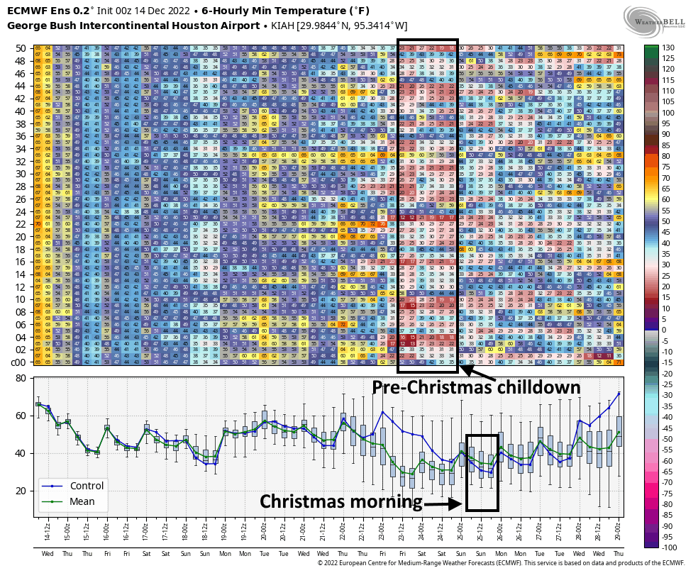
So what happens after Monday’s deluge? Rain chances look to back off on Monday night and Tuesday, but maybe not fade away entirely. We’ll see. The next couple of days look to be of the variety where we see partly sunny skies, with highs in the 60s, and lows in the 40s. Pencil that in for now. At some point—Thursday, the 23rd of December, maybe?—we’re likely to start seeing an influx of much colder, Arctic air. Still to be determined is how much of this colder air is modified or shunted east, and how much dives all the way down to the Gulf Coast.

We’re still talking about a forecast 8 to 10 days from now so, you know, it’s basically blindfolds and crayons at this point. But the vast majority of our model guidance suggests a light freeze for Houston, at least, with the possibility of some lows in the 20s. I don’t think extreme, power-sapping cold is in the cards, but it’s not something I’m ready to rule out. As always, the details of the forecast, including the chance of wintry precipitation, will come into clearer focus the closer we get.
But hey, you wanted it to feel like Christmas, right? Sometimes wishes do come true.
Thursday is the 22nd!
Love your humor!
Yay!!!! Just give me cold for Christmas Eve and Christmas Day and then you can have all the summer temps you want!!!
After an warm start, I’m glad to see December simmer down into a more seasonal range. The shorts and t-shirts can take a break, get a thorough washing, and be ready to go again soon.
And, to echo another commenter: I love the humor built into the writeup! “Blindfolds and crayons” for the win.
Cool ensemble 📊
The temps are finally tolerable. I can now walk outside in shorts and a t-shirt and not get sweaty!
1). December 24, 1983, at about 5:45 P.M., temperatures were in about the 20s Fahrenheit and gusts from the north. The low for Christmas morning dropped to 11° F.
2). I remember jogging a couple of Christmas morning in about 1990 and 1992. One day had light snow flurries and the second day may have had light snow buildup along the street sidewalks.
3). I do not remember a December “heatwave” like this since first paying attention to weather in 1966.
Last year was the warmest December ever. It was in the 80s most of the month.
Thanks for the chuckle this am. You need to trade mark that “blindfolds and crayons” line ! Have a lovely day !
Is it too late to put in a request for 1-2″ of snow?
I think it was Christmas Eve 2004(?) when all of the magical atmospheric ingredients aligned for some snowfall that night. If I recall, the forecast was calling for a a cold, dry night and a slug of moisture moved over the area. I remember throwing snowballs after church service. Great memories. It can happen again!