Good afternoon. Tropical Depression 14 formed late this morning from the disturbance previously dubbed Invest 97L. This is the primary system we will watch over the next few days as it moves toward the Gulf. Here’s a brief rundown of what we know and, more importantly what we don’t know.
Now
Tropical Depression 14 is located east of Honduras and south of Cuba over the western Caribbean Sea.
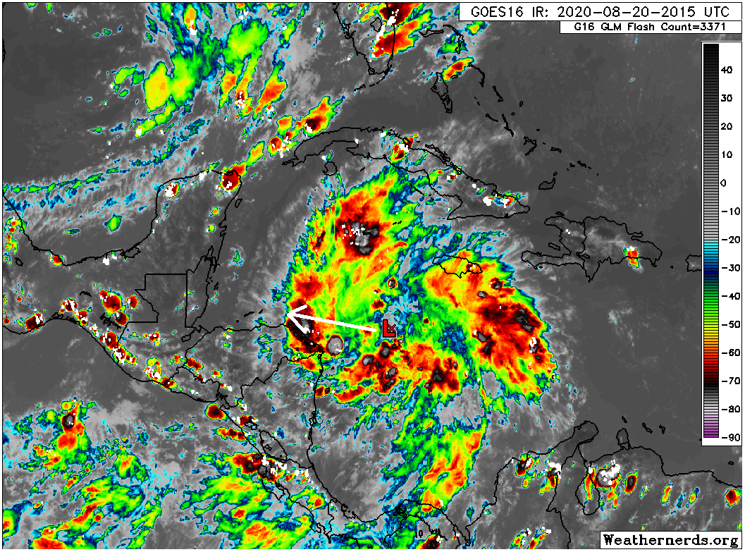
It’s basically what you would expect from a tropical depression: sort of messy, but with numerous storms both east and west of the center, so it’s not terribly asymmetrical.
The latest forecast from the National Hurricane Center has the system moving into the Gulf and remaining a tropical storm through early next week.
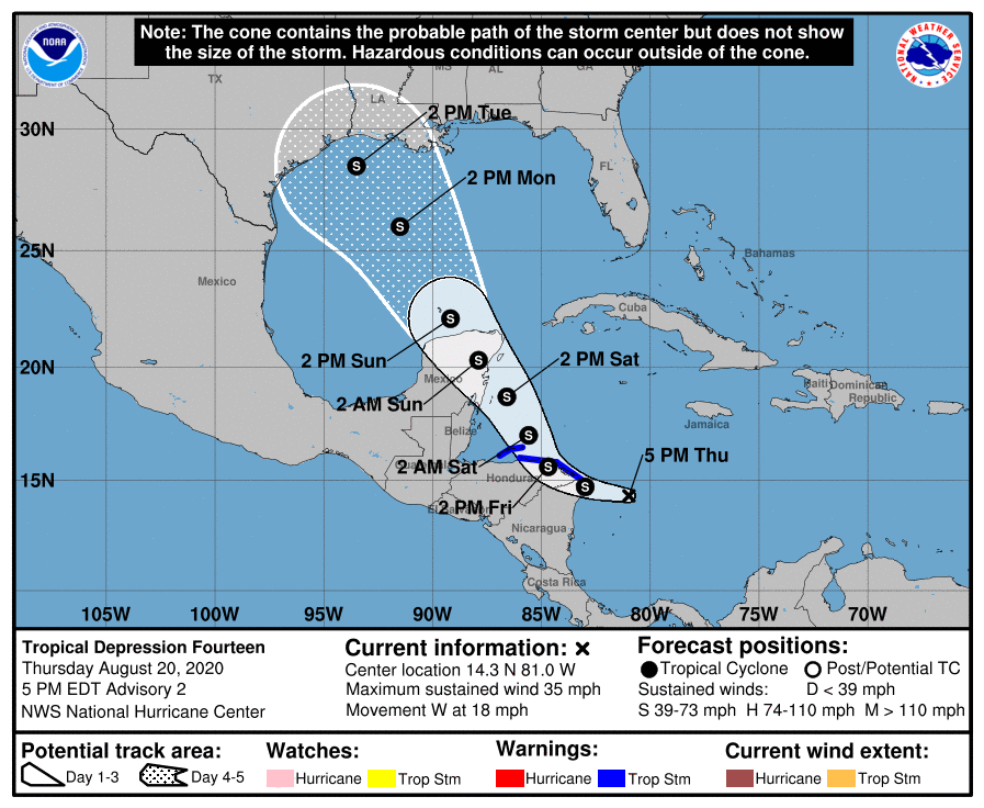
It’s important to note that while a “center line” points this right at Houston, the cone is the cone for a reason. The storm may track well to our east or well to our southwest. Our impacts here in Houston would vary considerably based on that, so this map should not be considered a license to panic or to write it off entirely.
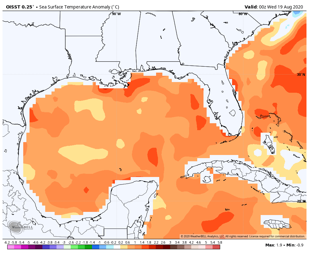
Over the next two days, TD 14 will enter an environment that’s pretty conducive for strengthening. Shear will continue to relax. As it moves toward the Yucatan Peninsula of Mexico, look for this to intensify into a tropical storm and possibly a hurricane. Water temperatures in the western Caribbean are more than supportive of strengthening.
Once it gets to the Yucatan and beyond, the questions begin to mount quickly.
Here is what we know:
We know that TD 14 should move across the northeastern part of the Yucatan Sunday morning. We know it will likely be at least a tropical storm. We know it will be pulled north by a trough over the South and nudged west by the Bermuda high as it expands westward across Florida. We know that if impacts occur in Houston, they would likely begin Monday night or Tuesday.
Here is what we don’t know:
We do not know where TD 14 will ultimately end up and how strong it will be when it gets there. I know this makes you throw your hands up in the air in frustration, but those are the realities.
We do not know how much wind shear TD 14 will encounter over the Gulf. As the trough over the South weakens and pulls out, there will be some wind shear left behind. If that ends up over the Gulf, that will help mitigate TD 14’s ultimate strength. If that wind shear goes north as the storm comes north, then we need to watch for TD 14 to intensify more significantly.
We also don’t even fully know how much land interaction TD 14 will have near Honduras and Mexico. The latest advisory suggests TD 14 is farther south than originally thought, so that is something that could ultimately impact the system.
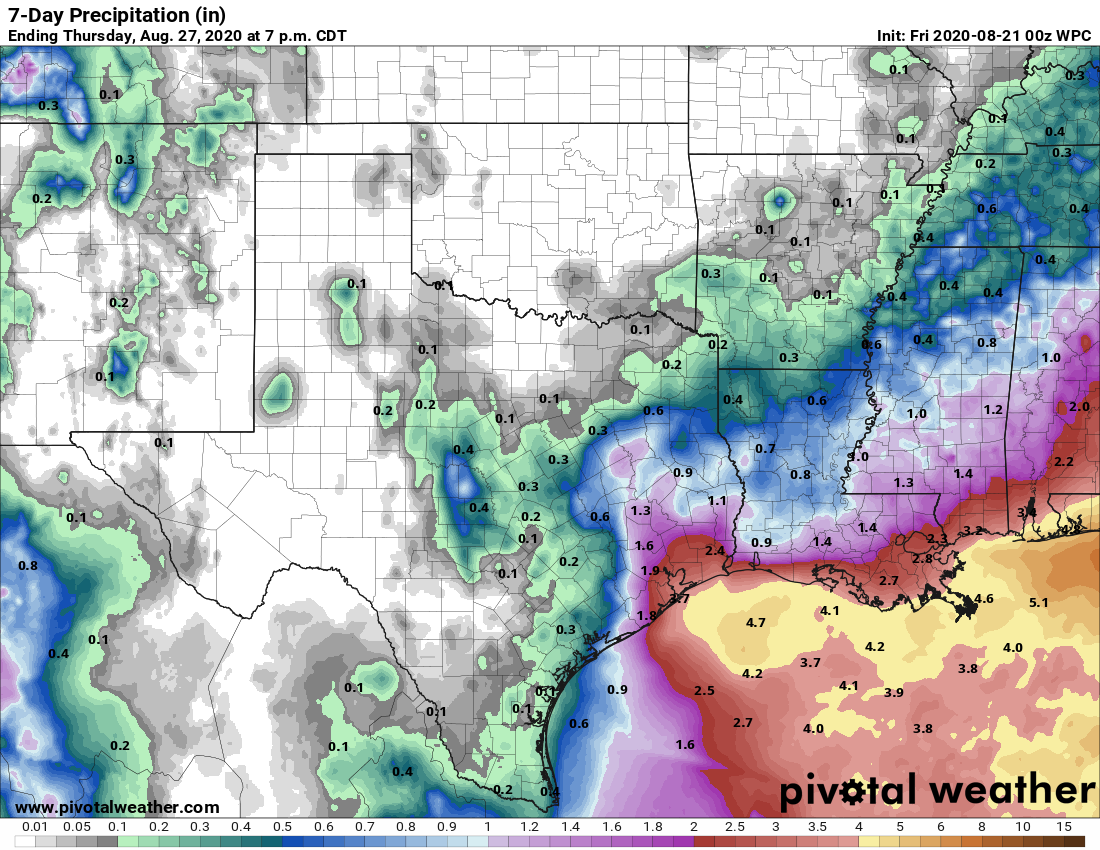
We don’t know how much rainfall we will see, as it will depend on how organized TD 14 becomes and exactly where it goes.
We don’t know how TD 13 may impact what happens with TD 14, so there’s a good deal of uncertainty there.
More ambiguous things we can say:
A stronger storm would likely go to our east, whereas a weaker one would come closer to us. But weaker does not necessarily mean “weak,” so keep that in mind.
We do not expect a stall/Harvey scenario at this time or even an Imelda one but we are not entirely sure how things will play out. Flooding is possible in any tropical system, so we cannot rule any sort of flooding out right now.
We should be able to narrow the cone a bit in the morning, and we should know a lot more later tomorrow and Saturday morning. So stay tuned.

Can you comment on the likelihood of the Fujiwara Effect coming into play here as TD 14 and TD 13 get within 1,000 miles of each other this weekend?
There are too many uncertainties right now. As I note, we don’t know how 13 will influence 14 or vice versa. Until we get a better read on what 13 ends up doing, I don’t want to speculate on how the interplay will go. It’s just far, far too soon, except to say it’s possible.
As usual thank you for sound report. Although it is full of uncertainty until it gets closer. I really appreciate it.
How far inland is this expected to go? Would Austin be safe?
Austin would most likely be fine. But there’s a good chance it will be fine in Katy too so, don’t make any serious decisions just yet if you can wait.
Thanks for being clear and blunt on what we know and what we don’t know, as unsatisfying as that might be to some. This no-nonsense approach is why I love this site.
Thanks Matt! I look forward to your next update! Thank you for all you do!
My new mini generator just arrived and is charging. Live in an apt and experienced a power outage (blown transmitter) that lasted more than 15 hrs during the last little storm. I thought, oh dear, hurricanes, and ordered. Thanks for the update.
Thank you, as always, Matt, for your straightforward analysis. Much appreciated. – Sid Sperry
You mentioned that the latest advisory suggests that TD 14 is further south than originally thought. How does this affect the system
It could interact with the coast of Honduras a bit more than originally expected, which could disrupt it for a time. It also means there’s a better chance it may spend more time over the Yucatan as it comes north. Both of those would help cap its intensity, at least initially. But you take what you can get.
Thank you for the clear and easy to understand reporting on this storm. Is it possible to know quite a bit more about this storm by Saturday around 10am. We are making decisions on an event in Houston next tues-thur and an update by Saturday for us would be helfpul