Given the weather events of the last couple of days—a hurricane making landfall in Louisiana, high temperatures in the low- to mid-90s across Houston—you’d be forgiven if you thought the calendar read mid-August, rather than mid-October. However a pair of fronts this week will remind us that we’re heading deeper into fall.
Monday
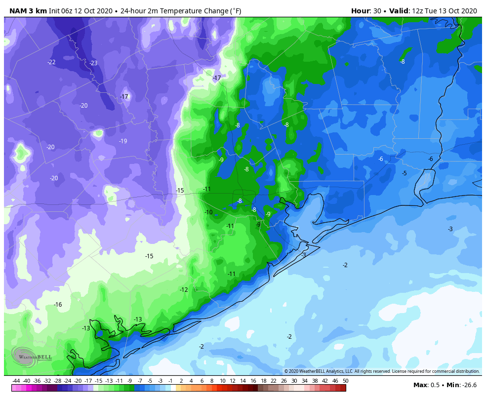
It is rather warm and muggy this morning, with lows only on the mid-70s across the region, and sweaty dewpoints to match. With the exception of areas far to our northwest, such as College Station, a cold front will not arrive in time to modify our high temperatures today, which should reach around 90 degrees.
However, the arrival of this weak front later today in Houston should bring drier air into the region overnight, allowing for lows to generally drop into the upper 60s. There will be a slight chance of rain showers with the frontal passage later this afternoon or evening along the coast. Although the front will be most noticeable west of Interstate 45, it is now expected to make it all the way off the coast.
Tuesday
This should be a pleasant day, with dry air, highs in the mid-80s. Winds will be light, out of the north or northeast. Lows Tuesday night should drop into the low- to mid-60s. Skies will be clear.
Wednesday and Thursday
These will be a pair of slightly warmer, and more humid days while we await this week’s second front—due to arrive later on Thursday. Highs likely will be in the mid- to upper-80s, and there’s perhaps a 30 percent chance of rain on Thursday afternoon or evening as the front blows through. This will be a stronger front that will bring noticeably cooler weather for the weekend.
Friday
We expect to see mostly sunny skies, with highs perhaps only in the low 70s. Lows Friday night should be the coolest of the week, with temperatures possibly dropping into the 40s for areas well inland, and the 50s for most of Houston.

Saturday and Sunday
We’re expecting a sunny weekend, with highs in the mid-70s to 80 degrees. The onshore flow may return by Sunday, or we may get yet another front—as of yet there is not great agreement on that in the global models.

Any more tropical systems we should be looking out for?
Good news is that the fronts sweep the tropical systems away. As long as they keep coming, we should be fine.
So this weekend I get to see if the windows will actually open after being shut tight all summer. Yeah!
Early October and we still have warm and muggy. No other place but Houston.
Unless you were in a Louisiana swamp. So, I guess that’s the good news – I’m not in a Louisiana swamp. Meow.
Did College Station move? I have it to the northwest. -)
low 50s and upper 40s is too cool, about 65 is perfect.
Thanks for keeping us informed!
Hi Matt and Eric. Our daughter in Cypress told us you guys are her go-to weather guys, and now she has us hooked too…even though we live in Corpus Christi. Good job, especially with the storm updates!
What about that disturbance in the Atlantic? Please comment about that on Tuesday.
Am I crazy or have we been short on rain lately? We got over a foot of rain from Beta and in hindsight, it was very much welcomed rain. My papaya tree uneasily echos my observations