Good morning. Houston has clearly moved into a summer-like pattern of weather, and our weather won’t change much over the next several days. And we probably won’t change too much next week, unless an area of disturbed weather in the tropics migrates to the north. We’ll discuss that possibility below.
Today
There may be a few spotty showers across central and eastern portions of Houston today, but for the most part a building ridge of high pressure should shut rain chances down for the area. Look for mostly sunny skies with high temperatures in the low 90s.
Friday and Saturday
Warm and sunny, with highs in the low- to mid-90s, and overnight lows around 80 degrees.
Sunday through Tuesday
The high pressure that will largely dominate our weather from now through Saturday or so may slip away to the north by Sunday, opening up the possibility of some isolated or scattered showers during the daytime. Temperatures will be warm when it’s not raining, with highs likely rising into the mid-90s. That will be new for us, as the warmest it’s gotten so far this year has been 93 degrees (twice).
Wednesday and beyond
To some extent our weather during this period will be driven by a large tropical system now in the western Caribbean Sea and moving toward the Yucatan Peninsula. The National Hurricane Center has given this system a 50 percent chance of developing into a tropical depression or storm over the next five days.
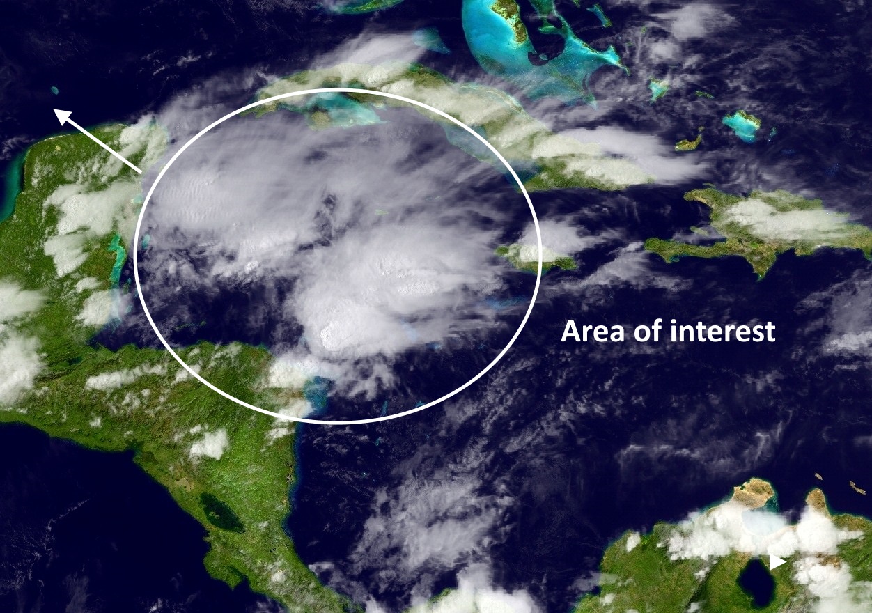
All of the usual caveats apply here: it’s difficult to forecast a track before a system forms, and overall confidence in forecasting the genesis of storms is low. But what does seem fairly clear is that over the next few days a tropical blob of some sort will move into the southern or southwestern Gulf of Mexico.
There is little indication that it will strengthen into any kind of significant hurricane, but it does have the potential to deliver a large amount of moisture. Right now it seems most likely the bulk of the moisture will remain south of the upper Texas coast, due to a ridge of high pressure in the middle and upper levels of the atmosphere. However we just don’t know, so we’re going to have to pay attention to tropics, because the second half of next week could end up being quite wet.
Posted at 7:55am CT on Thursday by Eric
Oh I hope this storm steers clear of us I know we could use the rain but my dear Fulgencio is already shaking fearing the worst of the floods
I live in Katy, should I start making evacuation plans now?
Sorry, I can’t help myself…