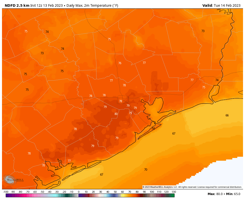
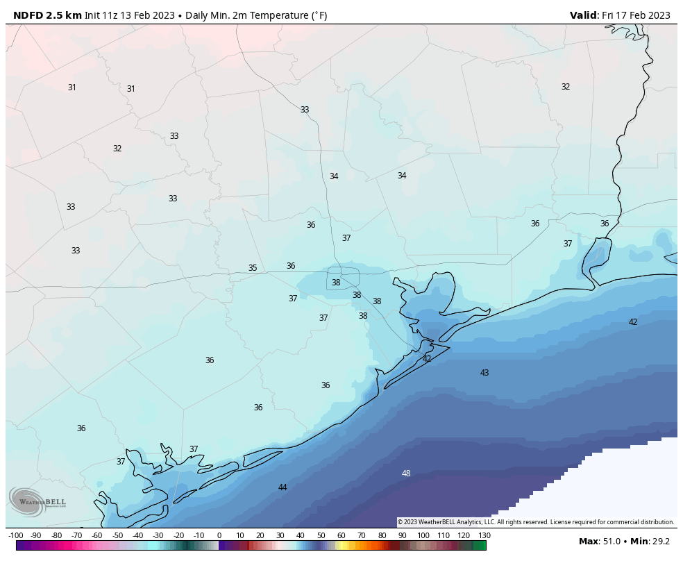
This week’s weather could be titled, “A Tale of Two Fronts.” The first will be rather weak and inconsequential—except for some rather blustery wind—and the second will bring in substantially colder air. While I don’t think a freeze is in the cards for the Houston metro area later this week, I’m not entirely ready to rule it out. Along the way we may also see a smattering of rainfall.
Monday
After a chilly weekend, warmer weather is on the way. Southerly winds today along with partly to mostly sunny skies will help raise temperatures into the low 70s. Look for winds out of the south at 5 to 10 mph, becoming stronger tonight with gusts of 20 to 25 mph. As clouds blanket the region later this afternoon and onward, overnight lows will only drop to around 60 degrees.

Tuesday
This will be sort of a weird day with an oddball front. Winds are going to be really strong, mainly from the south, early Tuesday ahead of the front. We could see gusts of up to 35 or even 40 mph. Some scattered showers are possible as the front moves through during the morning hours. While a thunderstorm or two is possible, for the most part I think we’re looking a brief, short-lived showers with the front. After it moves through we’ll see clearing skies, and because this air mass is not all that cold, temperatures likely will actually go up with the sunshine and moderately drier air. Accordingly, much of the region will probably see highs near 80 degrees on Tuesday afternoon. Overnight lows will drop into the mid-50s Tuesday night, with warmer conditions near the coast.
Wednesday
Tuesday’s front will wash out rather quickly, replaced by a southerly flow. This means Wednesday will be warm and mostly cloudy, with highs again around 80 degrees for most of the area. Winds should be fairly pronounced, out of the south. The week’s second, and much stronger, cold front should arrive on Wednesday night. This will bring another smattering of rain chances, and an influx of drier air by Thursday morning.
Thursday
Thursday looks breezy and colder, with highs perhaps of around 60 degrees to go along with mostly cloudy skies. Any rains should end during the morning hours. As skies clear out some Thursday night, look for lows to drop into the upper 30s in the Houston metro area.

Friday and Saturday
These look like a pair of partly sunny and cooler days, with highs in the 50s. Friday night should drop into the 30s again, with Saturday night a few degrees warmer.
Sunday
The second half of the weekend should see the resumption of a warmer, southerly flow. Look for highs of around 70 degrees, with a mix of sunshine and clouds. Rain chances are not entirely zero, but they’re pretty low despite the return of Gulf moisture.
Next week
The crystal ball starts to get cloudy by this point, but we should see a few warmer days to start next week before some sort of front moves into the area. Some showers will probably return to the area early next week as well, but I’m not seeing anything to write home about.


Spring can’t get here soon enough. 😫
It will be here in a little over a month.
We should look at these cooler temps as a chance to give the AC a rest and maintenance period. Your wallet should also enjoy the break.
Plus, it actually feels okay to be walking/running/exercising outside – we fool all the out-of-towners that it is always like this year-round and sucker them into moving here.
Any more on the polar vortex collapse?
I don’t mind the cold.. but you can keep the bluster.
The up and down every few days is also a bit tiresome.
Hey team…what’s up with the air quality? One of the apps shows our AQ numbers and they are crazy high. Some sort of inversion that’s trapping particles? (And I obviously don’t know what I’m talking about…haha)
I know there was a chemical leak in Katy over the weekend, I have been looking around today trying to figure out the same. I came here hoping there would be answers or others asking the same thing, jumping on the bandwagon for your question about AQI today.
Looking forward to the cold weather again this week. Last few days have been unbearable swamp weather.