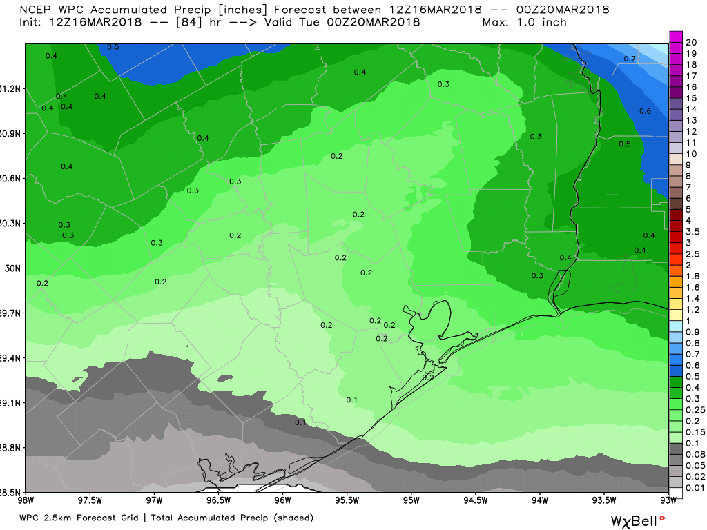
As we head into the weekend, rain chances will be with us most of the time. Truthfully, while we can’t tell you exactly when and where it’s going to rain, the weekend should be peppered with plenty of dry periods. More on that in a second.
But we actually could use a bit of rain. We finished about two to three inches above normal in February, but the combination of a small deficit in January and over an inch deficit so far in March means we’re close to average for this point in the year. When you consider the autumn rainfall deficit we had, we’re certainly not in bad shape but it could be better.

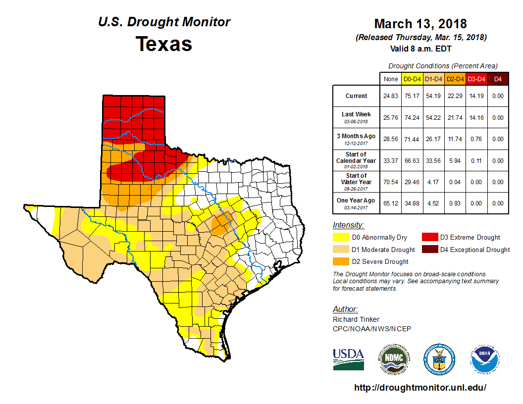
The Drought Monitor update from yesterday shows that about 54% of Texas is in drought now, with almost 15% (all in the Panhandle region) in extreme drought. In the Houston area, we’re technically drought-free, but you don’t have to go too far west to hit moderate drought. With rainfall over the next 10 days probably averaging at or below normal, we should see moderate drought slowly begin to creep back in on the outskirts of our area by the end of March. We’ll see how it goes, but a little rain would not be a bad thing right now.
On to the forecast.
Today
Cloud cover is in firm control this morning, and it will stay mainly cloudy through the day today. Rain chances will be with us basically all day, but there’s a big caveat here: It’s probably not going to be too bad in Houston. We’ll have some light rain showers or drizzle around this morning. We’ll have a few more showers or a rogue thunderstorm nearby this afternoon. But the best odds for some steadier rainfall will be east of Houston. So the way I’m characterizing today is a few showers or some pockets of light rain, but no need to cancel plans or anything. Temperatures will ramp up to around or above 80 degrees this afternoon.
Weekend
The weekend remains a bit of a tricky outlook, but I feel okay about saying it probably won’t be too bad. Rain chances, while with us both days, shouldn’t be a huge deal in and around Houston. On both Saturday and Sunday, the showers should be very hit or miss and sporadic. As I wrote yesterday, I think atmospheric capping will probably keep us from seeing either widespread or significant rains. I do think that the odds for showers this weekend will increase as you head inland and especially north and west of Houston on Sunday. Some of Sunday’s storms well north of Houston could be on the stronger side, but as of right now, I am not concerned about severe weather in the Greater Houston area.

So the message for everyone with outdoor plans: We believe you should go forward with them. We can’t promise it won’t rain for a time, but everything we’re looking at right now suggests the rain will be relatively minor and brief where it occurs.
Also, some fog may be possible in Galveston or around the Bays, particularly Saturday night into Sunday morning or Sunday night into Monday morning.
Temperatures this weekend should drop into the mid 60s to upper 60s at night and warm into the low or mid-80s Saturday and lower 80s on Sunday, cooler near the coast.
Next Week
A cold front should come through the region Monday, but it will be fairly starved for ingredients needed for storms, so don’t expect any significant rain with it. Monday’s temps should get into the low to mid-80s almost everywhere. Beyond that, I don’t see any hiccups next week as it stands right now, just a good deal of sunshine. Expect cool temperatures for mid to late March. Highs will generally within a few degrees of 70 and lows will bottom out in the upper 40s and 50s. It really looks like another nice week!

You guys do an incredible job! Thank you
Paul ~
I’m not sure where you found that information … on neither the site you posted nor ERCOT could I find it … I did find on both places that solar and wind turbines are going strong …
Paul: It’s a hyped up story. I’m not going to speculate on it because no one can possibly tell you right now whether it would get that bad. It’s probably going to be ok though.