After a string of three cool but beautiful days to start this week, we’re going to turn the corner today, back to slightly less nice weather, leading to some rain chances for Friday and the weekend.
Today
Look for a mostly nice start to Thursday. Just a few high clouds passing through this morning, though some newly developed low clouds are showing up near and east of US-59. But satellite imagery shows that the mainly clear weather elsewhere is running out of time.
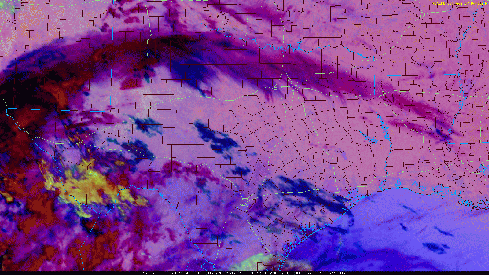
Expect temperatures this afternoon to reach for the mid-70s in Houston, with gradually increasing clouds. I can’t rule out a little light rain or drizzle well southwest of Houston by mid to late afternoon. This would be most likely near Bay City, El Campo, Matagorda, or Wharton.
Tonight and Friday
Expect clouds to thicken up tonight across the entire region. We’ll see at least a few showers, sprinkles, or drizzle try and move into the area. Temperatures will be nowhere near as cool as in recent nights. We’ll struggle to get below 65 degrees or so in the city, milder southeast and cooler northwest.
On Friday, look for clouds and pockets of drizzle or showers in the morning. We’ll shift to a mostly cloudy afternoon. Scattered showers and thunderstorms should begin to pop up however. That said, the best chance for those will be east of I-45, mostly between Houston and Lake Charles. West of Houston, expect a few isolated showers or downpours Friday afternoon. High temperatures should sneak into the upper 70s and low 80s, even with a good deal of cloud cover.

Weekend
I’ve been struggling all week on how to phrase which weekend day would be better. Initially it looked like Sunday had the better chance of showers. I think the general consensus in the modeling points to Saturday now as having the better chance. But it’s close. That being said, neither day is setup right now to have widespread, washout type weather, so if you have outdoor plans, our advice is to keep them. In fact, rainfall this weekend looks somewhat meager, with the best chances north and west of Houston. The atmosphere this weekend looks fairly capped, meaning it’s going to take a bit of work for heavier showers or storms to develop. I’m not sure we’re going to see many.
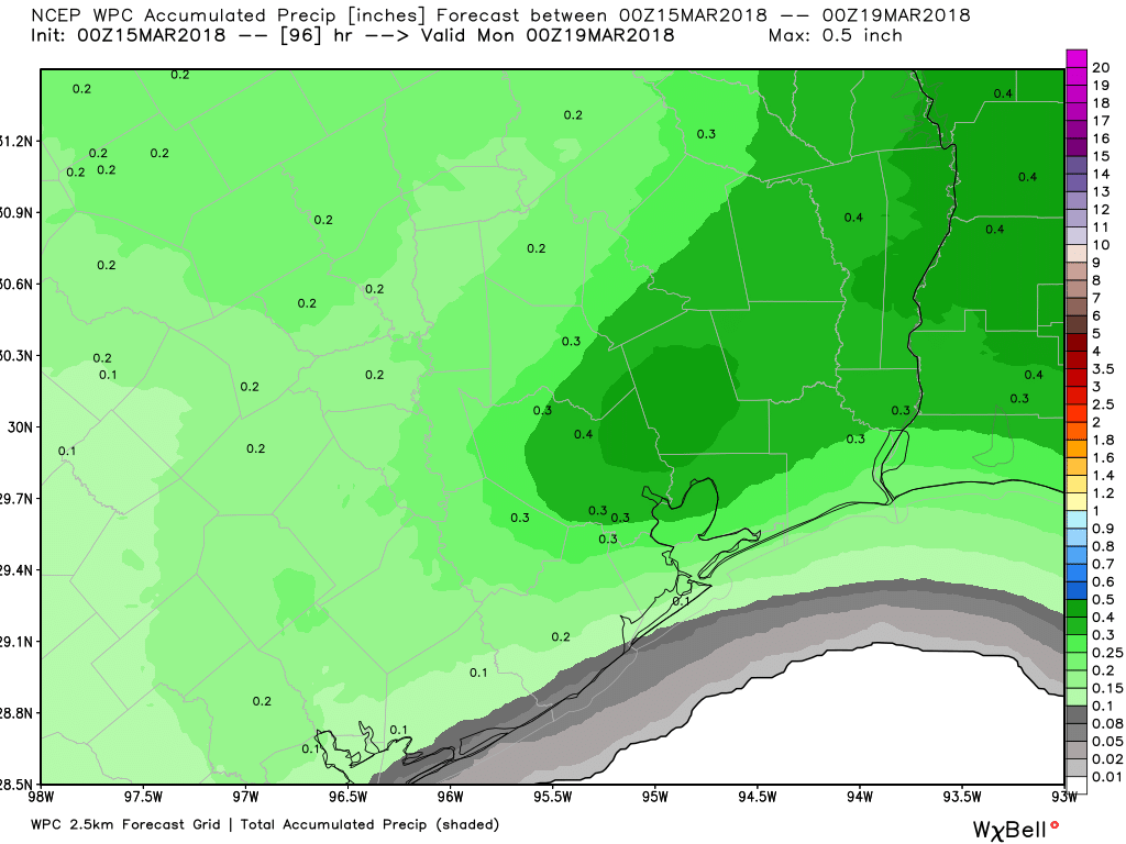
So, expect a warm and humid weekend with more clouds than sun (though probably at least some sun) and a handful of showers or a thunderstorm each day. Temperatures will bottom out in the mid or upper 60s and warm into the lower 80s.
Next Week
Honestly, next week looks quiet. The cold front we’ve been discussing is on track to pass the region on Monday with little to no fanfare. We’ll have low humidity much of the week, and temperatures in the 70s along with a good bit of sunshine. We could use a bit of rain though. More on that tomorrow.
Well, at least the weather is perfect for the azaleas!! I’ve never seen them so full and beautiful!
That’s a pretty good map for St. Paddy’s Day weekend.