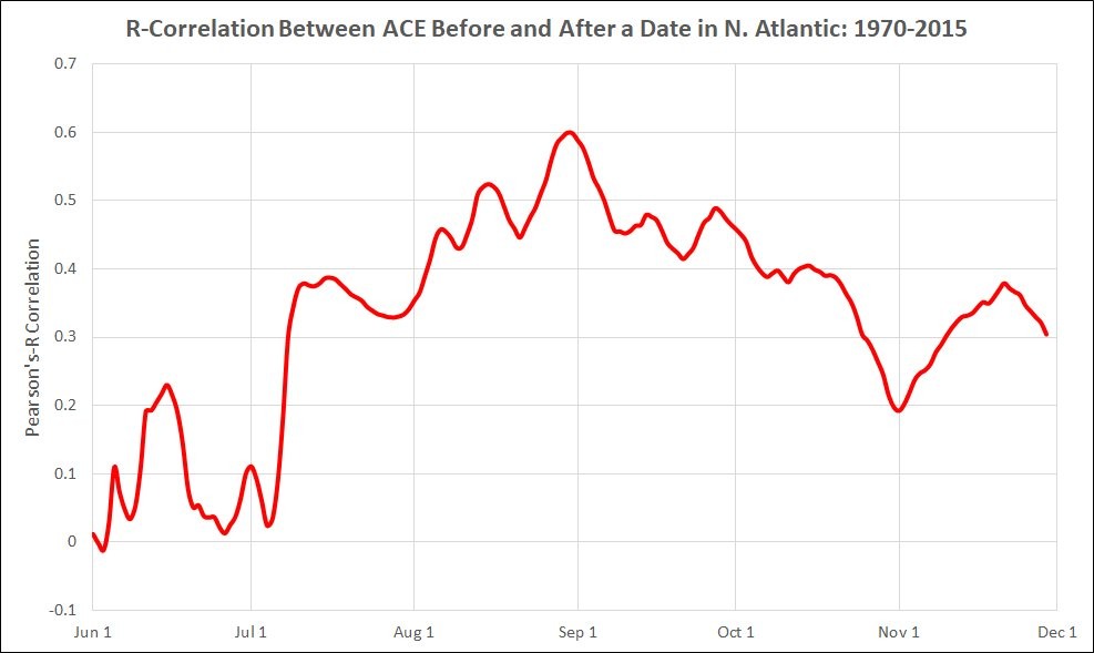
A number of people have asked about the early season development of two tropical storms last week—Bret and Cindy—and how this portends for the rest of the 2017 Atlantic hurricane season. Does this signify this year will be a busy one for the tropics? The answer is not really. The following graphic shows the correlation between Atlantic ACE (accumulated cyclone energy, a measure of total seasonal activity) before and after certain dates in a given year. The R-value for an active first three weeks of June (about 0.15 on this graphic) indicates a “very weak” correlation.

In other words, the fact that three tropical storms have developed before the end of June does not mean a whole lot with regard to potential activity for the rest of the season. If July is busy as well, that’s another story.
Monday and Tuesday
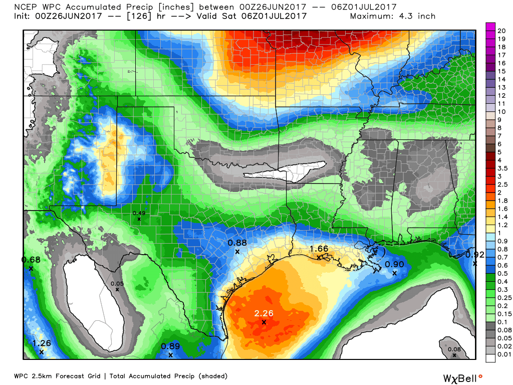
The Houston region experienced some very heavy downpours this weekend, the result of a rare June cold front sagging into the area and combining with high levels of atmospheric moisture. Accumulations of more than 5 inches of rain in a few areas flooded streets, but generally didn’t cause widespread, lingering problems.
This front will hang around for the next few days, allowing for a good chance of scattered to numerous thunderstorms to develop, especially during the afternoon and evening hours. I don’t think accumulations will be nearly so great as during the weekend, but certainly we could see some localized heavy rains that briefly turn roadways into waterways. The upside for this weather is that it should keep daytime temperatures in the upper 80s for the most part—a real blessing for late June in Houston. Nighttime lows should be in the mid-70s, rather than the upper 70s.

Wednesday through Friday
This pattern should linger through most of the work week, with a healthy chance of showers and thunderstorms—although nothing too disruptive—and highs in the upper 80s to around 90 degrees. Most areas will probably see about 0.5 to 1.5 inches of rain this week.
Saturday and Sunday
By the end of this week we should see high pressure building over the Houston area from the west. The most probable forecast for the coming weekend, then, is partly to mostly sunny skies, with high temperatures climbing into the lower- to mid-90s. A good beach weekend, perhaps?
Posted at 7:25am CT on Monday by Eric

Trying to understand the graph – I guess it’s telling us that if June is a busy “tropical” month, then chance of the seasons total energy being high is roughly 1 or 2 in 10. But if we have a lot of “tropical” stuff going in July, then the chance for the seasons total energy being high are 3 or 4 in 10.
Am I understanding the chart correctly?
No, it’s a graphic of “r” value.
http://support.minitab.com/en-us/minitab-express/1/help-and-how-to/modeling-statistics/regression/how-to/correlation/interpret-the-results/