As expected, some moderate-to-strong thunderstorms have developed across the Houston area this morning as a weak cold front sags closer to the region. This unsettled pattern will persist throughout the day and likely Sunday as the atmosphere is very moist.
Due to some especially heavy thunderstorms over northeastern Harris County, where in excess of 4 inches of rain have fallen since midnight, the National Weather Service has had to issue a flash flood warning until 11 am.
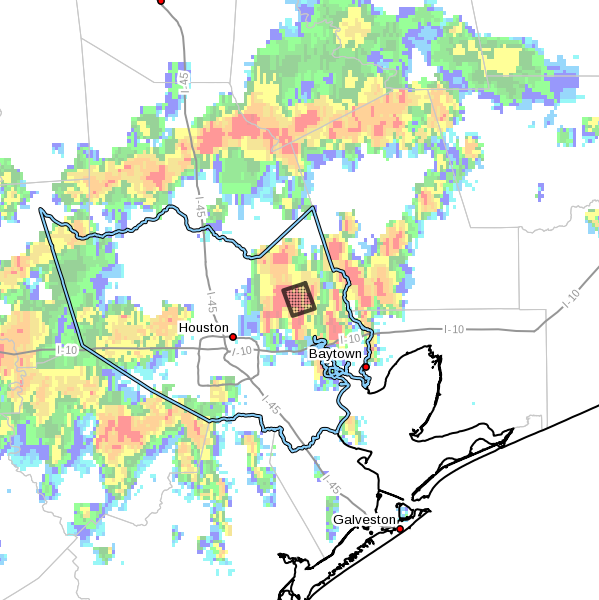
Strong storms have also developed near Sugar Land and Katy this morning. Most areas are not going to see nearly so much rain as 4 inches, but the flood warning warning illustrates the potential for heavy rainfall due to the abundant tropical moisture in our atmosphere. Basically, the advice Matt gave yesterday holds for this weekend—bring an umbrella, and be prepared to have outdoor activities disrupted due to periods of inclement weather.
I found this interesting in this morning’s Houston Chronicle weekly “Thumbs up, down” column reference Cindy staying east of us. “That spared us rain, downed trees and flooding but not hyperbole from local television meteorologists who breathlessly painted apocalyptic scenarios”.
Fortunately, I don’t watch much local TV. Was it really that hyped up?
It was partly sunny around Ellington this morning until I went to get gas for the lawn mower so I could cut. Then it started pouring when I arrived at the gas station.
Figures.