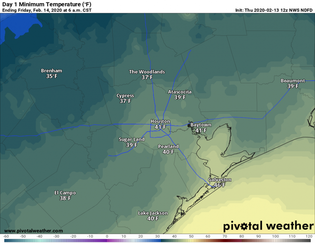
What a difference a day makes. With clearing skies and dry air, lows this morning have fallen into the 40s across the Houston area. Our forecast for the weekend continues to improve as well, now with at least some sunshine possibly breaking out over the area and diminishing rain chances. Looking a bit further ahead, a stronger front may bring a bit more of a prolonged period of cooler weather next week.
Thursday
Sunshine will prevail for most of the day Thursday, with high temperatures likely holding in the upper 50s. Northerly winds will blow at about 10 mph, gusting perhaps a bit higher, which should be enough to keep a decent chill in the air. Clear skies and light winds will push overnight low temperatures down into the 30s for most inland areas of Houston—although the entirety of the metro area will probably remain above freezing.

Friday
Another pleasant winter day, with sunny skies and high temperatures near 60 degrees. Winds shifting to come from the east should allow for Friday night’s low temperatures to settle in about five degrees warmer than Thursday night.
Saturday
Although the onshore flow returns on Saturday, for now we still expect some breaks in the clouds. With winds remaining moderate, from the southeast, we can probably expect temperatures to get into the upper 60s for most of the area. All in all, Saturday will probably be a compromise between clear and cold weather, and gray and warm. Lows Saturday night will drop only into the upper 50s.
Sunday
We will see a decent chance of rain from Saturday night into Sunday morning, perhaps 30 percent, with only slight accumulations. Chances are best near the coast, and for now seem most likely to end by mid-morning on Sunday. We should be left with a partly to mostly cloudy day, with highs in the 70s.

Next week
We’ll see a warming trend through about Tuesday, with mostly gray skies and high temperatures likely in the 70s to near 80 degrees. You’ll be familiar with this pattern. Rain chances appear to spike with the passage of a front—sometime Tuesday or Tuesday night?—with the potential for additional rain later in the week. A mix of sunshine and clouds will return after the front, and this time it seems like the cold may stick awhile longer, with perhaps as many as four nights in the 30s and 40s during the second half of next week.

What should we expect for Mardi Gras Galveston parade weather?
Off topic – the best questions! – what do you think of the “Resilient Houston” plan city hall just announced?
Mayor needs to concentrate more on PCP epidemic in Houston now.