Hello, mid-90s. A great time to be alive, but not so great a temperature profile

In brief: Houston’s weather turns stable and predictable for the next week. Although some thunderstorm chances remain today, by and large we are moving to a mostly sunny, hot, and humid pattern through the holiday weekend. Expect fireworks at night, and fiery weather during the daytime.

A warmer pattern

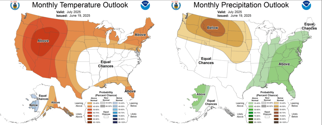
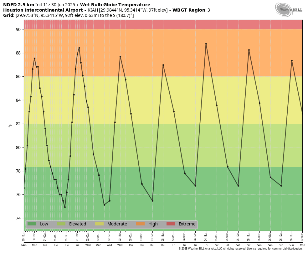
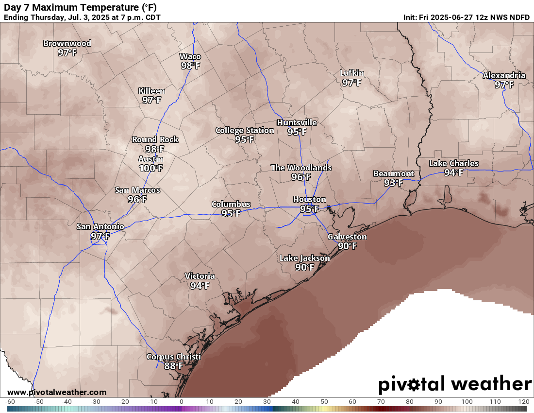
As high pressure starts to build over the area, Houston should see its most sustained heat of the year over the next week or so. We have had a few days of 95-degree plus heat here or there this summer, but from now at least through the weekend we should consistently be in the mid- to upper 90s with very warm nights. We will see mostly sunny skies to go along with this heat, with only a smattering of rain chances. So basically, prepare for that rich Houston summer weather you know and love, because it now lies at hand.

Tuesday

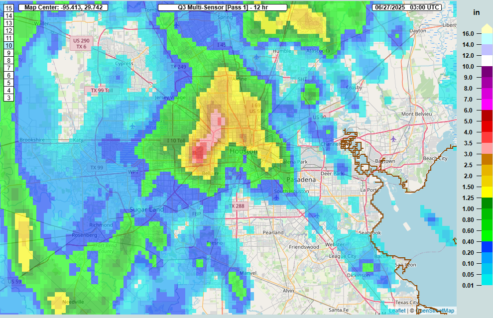
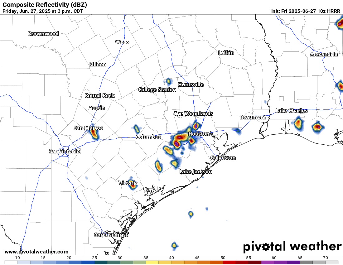
As noted above, we can expect high temperatures this afternoon to reach the mid-90s for most of the Houston area away from the coast. Skies should be partly to mostly sunny. I do think there is a decent chance of showers and a few thunderstorms today as there remains a fair bit of moisture in the atmosphere. This is probably the kind of thing where perhaps 20 percent of the area sees rainfall, but there will be some pockets of fairly intense rain in those locations that do see rain. Winds will come from the southeast at 5 to 10 mph this afternoon. Lows tonight will drop into the mid-70s.

Hello, heat. (Weather Bell)

Wednesday and Thursday

High temperatures will range from the low-90s near the coast to upper-90s for inland areas during these two days, with partly to mostly sunny skies. A few isolated showers will be possible during the afternoon hours, with peak heating. Nights will be partly cloudy and humid.

Friday, Saturday, and Sunday

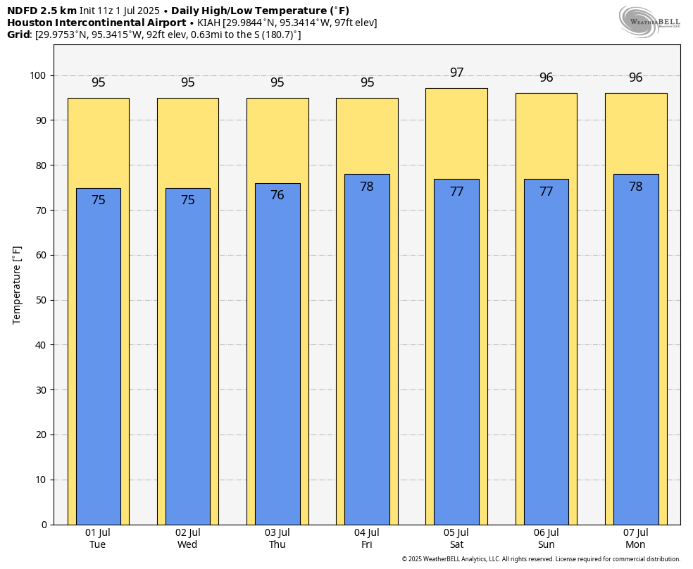
The weekend should bring plenty of sunshine and heat. Specifically for the Fourth of July, rain chances are near zero with plenty of sunshine expected. It’s a good holiday for the beach, but with the Sun at its highest level in the sky for the year, you’ll quickly burn if you leave skin exposed for too long. For fireworks we have few weather concerns. It will be humid, of course, but it is always humid on the Fourth of July in Houston. The rest of the weekend will see continued temperatures in the mid- to upper-90s. Perhaps there is a 10 or 20 percent chance of rain by Sunday.

Next week

As high pressure eases off a bit, we probably will see a slight uptick in rain chances next week, as well as a slight moderation in daily high temperatures. But how high those rain chances rise, and how much the mercury falls, remains an open question.
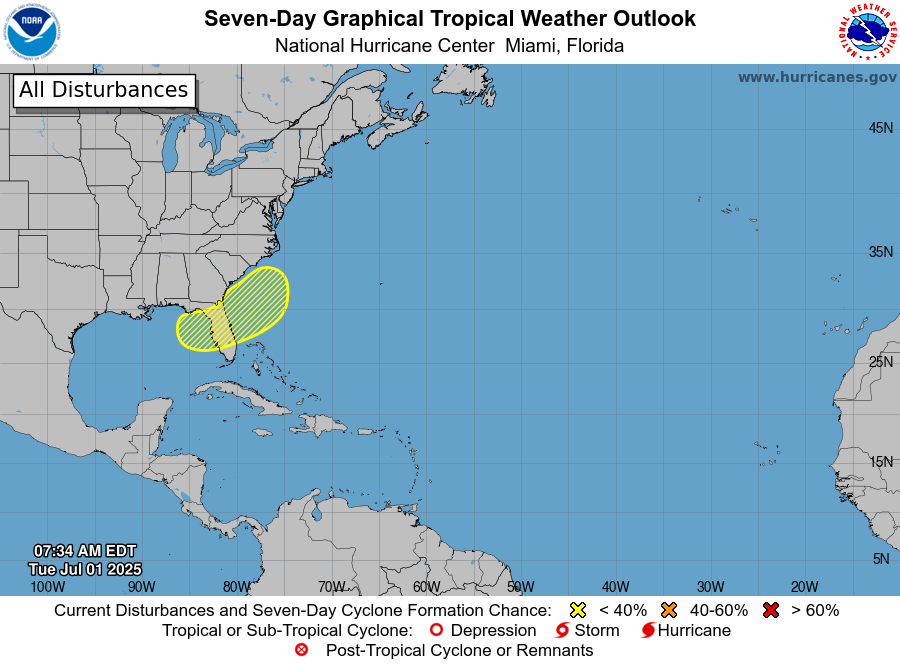
Tropics outlook from the National Hurricane Center.

Tropics

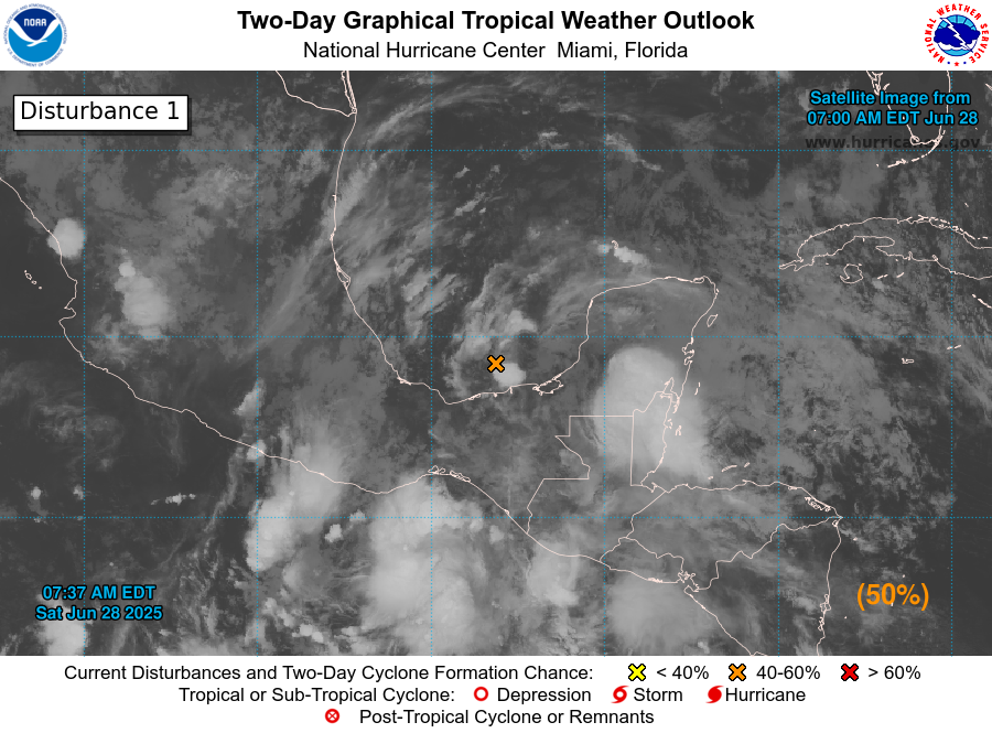
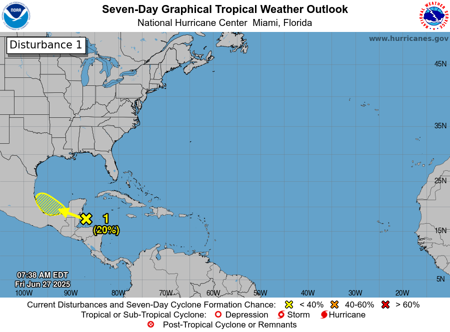
The National Hurricane Center is highlighting an area in the northeast Gulf as a potential area of development over the next few days. None of the models are getting too excited about this system, however. Regardless it is unlikely to have any meaningful impact on our weather here in Texas. Beyond this, the tropics appear to be quiet.

July will do July-like things in Houston

In brief: Today’s post looks back at a fairly typical June in Houston, and ahead to what we might expect in July. We are confident that the first week is going to be rather hot and mostly sunny, but there is no reason to expect high pressure to dominate the entire month.

June a bit warmer than normal

The month of June ends tonight, and if we look back the month delivered slightly above normal temperatures, and for most locations near-normal or above normal rainfall totals. All in all, it was a fairly typical June for the Houston region, which is to say plenty warm and humid, but without the high pressure that can lead to truly searing temperatures. That typically is reserved for July, August, and part of September.

Monthly temperature and precipitation outlook. (NOAA)

So what about the upcoming month? Although we are going to start out with high pressure in residence, there is no strong signal for it to hang around all month. Instead, seasonal forecasters predict near-normal temperatures for the month, and average rainfall totals. Therefore we might have some hope that despite the very hot start to the month of July, all of July won’t be like this. We shall see.

Monday

Today will be a bit of a transition day. Some scattered showers will still be possible later this morning and during the afternoon hours, but overall coverage should be lower than on Sunday. I’d put chances around 30 percent. We should also start to see increased levels of haze due to African dust. This may cause some issues for people who are sensitive to dust. This haze should stick around through about Wednesday, or so.

Otherwise, expect mostly sunny skies with temperatures in the low- to mid-90s. Winds, generally, will be from the south at 5 to 10 mph. Low temperatures tonight should drop into the mid-70s for Houston.

Tuesday, Wednesday, and Thursday

As high pressure takes hold, our rain chances will drop back to about 10 percent daily. Highs will vary between the mid- and upper-90s most days, with sunny skies and the aforementioned haze sticking around. Nighttime temperatures will drop into the mid- to upper-70s. Basically, it’s going to feel like full-on summer in Houston so prepare yourselves.

Wet bulb globe temperatures will be in the high, but not extreme range this week. (Weather Bell)

July 4th holiday weekend

Independence Day is Friday, and as usual in Houston we will celebrate our independence from cold air. Temperatures should peak this weekend, with much of the region away from the coast reaching the upper 90s to go along with sunny skies. We cannot entirely rule out a chance of rain on July 4th, but even if you do see a stray shower (perhaps a 10 percent chance), there should be nothing to mar fireworks shows across the area. Mosquitoes, on the other hand, are likely to be abundant after our rains of the last week.

Next week

There is some evidence that high pressure may back off a little bit next week, allowing for temperatures to moderate slightly by Monday or so, with a better chance of rain. We shall see, but at least it does not appear as though we are going to be seeing a perma-ridge type pattern where the high never wants to break.

Tropical system forming in southern Gulf: Not a threat to Houston, but may bring elevated rain chances Sunday

In brief: A tropical disturbance has developed in the southern Gulf, and it is expected to move into Mexico early next week. Houston can expect to see elevated rain chances on Sunday due to moisture from this system.

I hope everyone is having a great start to the weekend. It is sunny for most of us, and should remain so for much of today as high temperatures climb to around 90 degrees. For late June, this is mild weather. However, if we look a little bit further afield this morning we can see an area of low pressure in the Bay of Campeche, in the southern end of the Gulf.

The system should slowly move to the west, toward the coast of Mexico, and push inland by Monday. There is a healthy chance (50 percent, says the National Hurricane Center) that this could become a tropical depression or storm during the next 48 hours, before moving inland. The waters there are plenty warm to support development.

The National Hurricane Center gives this disturbance a 50 percent chance of developing.

We are interrupting your Saturday to emphasize that this system is of no threat to Houston in terms of high seas or winds. That goes pretty much for the entire state of Texas. However, moisture associated with the tropical low pressure system should help to increase rain chances on Sunday, and possibly into Monday.

This, as well, is not of too much concern. Overall I would expect accumulations for areas south of I-10 to average 0.5 inch or less on Sunday, with lower totals further inland. However, at this time of year, especially with tropical rainfall, we can see rain totals pile up quickly. So it would not surprise me to see a few isolated areas pick up a couple of inches of rain on Sunday, which would briefly cause some ponding on streets and in parking lots. Again, for the vast majority of the region these should just be your garden variety showers and thunderstorms.

Lesser rain chances linger into Monday, and then most of next week looks hotter, with highs likely reaching at least the mid-90s.

The sky may open up on parts of the Houston area again today with more pop up storms expected

In brief: Another round of localized heavy rain, street flooding, and lightning will be possible this afternoon somewhere near or just northwest of Highway 59/I-69 in Houston. Slightly less coverage for Saturday, then more numerous showers and storms come at us Sunday and Monday before we dry out and heat up.

If you live inside the Beltway on the north and west side of Houston, you probably got walloped yesterday. Over 4 inches of rain was recorded at Ella and White Oak Bayou.

Rainfall estimates yesterday afternoon ranged from near or over 4 inches just west of the Galleria through Garden Oaks. (NOAA MRMS)

Rain totals north of 3 inches fell in a pretty broad area between The Villages and Garden Oaks. Many other locations saw 1 to 3 inches of rain. Outside the Beltway, it went quiet until you got up to about Kingwood (always, Kingwood) and down into Fort Bend County. Yesterday was just one of those days where boundary collisions ruled the day. A few storms popped up, steering winds were weak, and basically atmospheric bumper cars ensued until we exhausted the instability in the area.

Today

We don’t expect a carbon copy today, however I would not be shocked to see a generally similar setup play out across the area. We’re already seeing some downpours in Liberty and Chambers Counties this morning. As the morning goes on and the sea breeze starts entering the mix, migrating inland with peak instability, we’ll likely see storms fire up near Highway 59/I-69.

Forecast radar from HRRR model for 3PM today showing isolated heavy downpours. Don’t focus on the specific location but rather the generalized picture. (Pivotal Weather)

A few places could again see multi-inch per hour rain rates that could cause street flooding. We’re holding off on a Stage 1 flood alert today, but I will admit it’s a close call. Just use caution in any storms today, as you should in summer.

Weekend

I think things will ease up a bit on Saturday. There will be showers and isolated thunderstorms around. There may be locally heavy downpours for a short time in any given spot. But overall the intensity and coverage of storms may be lower tomorrow than it has been to close the week out.

Unfortunately, the same does not hold true for Sunday, which should see more numerous, if not widespread showers and thunderstorms across the region. Storms could begin firing up as early as mid-morning and continue through the day, migrating generally north and west as the day progresses. Have an umbrella handy both days, but have a good indoor backup plan available on Sunday.

Temperatures should top out in the lower to mid-90s on Saturday and low-90s or even upper-80s on Sunday.

Monday

Monday looks like another active day with showers and storms popping with daytime heating. Look for low-90s and scattered PM storms.

Rest of next week

Tuesday begins a trend of diminishing rain chances. Expect more of isolated coverage of storms on Tuesday, a handful on Wednesday, and perhaps none at all by the end of the week. In response, temperatures are going to begin to pick up. We’ll have mid-90s Tuesday and Wednesday, followed by a chance at upper-90s to close the week.

By next Thursday, some areas do have a chance at upper 90s. (Pivotal Weather)

Recent rains and saturated soils may act to keep daytime highs from getting much past 97 or 98 degrees or so officially, but there may be a few parts of the area that threaten upper 90s to near 100 by next weekend. Stay tuned.

Tropics

A discerning eye will notice a new tropical area to watch on the National Hurricane Center site down in the Bay of Campeche. This has a very, very slight opportunity to develop over the next couple days.

A possible disturbance in the Bay of Campeche will not be of concern for Texas. (NOAA NHC)

The good news is that it will almost certainly scoot right into Mexico by Monday. This limits any significant development risk, and this is not a concern for the Texas coast. The next tropical area of interest may be something in the northeastern Gulf or off the Florida coast by next weekend. That too is expected to stay away from Texas and is mainly worth watching for Florida or the Southeast coast.