The good news is that the worst of the weather the next couple days will likely miss the Houston area well to the northeast. The bad news is that we will still have multiple rain chances to contend with through tomorrow before we get on to the good stuff.
Today
While today should not be a washout, there will be plenty of shower activity around. Initially, showers are west of Houston near Katy and north up through Conroe.

As we go into this afternoon, I think we’ll see the focus of these showers shift east of I-45 and north of I-10. Thunderstorms will also be possible, but with the area likely to see some degree of atmospheric capping (“the cap,” as it’s often referred to, which is basically an atmospheric temperature inversion that inhibits thunderstorm growth) I don’t think we will see too much in the way of significant storms. That will be reserved for areas well north of Houston, up toward the ArkLaTex.
Yesterday was cold and drizzly. Today will begin similarly. We should see temps warm a bit further today though and manage at least the upper-60s in Houston, mid-60s in The Woodlands, and low-60s in the Brazos Valley. That being said, sometimes temperatures behave very stubbornly in these types of patterns, so there’s a definite slight chance we don’t get out of the 50s until later tonight. Keep the jacket handy.
For at least the 500th* time this month, fog is pestering the coast this morning once again.
*approximate
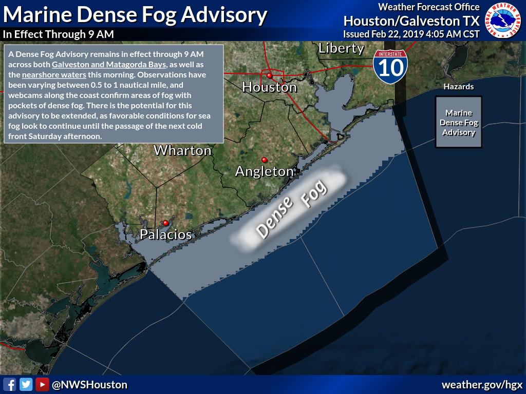
Dense fog is likely to hang along the coast and in the bays most of the day today. Exercise caution if you’ll be driving to or from those areas today.
Tonight
We will carry a continued chance of showers through the night, but no heavy activity is expected. It may be more mist or drizzle than anything, with a gradual transition toward showers. Fog will continue in the bays and along the coast, though it could begin to become a little more dispersed at times overnight as winds pick up a bit. Look for temperatures to hold steady or finally rise into the mid- to upper-60s if they haven’t gotten there this afternoon.

Saturday
Look for scattered showers in the predawn hours to probably become more numerous after sunrise. We may even see a more organized line of showers and thunderstorms form. This will be along a cold front that sweeps through the area and ends this round of unsettled weather.
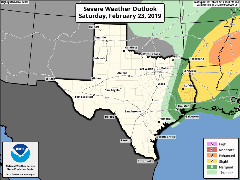
Look for the front to cross around midday, give or take a few hours. Storms along the front could be strong to locally severe, but widespread severe weather is not expected. The main threat tomorrow would be strong winds, followed by hail. Any tornado threat is mainly from northern Louisiana into Tennessee.
Showers should wind down and end from west to east through the afternoon. We will manage to top off in the lower or middle 70s in Houston (cooler northwest) before the front passes and knocks us back into the 60s. We could rebound back to near 70 in the afternoon with enough clearing.
Sunday
Magnificent: Look for sunshine and high temperatures warming from the 40s in the morning into the mid- to upper-60s Sunday afternoon. Do enjoy!
Next week
We’ve got a fair bit of details to sort out for next week, but a general picture has come together. Look for a nice day with slowly increasing clouds Monday. Some showers may develop Monday night south of Houston, and Tuesday sees a slight chance of showers everywhere. Wednesday appears to have a good chance of being partly sunny and dry. Beyond Wednesday the forecast will depend on timing and orientation of an approaching cold front. Temperatures look fairly mild before that. Look for 60s and 70s next week. There’s a growing chance that we could be dealing with some legitimately cold weather for early March for a day or two late next weekend or early the following week. No, a freeze is not expected, but you’ll want to keep the “Houston winter” clothing handy just a little longer.
More of the same. 😑
I hope Spring Break is dry. I would REALLY like to get out in the yard and do some work. Without mud boots. 🤣
Approximately what’s the best guess as to how long this pattern will persist and what might we expect, trend-wise, sixty days out? Is el Nino anticipated to wax or wane and is it the dominant factor in what we’re seeing? Just tired of the rain!
Dry land is a myth!
Given that we’re in an El Nino, and it’s unlikely to disappear in the coming weeks, I have to think we will be at risk for more rainy days than usual over the next 2 months. I do think at some point the frequency and pace of the gloomy days has to slow down, but I’m not especially optimistic that it’s going to be a super nice spring here. Here’s hoping that’s incorrect.
Yea this rainy, dreary weather is starting to get on my nerves. I want to play some golf and ride my motorcycle!
I hear ya! It’s beginning to affect my attitude!! Need some wind therapy!
..well no sense in planning anything until summer…
mud mud everywhere and the forecast is for at least two more months of it… ugh!!
Very Very Depressing !!!!
Any thoughts on timing of the showers on Saturday morning? The rodeo run starts at 930, followed by the parade!
Wish I had better news, but unfortunately it looks like the best shower/storm chances will be somewhere in the 7 AM-Noon window tomorrow. I would expect rain to last 2-4 hours before clearing.
Don’t sweat it Matt.
We’re all just getting salty about it. Lol. 🤣