As high pressure has scooted east of the area, low pressure has returned, and along with it plenty of moisture that will fall as rain the next few days. Rain chances will remain above 50 percent through Saturday, before a front arrives to bring us some much nicer weather—we still anticipate an outstanding second half of the weekend.
Thursday
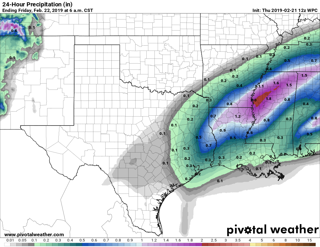
Rains developed offshore late Wednesday, and have moved into coastal areas this morning. So far amounts have been more than manageable, with about one-quarter inch the maximum amount. But this surge of low-level moisture and low pressure will nonetheless make for a wet and gray day, with highs struggling to reach 60 degrees. Most of the area likely will not see more than one-quarter to one-half inch of rain. With the southerly flow, temperatures Thursday night will not fall much as on-and-off mostly light to moderate showers continue.
Friday
Friday will be warmer, with cloudy skies, and highs in the 70s. With more moisture moving in Friday, we can expect more come-and-go rain showers. Again, there should be no real concerns with accumulations, as this will be just another gray, wet, albeit warmer day in Houston. The greater rain accumulations—one inch or more—should occur well to the north and northeast of the region. Lows Friday night may not fall below 70 along the coast, and probably will only drop into the upper 60s for the city.

Saturday
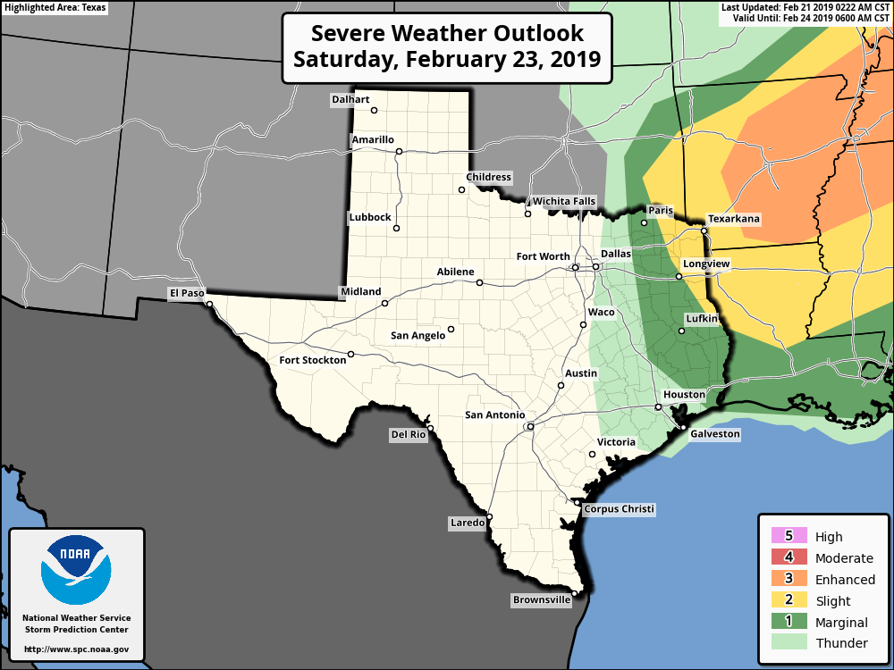
This will be another warm day, for February, with our accustomed gray skies and rain chances. A broken line of showers will probably move through the region around noon, heralding the arrival of a cold front and some drier air. (Severe weather chances, as shown in the map below, are much better to the northeast). After this, the rains will end, and Saturday afternoon and evening should see clearing skies. Lows Saturday night will fall to around 50 degrees in Houston, a bit warmer near the coast, and a bit cooler inland.
Sunday
What a day! Highs in the upper 60s. Sunny skies. Moderate, dry winds. Make your outdoor plans now.
Next week
Forecast models are now in generally good agreement that most of Monday should remain dry, before some rain chances return Tuesday. We should see a general warming trend through Wednesday, before some kind of front cools the second half of next week off.
So you think we will have rain for the rodeo run on Saturday?
Maybe. It depends on the timing of the showers associated with the front. It’s possible the morning is dry until 10 or 11 am or so.
I’m so done with all this grey weather. Is it possible to know if March which I always feel is a perfect outdoors month will be any better?
It might be a little depressing, but far better than day after day of sunny, humid, and 98 degrees.
It’s coming to a city near you really soon.
so I’m ready to prune the tropical vegetation that got nipped way back last November. what’s the odds of another freeze in southwest Houston?