Sunday, 7:50am CT— Labor Day weekend rolls on and so does our mostly quiet weather. Given what’s needed for relief and recovery efforts across the region, this about as good a forecast as you could hope for in early September.
Today and Labor Day
Expect similar weather both today and tomorrow to what we’ve been seeing the last couple days. It should be mainly sunny, hot, and humid both days. High temperatures will top off in the lower 90s in much of the area. Morning lows will be in the low-to-mid-70s. We did have one or two very isolated showers around the area yesterday, and I suppose we could do the same today and tomorrow. But for the most part, the odds strongly favor you not seeing rain through Monday. Also, air quality will remain stagnant, so you’ll continue to notice haze in the area.
Tuesday and Wednesday
Gulf moisture begins to increase on Tuesday, ahead of our midweek cold front. As this happens, we should note a few more showers and storms in the area Tuesday afternoon and evening. Again, this won’t be serious stuff, and there’s a better chance that most of you won’t see rain.
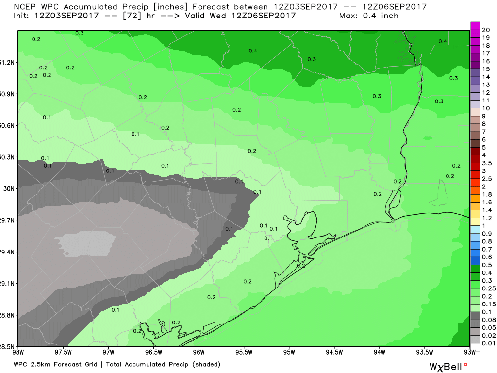
In fact, total rainfall through Wednesday morning should be about a quarter inch or less on average.
The front passes through the area from north to south Wednesday morning or afternoon, ending the rain threat and dropping dewpoints (humidity) from the 60s and low 70s into the comfortable 50s!

Beyond Wednesday
For the foreseeable future beyond Wednesday, things look spectacular. Expect ample sunshine, comfortable humidity driven by some offshore flow, and temperatures that are pleasant for Houston during the first third of September. Highs will top off in the 80s, and nighttime lows will generally be in the 60s for a few days beyond Wednesday. We will gradually warm up back up over the weekend, but we should continue to keep the humidity fairly comfortable for September.
Tropics
Weather models continue to keep Hurricane Irma away from the Central and Western Gulf over the longer-term, so it remains of no real concern for Texas at this point. This continues to look like a close call for Florida and the East Coast however. There’s still a very high degree of uncertainty as to Irma’s final outcome there, and a number of puzzle pieces will fall into place the next few days to clarify that. Hopefully some more confident forecasts for those folks tomorrow or Tuesday. We also aren’t seeing much of anything behind Irma that would worry us in Texas. So for our backyard, things look alright at this point, and we can continue to focus on recovery efforts. Eric and I will of course continue to keep you posted.
Posted at 7:50 AM Sunday by Matt
Thank you two for all you do. You have made it possible for me to remain sane during all this. You guys rock!
“Posted at 7:50 AM Saturday by Matt” Sunday!
Just a sign of the times 🙂
Ha…thank you. Fixed. I don’t really know what day it is.
I have been depending on Eric Berger for hypeless forecasts for years. He has gotten me through some very anxious periods. I so appreciate his presence of mind and analytical ability. I will consider subscribing.
I know of many others who use your site religiously. And commend it for its relative temperment. Just wanted you to know.
Eric & Matt,
There is a “Magic Date” for Texas, after this date the chances of a hurricane drop considerably. I cannot remember the date, the 25th of September??
Could you please let us know the date and a little science whsy that date is good for Texas.
Thanks both of you for all of your work.
Monty
https://spacecityweather.com/texas-hurricane-season-over-2016/
Thank you!!!
Behind Irma is another one but far far away…
I hope we make to the 24th
Thanks again
Monty
I need to send an email about a graphic I made with atmospheric condition. Can you pass me one?
Thank you both for your excellent work! I’ve enjoyed reading your weather reports during Harvey and will continue to do so post-Harvey. What an awesome team!
Enjoy the next few day, guys!
Thanks, Matt! Hope you and Eric have been able to catch a break to rest and take care of any personal matters that may have been impacted by Harvey
Eric, I am currently stuck in a hotel room in San Antonio. I plan to go back to Houston on Tuesday, but am concerned about travel and road conditions for that day. Will I encounter any serious, heavy rain or flooding en route to Houston? Get back with me ASAP!
Wow. Paul, considering how hard these guys have been working both behind the scenes and on this blog to provide us with thorough and accurate reports, especially during the kind of disaster we’ve seen lately, I think we can afford to be a little less demanding. I understand you might be in a dire situation, but so are many others. A small please or thank you might be appropriate here.
@Paul,
I’m looking at drivetexas.org, and see no flood conditions *presently* on I-10 to Katy. There is reservoir overflow currently in the energy corridor (south of Addicks) frontage roads only. Then clear into downtown.
If you’re doing US90 exclusively, be aware of the bridge being down that crosses hwy 36 in Sealy.
Monitor drivetexas.org
Eric put this up a few days ago:
https://drivetexas.org/#/9/29.5310/-95.3757?future=false
I grew up in west Texas. We have playa lakes out there in the big wide open.
They are fun to play in, when they are there.
It’s not like Houston where they come to visit your house.
This flood wasn’t a result of climate change, although it is reasonable to conclude that climate change, combined with too few green spaces and a lack of developmental controls, certainly exacerbated the damage.
Regardless, this clearly was Houston’s most democratic flood. The usual (poorer) area flooded, but so did the rest of the city, including the “wealthier” areas. Virtually every Meyerland home that wasn’t raised up flooded. And unlike the last floods, many expensive Memorial area homes are now under water…for weeks. Gessner still looks more like a lake than a street.
I remain disappointed that I didn’t take more affirmative action after I emailed you last Thursday asking whether you thought this had the potential to be Houston’s most widespread catastrophic flood. The fact you replied “no” should not have stopped me from warning friends and family about what I thought. MAybe nothing more could have been done,but I am haunted that my failure to act may have put lives at risk. Perhaps no one would have believed me. I don’t have a weather degree and my assessment was not necessarily shared by you or anyone else. But still….
I understand your chief attribute is to present information calmly and not to hype, but when model run another model runs show basically the same result, it would not be hype to first warn of the worst case possibilities (earlier than you did) while still hoping for the best…instead of taking the reverse action.
Yes, I know it is tough to imagine an event that’s never happened, but it was not as if the signs weren’t there two to three days prior.
I blame myself for not acting on my convictions. You weren’t convinced. I was. Your reach is large. Mine is small. Nevertheless, instead of just telling my wife on Saturday that there was no way Meyerland wasn’t going to have massive flooding, I could have at last called friends I know there.
I hope I never get another chance to be “right” and city leaders actually lead us further away from the potential for future catastrophic floods.
any dew point temp predictions for the front due in Wednesday? and like everyone else… y’all’s (what looked like) tireless work during Harvey was award winning! thank you & your families.
These guys. They deserve a lot of recognition. Thank you from the bottom of my heart.