When I do Friday posts, I often have a problem where I feel as if I am writing too much about what’s happening with the weather. So I spend a good bit of time editing down some stuff and trying to focus on the important points. Today should be easy, as there is really only one important point: Sunshine!
Today through Sunday
This is the weekend we have been anticipating for months. It will feature mostly clear skies, pleasant temperatures, and pretty comfortable humidity. There are a couple things going on in the background to point out.
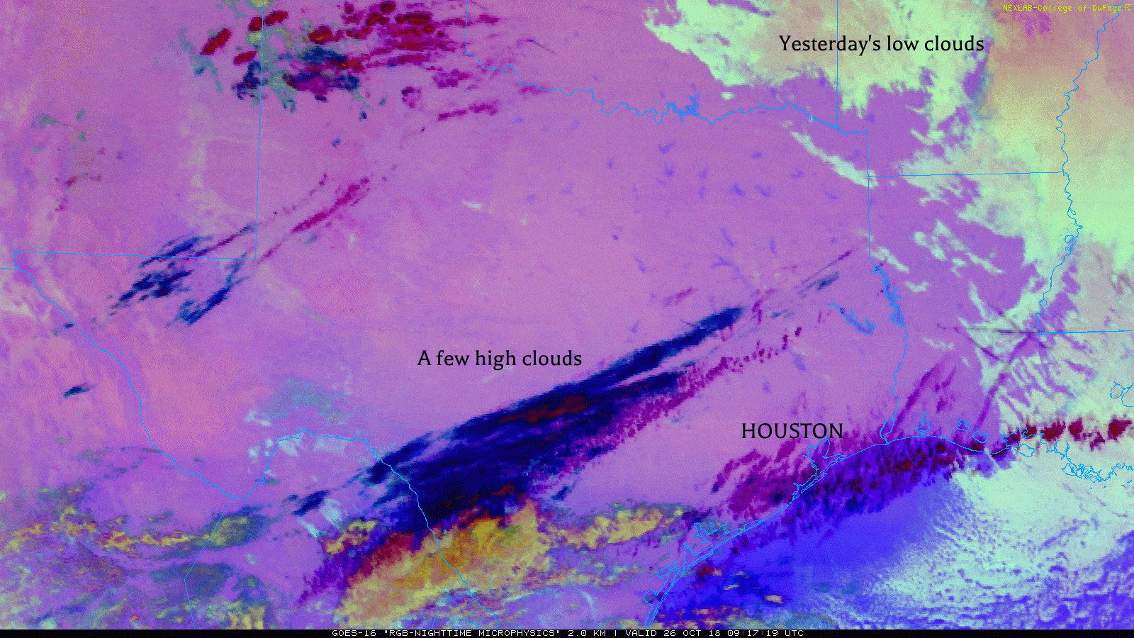
First, a few high clouds will stream across the region today, but they should not do anything other than add character to an otherwise blue sky. Look for temperatures to warm up into the middle 70s this afternoon.
A weak cool front should pass through the area this evening, but it likely won’t do much. Look for mid-to upper-50s in most spots and near 60 at the beach.
Saturday will be sunny and gorgeous. It will be a touch warm, but the low humidity will counteract that a bit. Expect generally lower 80s for high temperatures. We will be a few degrees warmer Saturday night, so expect around 60 in Houston, lower 60s near the beach and upper-50s northwest.
“Sun”day will live up to its name. It will be a little warmer still, with highs in the middle 80s possible. Again, mostly comfortable, low humidity will help.

Monday and Tuesday
Another weak cold front will pass through the region Sunday evening, reinforcing drier air and offering a slight cooldown to start the workweek. Look for around 60° on Monday morning before another sunny day with highs in the upper-70s to around 80° Monday afternoon. Tuesday will see onshore flow begin to resume, so expect slightly higher humidity with a mix of sun and clouds. We should manage low-60s in the morning, followed up with at least low-80s in the afternoon.
Halloween & beyond
The latest on Halloween continues to look a little spooky for trick or treating. A word of caution: We’re still six days out, so a lot can change. But as of right now, model data is pegging Halloween afternoon or evening for our next cold front. The good news is that even though we have to mention there could be rain on Halloween, it might be a quick mover and it may not rain everywhere.
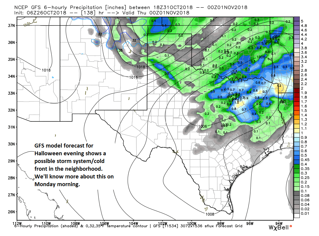
Temperatures for Halloween could be a bit changeable, with highs around 80, but with falling temperatures during the evening into the 60s, a steeper drop than usual. Since most of us won’t have two costumes to wear, I would advise having a jacket on standby. We’ll know a lot more about the timing and impacts on this Halloween ghoul front on Monday.
Beyond that, it does look like we should have another day or two of nice weather before a stronger cold front next weekend. We could be talking 40s for lows in some spots, but the details and timing of what’s to come is very uncertain right now.
I don’t think it’s possible to talk too much about the weather on SCW 😀 It’s why we’re here, man!
Speaking of—I know i’m jumping the gun a bit, but when can we look forward to a nice string of days with highs in the low 50s or 40s? That’s the weather I pray for all year.
Next weekend I think we’ll see two or three nights in the 40s to low 50s. Days? Well. We’re at least a couple of months from that most likely.
You never have to trim your words here…we’ll all be goblin them all up!
Just called Ellington to report a big yella UFO in the east. Suggested they send up an F-16 to check it out. It could be an alien invasion!
ghoul front – so bad – but I love it!