Cindy turning north, heavy rains remaining east of Houston

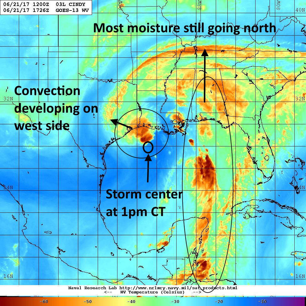
Just a quick update tonight. As expected, Tropical Storm Cindy appears to be headed toward landfall near the border between Texas and Louisiana. This north-northwest movement has spared the Houston metro area from heavy rainfall this evening, and kept the bulk of precipitation over the Beaumont area, and Louisiana.

Cindy’s rains from Wednesday night onward will threaten East Texas more so than Houston. (Weather Bell)

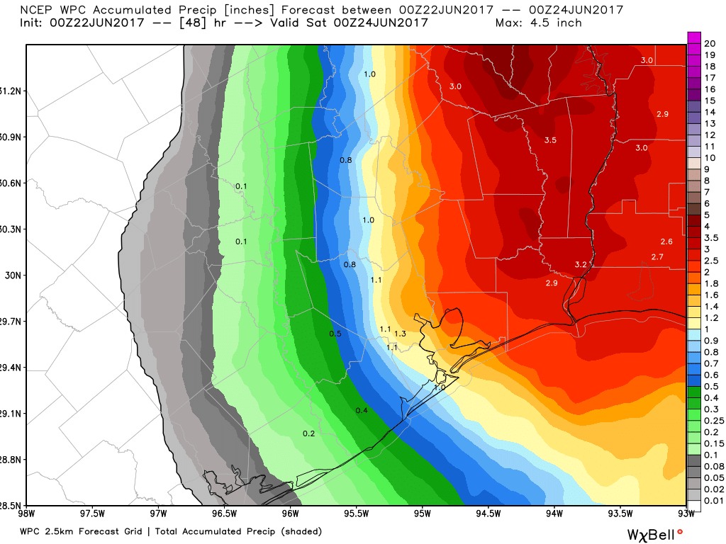
During the overnight hours it seems likely that some of those rain bands will work their way into Houston, at least on the east side of Interstate 45. But even so I’d expect moderate accumulations, likely no more than 1 to 3 inches, and probably less than that for most people. Because the storm is turning to the north-northwest now, it looks like Houston will also escape sustained winds of tropical storm strength during the overnight hours. I’d expect winds to die down on Thursday afternoon.

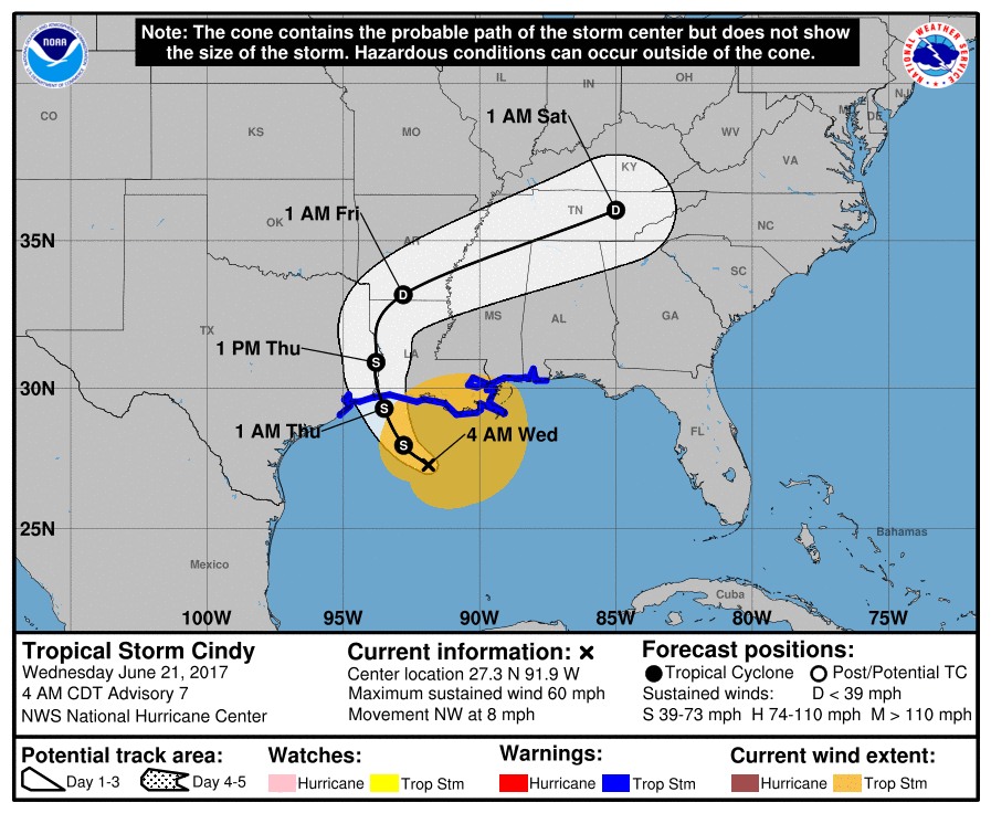
After Cindy moves inland on Thursday morning, likely around sunrise, the storm will gradually move north throughout the day, taking the potential for heavy rain with it. I’d expect a chance of scattered showers and thunderstorms to linger, however. We’ll take a comprehensive look at the forecast ahead in a new post tomorrow morning. Until then, breathe a sigh of relief—this bout of tropical mischief has left us largely alone.

Posted at 10:10pm CT on Wednesday by Eric

Cindy moving toward the coast, Houston should be mostly spared

Just a quick update on Wednesday afternoon to say that our forecast from this morning holds—effects from Tropical Storm Cindy are unlikely to be too significant for the greater Houston area. Mostly, we can expect some heavy rainfall. The only thing that could change this is if the storm follows a westerly track into the Galveston area, but at present that seems to be a low probability.

Rainfall

We’re starting to see some convection firing up on the west and northwest side of Cindy’s center today, but the storm is running out of time to become a real rainmaker for the Houston region as it will near the coast tonight, and move inland by Thursday morning. The water vapor image below shows some of the convection developing out in front of Cindy as the storm moves northwest toward the Texas-Louisiana border.

Water vapor image from early Tuesday afternoon. (US Navy)

Most of the model guidance suggests the Houston region will likely see 1 to 3 inches of rain from Cindy later today, tonight, and on Thursday. Generally, rain chances will be greater to the east of Interstate 45. Given the tropical nature of this system, we can’t rule out some isolated bullseyes of 6 inches, but I think we can confidently say this is likely not going to be a major flooding event for the area.

Average rainfall totals from GFS ensembles for now through Friday. (Weather Bell)

Tides and winds

At present waves are coming up onto Bolivar Peninsula, and seas are rough, but road conditions along the coast are generally manageable. Rip currents are a concern as well. It looks like high tides will reach a maximum of about 4 feet above normal.

In regard to winds, expect some gusts tonight in the upper 20s or low 30s in the city, and possibly in the low 40s along the coast. Sustained winds will be lower.

We’ll keep you posted as conditions change.

Posted by Eric at 1:55pm CT on Wednesday


TS Cindy nears coast, but isn’t a huge threat to Houston

Tropical Storm Cindy began moving again on Tuesday evening, but after strengthening into a 60-mph system it has become a little ragged overnight. Increasing wind shear and dry air have caused the system to look like something less than a tropical storm. This bodes well for the Houston region, as without wrap-around rains the storm seems unlikely to bring the worst—floods and damaging winds—into the area.

Track

Cindy has been moving to the northwest overnight, and models now generally agree that the system will turn north toward the Texas-Louisiana border later today. It should make landfall around midnight tonight, or during the pre-dawn hours Thursday. This would place the greater Houston region on the left side of Cindy tonight and that should make some difference in our weather conditions.

Official forecast track of Tropical Storm Cindy at 4am CT. (National Hurricane Center)

Rainfall

During the last 24 hours Cindy’s northern rain bands have battered the northern Gulf Coast, generally producing 4 to 6 inches of rain across a widespread area along Interstate 10 from Louisiana through the Florida panhandle. More is coming today while the west and southern sides of the storm remain mostly dry. This is due to the asymmetric structure of the storm in which most of the severe weather is north and northeast of the center.

See full post

Cindy forms, and yes, Houston should be watching closely

As most of you probably know, Tropical Storm Cindy formed in the Gulf of Mexico today. This post will assess the storm’s rainmaking potential, and whether high winds or tides will impact the Houston area. I’ll also discuss why I’m becoming a little more concerned about Cindy.

Track

Although Cindy has improved its circulation, it has stalled in the Gulf of Mexico a few hundred miles south of Louisiana. This adds some uncertainty to the landfall location, but I still feel pretty confident that it will be come ashore somewhere between Matagorda and the Texas-Louisiana border. Landfall timing is probably Wednesday night or Thursday morning.

The European model shows a tropical storm coming ashore near Galveston early Thursday. (Weather Bell)

See full post