Houston’s version of cool mid-summer weather continues

Most people wouldn’t call the last couple days “awesome.” But then again, most people don’t live through Houston summers annually. We’ve had a couple days of tapping the brakes on our early August temperatures, with official highs of 90° on Wednesday and 89° yesterday. Though they aren’t refreshing days in the literal sense of the word, they’ve offered a nice break from the typical mid-90s broiler we have this time of year. We have a few things to talk about going forward, however.

Today through Sunday

All three days this weekend will feature somewhat similar conditions: Clouds, sun, and a good chance for a smattering of showers and storms each day. Temperatures will continue to be held back a bit. Expect upper 80s to lower 90s each afternoon, contingent on exactly where and when showers and storms develop.

In terms of storms, I think the edge for best chance goes to Saturday over today. Occasional disturbances aloft will be moving across the region, giving the trigger needed for more widespread showers/storms the next couple days.

Colors on this animation indicate possible “triggers” for showers and storms this weekend. The best chances will be today and tomorrow. (Pivotal Weather)


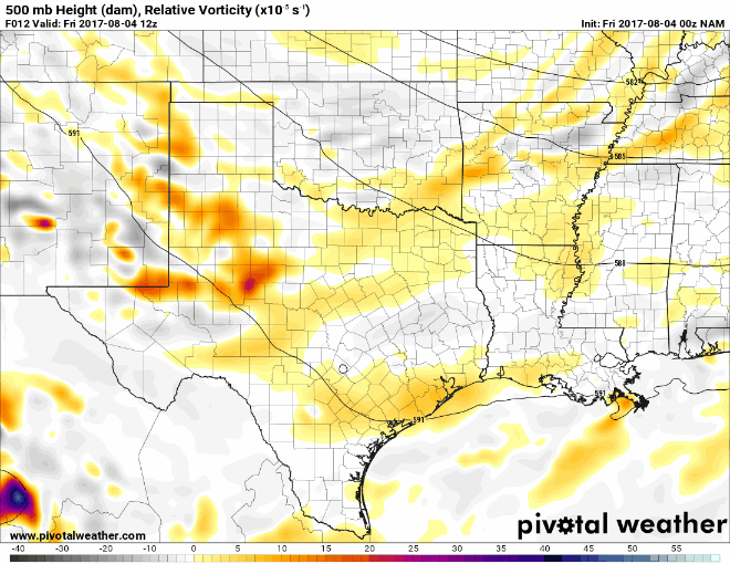
Another disturbance is possible on Sunday too, but as of today, weather models suggest that there may be more of a lid kept on storm development Sunday afternoon. We’ll see.

In terms of rainfall, expect varying totals this weekend, as is often the case in Houston’s summer. Some areas may not see much at all. Others could see 2-4″ from a couple heavy downpours. But overall, the rain should be mainly a nuisance than a serious problem this weekend.

Also worth noting, when the sun peeks out, you might notice another batch of Saharan dust in the skies over Texas this weekend. Sunrises and sunsets may look a bit different than usual.

See full post

Cloudy, rainy weather to continue for Houston

Good morning. Houston’s cloudy, on-and-off again rainy weather will continue for several more days. I’ll also discuss the tropics, which seem likely to begin heating up soon as we’re now into August.

Thursday

Most of Houston saw 0.5 to 3.0 inches of rain on Wednesday, and while I don’t think today will be as wet, I do think the region will see fairly widespread showers and thunderstorms later this morning and during the afternoon hours. Accumulations shouldn’t be too concerning—i.e. they’re unlikely to produce some of the street flooding we saw Wednesday. Temperatures will remain pleasant for this time of year, with highs in the upper 80s to 90 degrees.

Friday through Monday

Not a whole lot is likely to change from Friday through the weekend, as a very moist air mass remains settled over the greater Houston region. This will bring partly to mostly cloudy days to the area, and a healthy 40 to 50 percent chance of rain. I don’t think we’re looking at any kind of significant flooding, and accumulations will probably be less than 1 to 2 inches for most areas

The heaviest rains are likely to be offshore this weekend. (Weather Bell)

Overall, the clouds should be enough to hold temperatures to around 90 degrees for the most part. One warning, if the Sun does come out for a few hours over your location, it will turn hot and steamy fairly quickly.

See full post

Houston, here comes the rain

July was a fairly wet month for the region—most of the area saw about 100 to 200 percent of normal rainfall levels—and August looks to start out the same. This is the time of year when we worry most about drought in southeast Texas, but happily that seems unlikely to be a problem this year. Here’s a look at our wet week ahead.

Wednesday

Atmospheric moisture levels have surged across the area, and we should see the development of widespread showers and thunderstorms later this morning, and they should continue on and off throughout the afternoon and evening hours. While much of the area should see 0.5 to 2 inches of rain, and isolated areas could see a bit more, I don’t think there will be enough precipitation to cause more than street flooding. Highs should remain in the upper 80s due to clouds and rain.

Precipitable water values of 2 inches or higher are favorable for rainfall. They’ll be 2.2-2.5 inches today for Houston. (Weather Bell)

Thursday, Friday, and Saturday

More atmospheric disturbances should move in from the northwest to end the work week, and with atmospheric moisture remaining high we can expect to remain in a gray, wet pattern. I don’t anticipate showers will be quite so widespread as on Wednesday, however. Look for highs of around 90 degrees. If you’re planning outdoor activities on Saturday, it won’t be a total washout, but you’re definitely going to have to keep an eye out for scattered showers.

See full post

Houston is about to have an amazing week of weather for August

Perhaps you’re not impressed with the region’s rare mid-summer cool front, but anyone who knows what August feels like in Houston will be pleasantly surprised when stepping outside this morning. Dewpoints in the northern half of Houston have generally fallen below 70 degrees, which is remarkably low for this sultry time of year. These pleasant mornings and evenings will linger for a few more days, and daytimes should be moderate as well with increasing rain chances. Essentially, for most of the rest of this week, it will be like late May or early June, only it’s actually the dead of summer. That may not seem like much, but August is typically so consistently hot and humid, that this weather is kind of amazing.

Tuesday

After a cool, dry start today should see partly sunny skies, with highs in the low 90s. Today’s probably the last day of the week that most of Houston will not see any rain.

Wednesday through Friday

As a very strong ridge of high pressure builds over the western United States, and lower pressure over the east, the Houston region will kind of be stuck in the middle. But that’s better than being under the ridge, which is just going to bake the western United States. Places like Portland, Ore., are likely to see highs above 100 degrees.

High pressure to the west, low pressure to the east. Houston sits pretty in the middle. (Weather Bell)

See full post