Most people wouldn’t call the last couple days “awesome.” But then again, most people don’t live through Houston summers annually. We’ve had a couple days of tapping the brakes on our early August temperatures, with official highs of 90° on Wednesday and 89° yesterday. Though they aren’t refreshing days in the literal sense of the word, they’ve offered a nice break from the typical mid-90s broiler we have this time of year. We have a few things to talk about going forward, however.
Today through Sunday
All three days this weekend will feature somewhat similar conditions: Clouds, sun, and a good chance for a smattering of showers and storms each day. Temperatures will continue to be held back a bit. Expect upper 80s to lower 90s each afternoon, contingent on exactly where and when showers and storms develop.
In terms of storms, I think the edge for best chance goes to Saturday over today. Occasional disturbances aloft will be moving across the region, giving the trigger needed for more widespread showers/storms the next couple days.
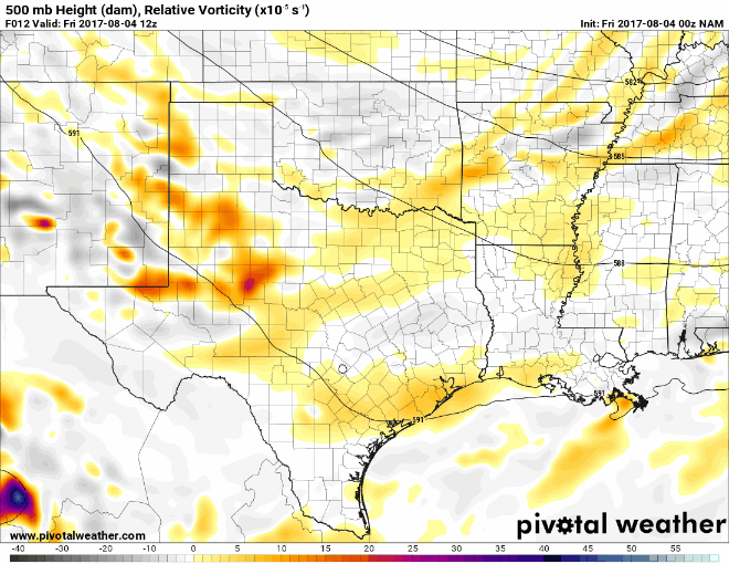
Another disturbance is possible on Sunday too, but as of today, weather models suggest that there may be more of a lid kept on storm development Sunday afternoon. We’ll see.
In terms of rainfall, expect varying totals this weekend, as is often the case in Houston’s summer. Some areas may not see much at all. Others could see 2-4″ from a couple heavy downpours. But overall, the rain should be mainly a nuisance than a serious problem this weekend.
Also worth noting, when the sun peeks out, you might notice another batch of Saharan dust in the skies over Texas this weekend. Sunrises and sunsets may look a bit different than usual.

Monday & Tuesday
We’ll continue with a chance of showers and storms both days. Yet another front nearby will act as a focal point for this activity. If I were placing bets, the bulk of the heavy storms Monday and Tuesday would stay north of our area (it may be a stormy couple days in Dallas). But the chances are definitely in place here. Temperatures aren’t going to heat up much, and we should see relatively benign readings stay in place through early next week, as an anomalously cool trough remains an issue in the center of the country.
Later Next Week
Conditions beyond Tuesday become a little more uncertain. For one, we should see that trough over the central US begin to weaken and pull back a bit. This should allow temperatures to warm up some and probably allow rain chances to diminish some also. On the other hand, we have weather models continuing to show tropical development to our south.
Right now, the National Hurricane Center is assigning about a 50% chance that a disorganized wave in the Caribbean develops over the next 5 days as it works toward the Yucatan of Mexico (the system off Africa has a good chance to develop too, but that’s a much less urgent concern we can address next week if it becomes an issue). Our weather models are having some disagreements right now on exactly what happens here. But a tropical wave, moving into an environment with lowering wind shear in the western Caribbean in August is usually something you want to keep tabs on.
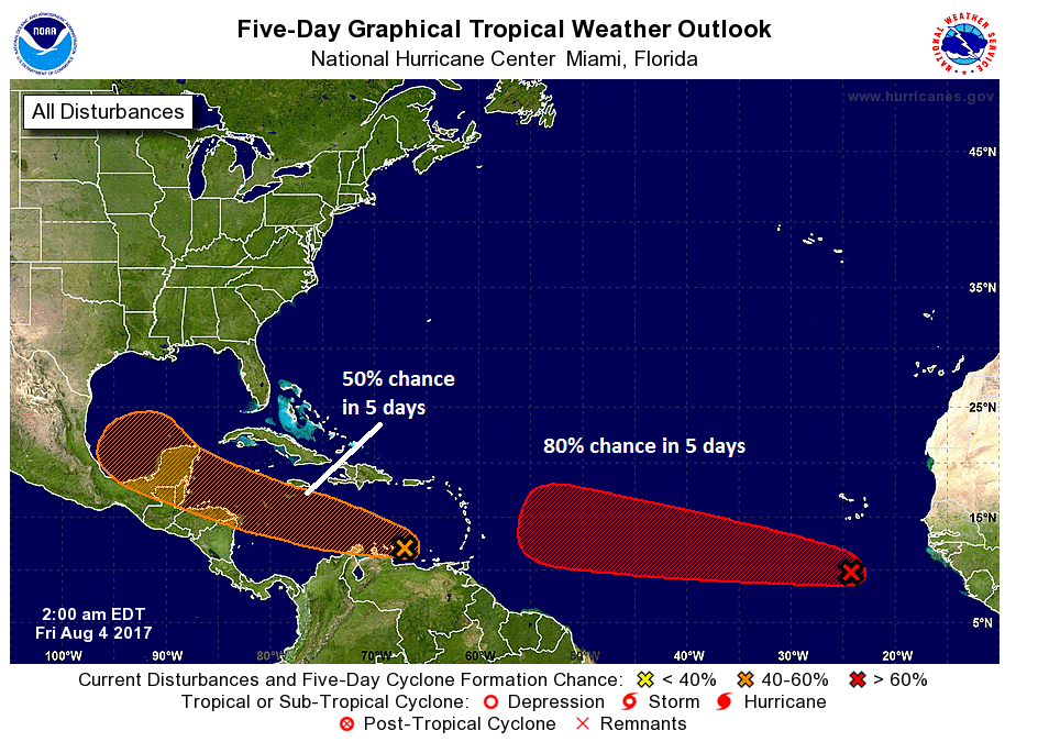
The big question as this meteorologist sees it revolves around how strong this system gets. As mentioned above, the central US trough weakens next week, replaced by a weak ridge over Texas. If we have a weak tropical system moving into the Bay of Campeche and Southwest Gulf next week, that ridge should easily keep it well south of our area, probably south of the Rio Grande into Mexico. This is the scenario most of our weather models support right now. However, a stronger system could overcome the ridge and inch further north. In that instance, even though I still believe it would stay well to the south of the Houston area, we’d want to watch it closely.
As of Friday morning, this isn’t anything for us to worry about, but it is worth checking back in on late this weekend or certainly Monday morning. If you have plans to travel to Port Aransas or South Padre next week, you’ll definitely want to keep a close eye on things. Eric and I will keep you posted on this as the details gradually become more clear. Meanwhile, it’s a good time to remember it’s August. Hurricane season normally ramps up now, and the more proactive you are with planning, the better off you will be should one actually threaten.
Posted at 6:30 AM Friday by Matt
As of last night, the weather service we use at work has the thing in the Caribbean becoming a tropical storm Wednesday, and potentially a hurricane before landfall in northern Mexico.
That’s as good of a guess as any, but right now there are too many questions about intensity and the strength of the ridge to say much about the track.
Is a turn northward toward Houston likely if system is strong enough?
Nope. Does not appear to be a real risk at this point.
In last paragraph of “Today through Sunday” I believe you mean “the sun peeks out,” since it will lift a cloudy veil rather than “peaks out,” which implies reaching its height or similar usage.
Thanks!
89 to 90 might not be “pleasant” for other areas / people, but it’s far better than the typical
“90-squared” (99 F with 90% humidity) we get in Houston in August! I’ll take 89-90 ANYTIME in August!
And is it correct to say the “pain” we get when high pressure beneficially blocks the tropical nasties from hitting us is the “90-squared” steaminess?
That can indeed be the case! Sometimes the humidity is a bit lower in those instances, but yes, sometimes the price to pay to avoid a tropical storm or hurricane is a little hotter weather!
Thanks.