Good morning. Houston’s cloudy, on-and-off again rainy weather will continue for several more days. I’ll also discuss the tropics, which seem likely to begin heating up soon as we’re now into August.
Thursday
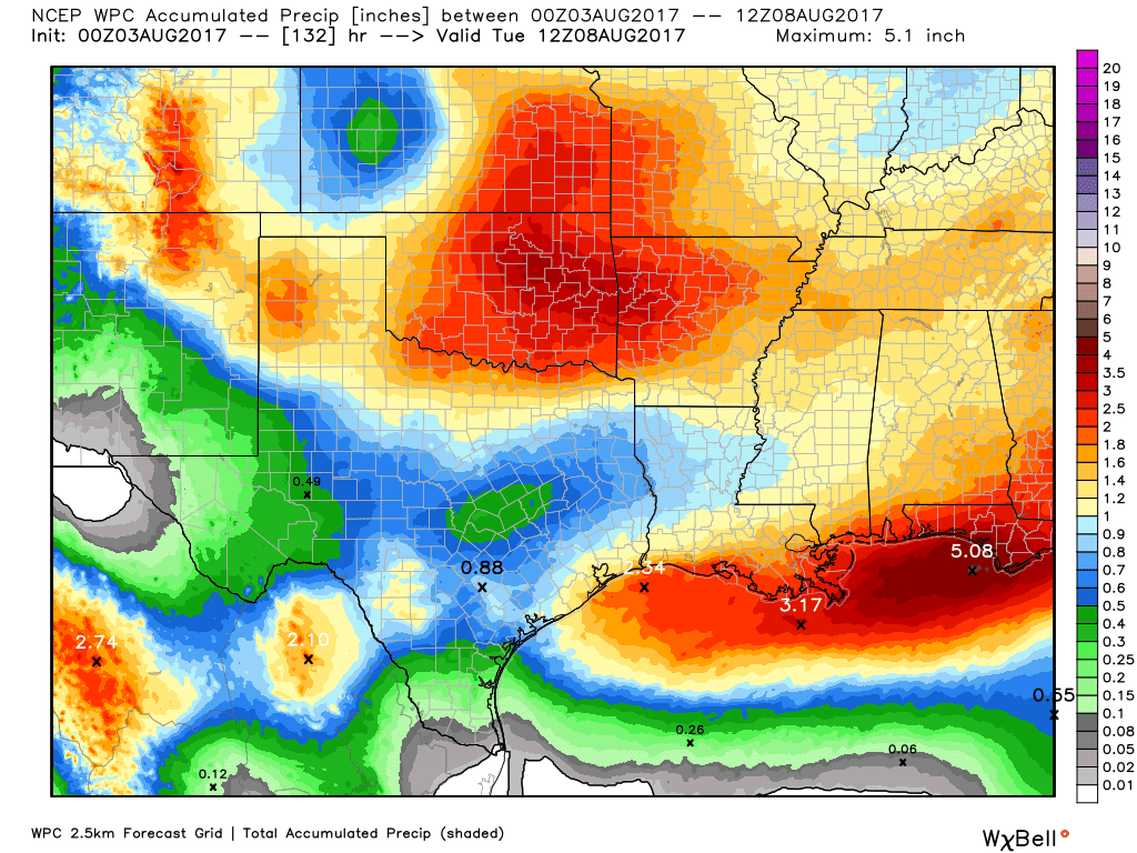
Most of Houston saw 0.5 to 3.0 inches of rain on Wednesday, and while I don’t think today will be as wet, I do think the region will see fairly widespread showers and thunderstorms later this morning and during the afternoon hours. Accumulations shouldn’t be too concerning—i.e. they’re unlikely to produce some of the street flooding we saw Wednesday. Temperatures will remain pleasant for this time of year, with highs in the upper 80s to 90 degrees.
Friday through Monday
Not a whole lot is likely to change from Friday through the weekend, as a very moist air mass remains settled over the greater Houston region. This will bring partly to mostly cloudy days to the area, and a healthy 40 to 50 percent chance of rain. I don’t think we’re looking at any kind of significant flooding, and accumulations will probably be less than 1 to 2 inches for most areas
Overall, the clouds should be enough to hold temperatures to around 90 degrees for the most part. One warning, if the Sun does come out for a few hours over your location, it will turn hot and steamy fairly quickly.

Tuesday and beyond
Nothing too exciting to start out next week, as Houston remains in a pattern of partly sunny days, with highs in the low 90s, and a modest chance of afternoon rain showers. It won’t be great—but conditions could be far, far worse in early- to mid-August.
Tropics
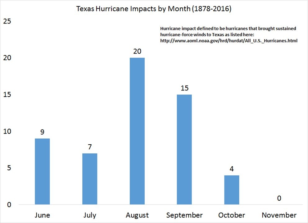
Speaking of August, this is when the tropics typically come alive. This is for several reasons: The Atlantic nears peak heating, waves moving off of Africa into the tropical Atlantic are more vigorous, and wind shear tends to drop across the tropical Atlantic and Caribbean Sea. For Texas, August is the month when most hurricanes have typically struck the state.
Already, we’re seeing a fairly organized wave in the far eastern Atlantic, that is likely to become a tropical storm or hurricane even during the next five days (60 percent chance). It is way too early to say whether this system will move toward the Caribbean Sea (and eventually the Gulf of Mexico), or curve out to sea. But it is indicative that we’re about to see the Atlantic heat up. Closer to home, there are also a few hints in the models that something may spin up in the southern Gulf of Mexico next week
Right now, neither of these systems presents any kind of impending threat to Texas. But it is time to watch the tropics, as the next eight weeks are typically the busiest time of year for us.
Posted at 7:15am CT on Thursday by Eric
Sadly, I was the ONE rain gauge in Harris county to record Zip, Zilch, Nada yesterday but a few spits. I would Love some if the flooding downpours as the years is suffering…..and so am I! Rain, rain everywhere but here. Sigh.
59/San Jacinto river by Humble.
Thanks for a Great website…you are doing a great service.
Quite welcome!
Another site shows heat index for Fri Sat Sun at 109 110 and 111.
Is that realistic? Planning some outdoor activity and if it’s going to be that steamy…
I don’t think so — most likely in the low 100s. However as I mentioned this morning, if the sun stays out for awhile could see the heat index creep up into the 105-degree range.
Eric, I’m very worried about Invest 90 in the E Caribbean, which now has a 40% of development. Our area’s only chance seems to be a mid-level ridge that will attempt to build westward from FL toward LA/TX by the middle of next week. If so, this would keep any weak tropical system buried over the Bay of Campeche. But I’m told that this isn’t forecast to be a strong ridge and a stronger tropical system (as suggested by the ECMWF) would likely be able to turn more WNW or even NW pushing against the ridge once in the Gulf of Mexico. Problem is, I don’t know what the more likely scenario is:
1. A weak system that goes into Mex. well south of Texas. OR:
2. A powerful hurricane that turns more NW and then N, to bear down on SE Texas by the end of next week.
Please help me!
One nice thing about the three + inches of rain we got Wednesday – an evening walk with the temperature at 76F. Can’t do that in August very often around here.
Curious whether you can plot this data in such a way that illustrates whether more recently storms tend to come later. Maybe bin the years and make a 3D plot vs the number of storms per month?