Warm weather this week, fall weather next week for Houston

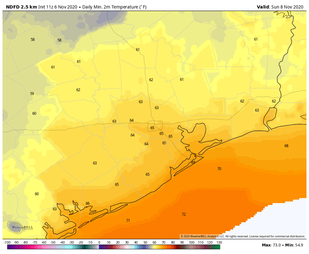
Good morning. Normal high temperatures for mid-November generally run in the low 70s for Houston, with overnight lows in low 50s. For much of the city—with the exception of some outlying areas far from the coast—we are going to run about 10 degrees above this through Sunday before our next robust front arrives. That’s OK if you like warm days, but bad news if you’re eager to wear a sweater.

Wednesday

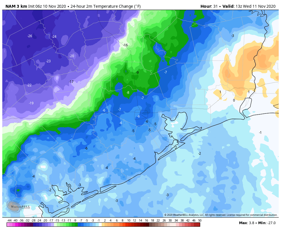
A weak front has made it through most of the region and will limp off the coast later this morning. As the air dries out behind the front we should see our cloudy skies turn more sunny. Highs should reach into the low 80s today, but the night will feel more crisp thanks to the front. Expect lows to drop down to around 60 degrees for the city, with cooler temperatures inland, and a bit warmer closer to the coast. Winds will be out of the northeast at generally 5 to 10 mph.

Wednesday night will be the coolest of the week for most of Houston. (Pivotal Weather)

Thursday and Friday

A generally northeast and then easterly flow should keep some of the humidity at bay, and as a result we can expect a pair of quite nice, sunny days. We should see highs in the low 80s, and with the dry air helping to drop overnight lows in the low 60s for most.

Saturday and Sunday

As winds shift to the southeast, we can expect rising humidity levels this weekend. Mostly sunny skies should help nudge daytime highs into the mid-80s, and Saturday night should be warmer for most, perhaps nearing 70 for some areas. Sunday should be mostly sunny again, but then a front will sweep through. Timing is still to be determined, but it probably will come through some time during the afternoon and overnight hours. The moisture profile with this front is not overly impressive, so I don’t think we’ll get the rains we need as it passes.

Next week

This week should definitely feel more fall like, with highs generally in the 70s, and lows in the 50s in Houston—and perhaps in the 40s for areas further inland.
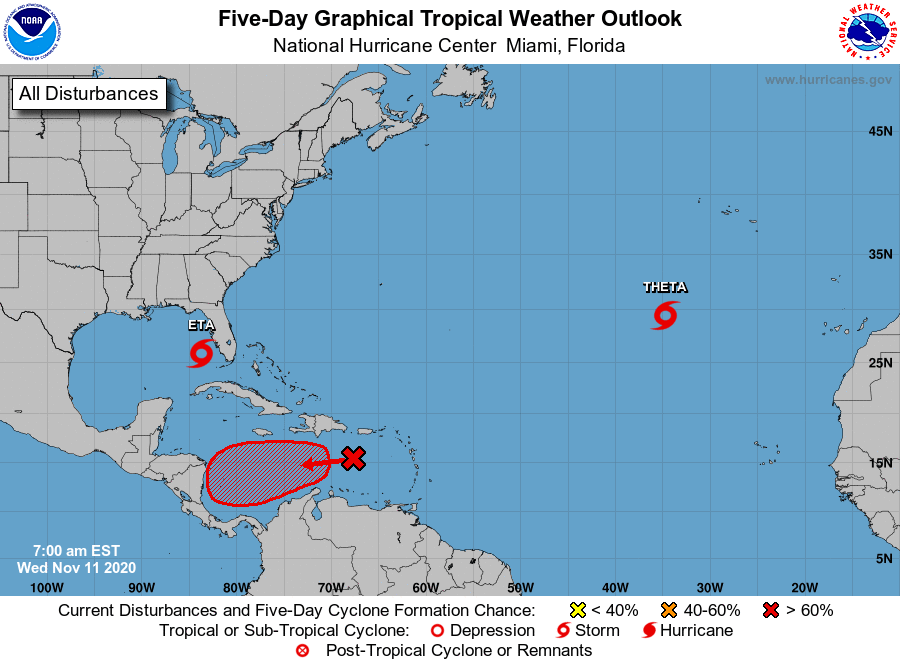
I mean, come on already, it’s mid-November. (National Hurricane Center)

Tropics

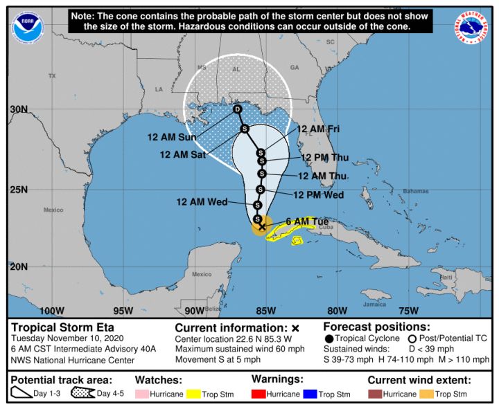
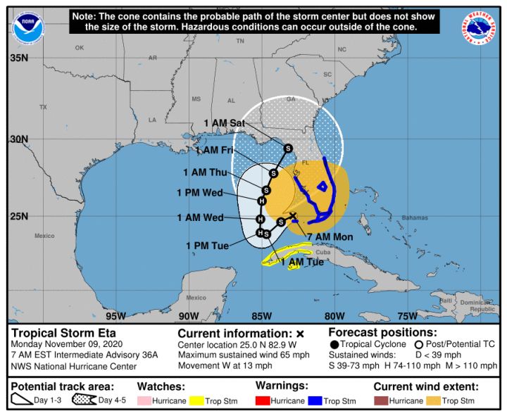
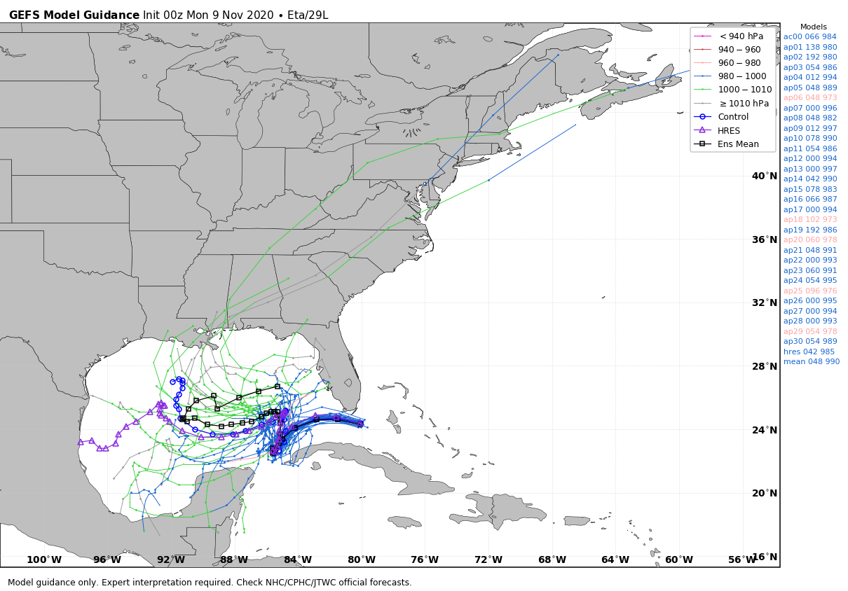
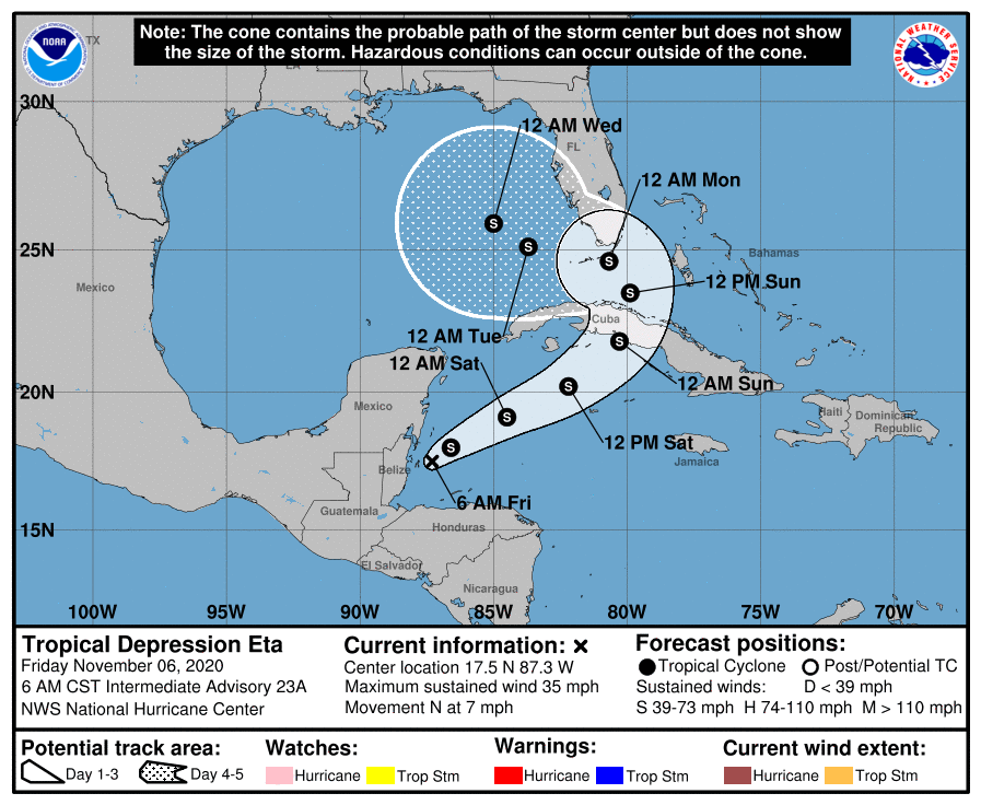
We’re still tracking Eta, Theta, and soon … Iota? Eta has become a Category 1 hurricane in the southeastern Gulf of Mexico, but it should begin to weaken in the next 24 hours as it encounters more hostile wind shear. It will be a rainstorm, primarily, for Florida as it crosses the peninsula on Thursday and then begins to head toward the exits. (Yes, there finally is some confidence in the storm’s track). Theta seems unlikely to threaten major landmasses. When it forms in a few days, Iota most likely will track into Central America, and not reemerge as Eta did.

After another humid day, drier air arrives in the region on Wednesday

Good morning. Yesterday we launched our 2020 fundraiser, and the response has been tremendous so far. It really is humbling to find out, at the end of each year, how much the greater Houston community supports this site—and it energizes Matt and I to keep doing what we do. So thank you very much. As for our forecast, well, it’s changed a bit for the week ahead with more drier air making it into the area than anticipated. (Not that we’re complaining).

Tuesday

Conditions are quite warm this morning, especially for November, as lows have not fallen below 70 degrees for much of the area. An increase in atmospheric moisture should allow for a decent chance of rain today, with perhaps 30 percent of the area seeing light to moderate showers. Otherwise, high temperatures should rise into the mid-80s under partly sunny skies. The good news is that a much-discussed weak front is now expected to make it all the way to the coast on Tuesday night or Wednesday morning.

The front will make it to the coast on Wednesday morning, but its effects will be much more pronounced for inland counties, as seen in this map of 24-hour temperature differences. (Weather Bell)

Wednesday, Thursday, and Friday

The weak front will bring moderately drier air into the region, and while this will not have too much effect on daytime temperatures—still likely to be in the low 80s beneath sunny skies—nights will be more pleasant for the second half of the week. Look for lows down near 60 in the city of Houston, with warmer temperatures along the coast, and cooler weather inland. Rain chances will be near zero.

Saturday and Sunday

Most of this weekend will probably continue to bring sunshine and warm temperatures in the low 80s. A front will also push through the area, but I can’t tell you now whether that is going to happen on Saturday night, or Sunday night. Also, while we definitely need rain, unfortunately this front does not appear to be of the rainmaking type—at least not at this vantage point. Things could still change.

Next week

Our weather for much of next week looks splendid in the wake of the front, with highs in the 70s and lows generally in the 50s.

Tropics

The 2020 Atlantic hurricane season just will not quit. On Monday, Subtropical Storm Theta formed in the far Atlantic Ocean, and it may eventually threaten Europe with winds and heavy rains. This means we have broken the all-time record for named tropical systems in the Atlantic this year, with 29. Fitting, I’d say, for this year.

Track forecast for Tropical Storm Eta. (National Hurricane Center)

Closer to home, where there is virtually no confidence in the track for Tropical Storm Eta. My personal guess is that it will eventually succumb to wind shear and dry air over the eastern Gulf of Mexico, and not make landfall again. But that is solely a guess—the tropics have continually surprised us this year. All I can say for sure is that Texas need not worry about Eta.

Launching the 2020 Space City Weather fundraiser—your chance to give back

Before jumping into the forecast this morning I want to announce the beginning of our 2020 fundraiser, which will last for the next three weeks. We only do this once a year, and never during inclement weather, because Matt and I do not want to seem opportunistic. But if you would like to help support the site—which is a considerable undertaking—this is your chance. All items should arrive a week before Christmas.

At our fundraising link you can purchase:

With this design Matt and I hope to earn your vote in 2021. Our campaign promise to you: Low humidity!

Given the horrendous hurricane season endured by our neighbors to the east this year, we are donating 25 percent of proceeds from the “Texas stands with Louisiana” shirt to the Louisiana-based charity SBP, which helps homeowners and businesses rebuild after tropical disasters. The design of this t-shirt and sweatshirt showcases Texas’ solidarity with our neighboring state after it endured five hurricane landfalls this year.

Louisiana-Texas t-shirt design. 25 percent of funds raised with this design will be donated to SBP.

Thank you for your support—Matt and I are always truly humbled by the response to this fundraiser.

Monday

Today’s weather will more or less be a continuation of Sunday, with some patchy fog in the morning giving way to partly sunny skies later in the day. Expect light southeasterly winds, and highs to reach into the low 80s for most areas. Temperatures Monday night are unlikely to drop much below 70 for most areas, with plenty of humidity. This should be the warmest night of the week.

Tuesday

This is the day a cold front approaches the region, but it probably will not push into the metro area until the overnight hours. Also, it’s almost certainly going to stall near the Interstate 69 corridor—so if you live south or east of Houston you’re unlikely to see much of a sensible change in your weather. This front may generate some scattered, light showers, but overall rain chances are probably less than 30 percent on Tuesday and Tuesday night. Expect highs to reach around 80 degrees.

Wednesday, Thursday, and Friday

The effects of the front will wash out pretty quickly on Wednesday as the it waffles around and retreats, but our overall flow should turn more easterly to end the week. The net effect of this will be to bring slightly drier and cooler air into the region. Expect sunny days, highs of around 80 or in the low 80s, and overnight lows dropping into the low- to mid-60s except right along the coast.

Saturday, Sunday, and beyond

This weekend should see a continuation of our sunny weather and warm days, with highs of around 80 degrees, or a bit warmer. The pattern finally changes—timing to be nailed down later—with a front later on Sunday, or Sunday night to bring much drier air into the region and cool us down. At this point, the front does not look much like a rainmaker however.

Tropical Storm Eta

This system continues to confound forecasters. The storm’s official track forecast is shown below, but the European and GFS models diverge broadly in their forecasts. The official track more or less follows the European model forecast.

Official Eta track forecast. (National Hurricane Center)

But there is another reasonably likely possibility in which Eta continues to drift west in the Gulf of Mexico on Tuesday and Wednesday and then … succumbs to wind shear and dies, or bends back north toward the northern Gulf of Mexico coast, or keeps drifting southwest into Mexico.

GFS model ensemble forecast for Tropical Storm Eta. (Weather Bell)

If you’re looking at this and you’re worried about Texas, don’t be. There are no real plausible scenarios in which Eta drifts westward far enough, and holds a circulation together long enough, to have a meaningful impact on the state.

A nice, slightly warmer weekend ahead, so when is Houston’s next front?

After a truly delightful stretch of autumn weather the last week or so, the weather pattern will change this weekend, ushering in slightly warmer temperatures (especially in the mornings) and noticeably higher humidity. Overall, it should still be pretty nice though!

Today

Look for abundant sunshine today. We’ll manage to warm into the low-80s this afternoon after a cool start in the 50s for most.

Weekend

We should continue with partly to mostly sunny skies this weekend, although I think we’ll probably see at least a few more clouds on Sunday. Shower chances should be very low and mainly off to our east. They won’t be zero though, so don’t be shocked to see some sprinkles or a passing shower, especially east of I-45 on Sunday.

Sunday morning should feature low temperatures back up into the 60s in most places as humidity returns. (NWS forecast via WeatherBell)

While daytime highs should be basically in the low-80s each day, morning lows will build from the upper-50s tomorrow, about 5 or 6 degrees warmer than today, to the mid-60s on Sunday morning.

Next week

We will continue to see temperatures and humidity build a bit on Monday. There should be a good amount of morning low clouds around, followed by some gradual clearing. That said, an isolated shower is possible. Highs should again be in the 80s after starting the day in the mid- to upper-60s. Tuesday sees a cold front approach the College Station area. We will again be warm with highs in the 80s and lows in the 60s, if not low-70s.

The question then becomes: Does that front get to Houston? Right now, the answer is probably not. At least not right away. Expect that front to flirt with us or areas to our west into later next week before perhaps getting a kick through by next weekend. We should see a mix of sun and clouds in the lead up to that. Temperatures will still be warm, but they might be a few degrees cooler than early in the week, however. More on this for you Monday.

We could use some rain

Since Tropical Storm Beta back in late September, the Houston area (officially) has had less than 1 inch of rainfall. Some places have seen some more, others less. While Harris County is not in drought, we are starting to see pockets of drought flare up in surrounding counties.

Drought is slowly expanding in the counties surrounding Houston. (UNL Drought Monitor)

We could use a bit of rainfall. While the chance of showers isn’t zero over the next week, we aren’t expecting any meaningful rain. Perhaps with next weekend’s cold front push. We’ll see.

Tropics

Tropical Depression Eta is expected to return to tropical storm strength this afternoon or tonight. It will then take a very convoluted track over Cuba, possibly east of Florida, then back west into the Gulf.

Eta is expected to become a tropical storm again before taking a really abnormal track around Cuba and Florida over the next 5 to 7 days. (NOAA NHC)

We don’t expect Eta to intensify significantly, but nevertheless it will be a tropical storm, capable of doing tropical storm things for Cuba and South Florida. The end game here should see Eta picked up and lifted north into the eastern Gulf Coast later next week as our cold front slides that way, probably still as a tropical storm.