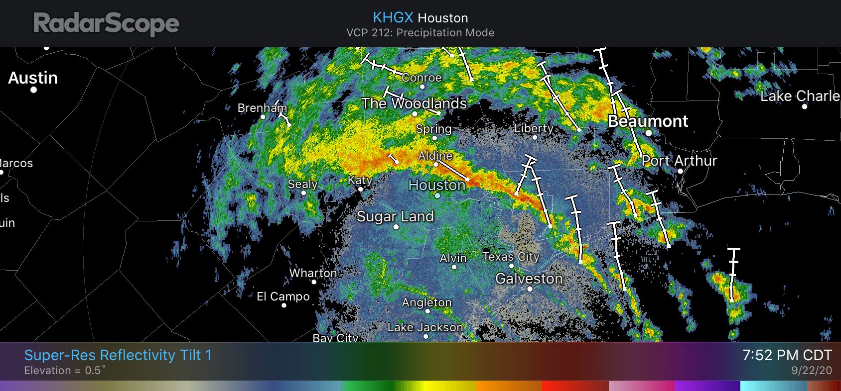
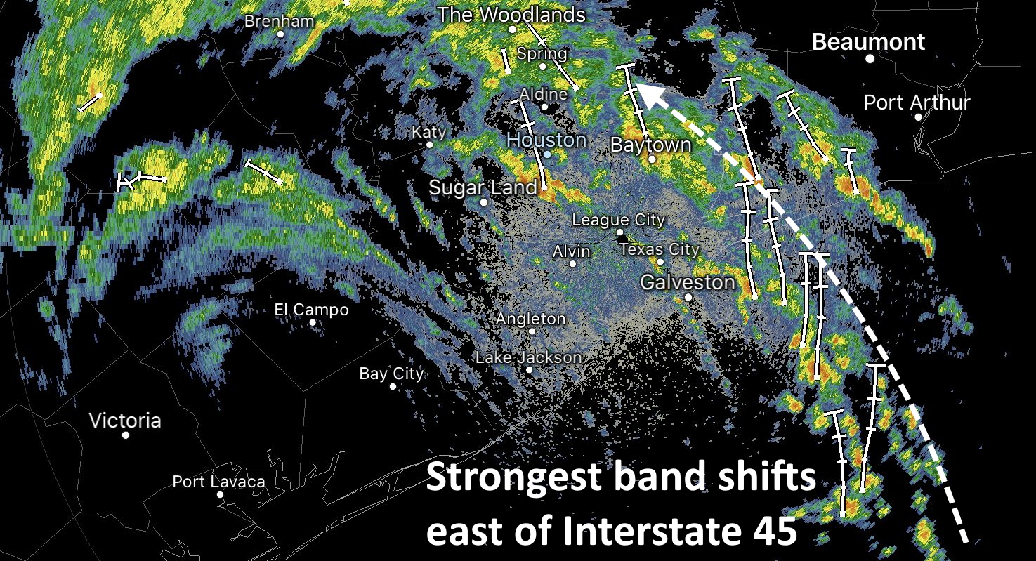
10:15 pm CT Tuesday: The remnants of Beta are continuing to trudge toward the east-northeast, and that’s good news for the greater Houston area. The strongest, outer band has already moved well east of the city, and now lies mostly north of Harris County. And it should keep right on going thanks to Beta’s progressive movement.
We’ve seen some strong storms this evening that have dropped 2 to 5 inches of rain over north and northwest Harris County, including areas such as Cypress Creek. This has brought the creek to near bankfull at some locations. But these storms appear to be moderating somewhat, and slowly lifting out of the area. The heaviest rains are now moving into areas such as The Woodlands, Kingwood, and Liberty that have largely been untouched, heretofore, by Beta’s heavy rains. Some of these locations may pick up 2 to 4 inches, but that’s probably about the top end of things tonight because the storms seem to be moving through at a reasonable clip.

There is a secondary circulation near Beta’s center this evening, and this is producing some light to moderate showers over Pearland, Sugar Land, League City, and other areas hard hit by Beta on Monday night. However, we have no expectation that this inner circulation will “blow up” as it moves through these areas and into Houston. These storms may put down a few tenths of an inch of rain, perhaps as much as one inch in a few areas, and then move on.
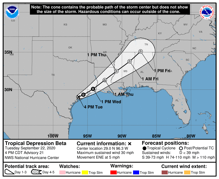
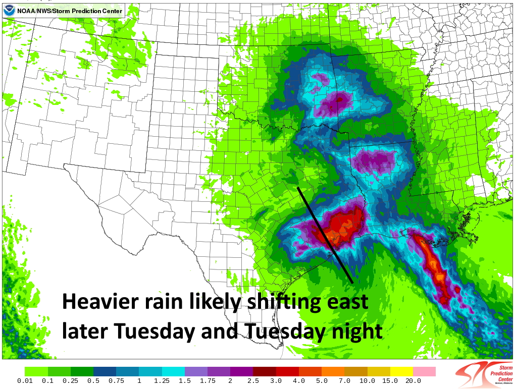
Generally, we still expect any heavier rain to move east of Interstate 45 by around midnight, or shortly after; and for the messy stuff to move beyond Harris County by around sunrise on Wednesday. From there the focus moves into East Texas, where places like Lumberton or Silsbee may see some very heavy rain on Wednesday morning. We are close to the end of this one, folks, and damn if it doesn’t feel good.
Our next post will come on Wednesday morning, after I’ve had some sleep.