Our weather: Mostly dry and plenty hot, with a wary eye on the tropics

Good morning. A front is having subtle effects on Houston’s weather, but we’re still going to be plenty hot in the coming days. High temperatures should moderate slightly by the weekend, but we’re still looking at mostly sunny weather for several days. Next week our weather will be guided, to some extent at least, by any tropical systems that move into the Gulf of Mexico. We’re not seeing any direct threats, at least not yet, and Matt will have a full rundown later today on the tropical state of play.
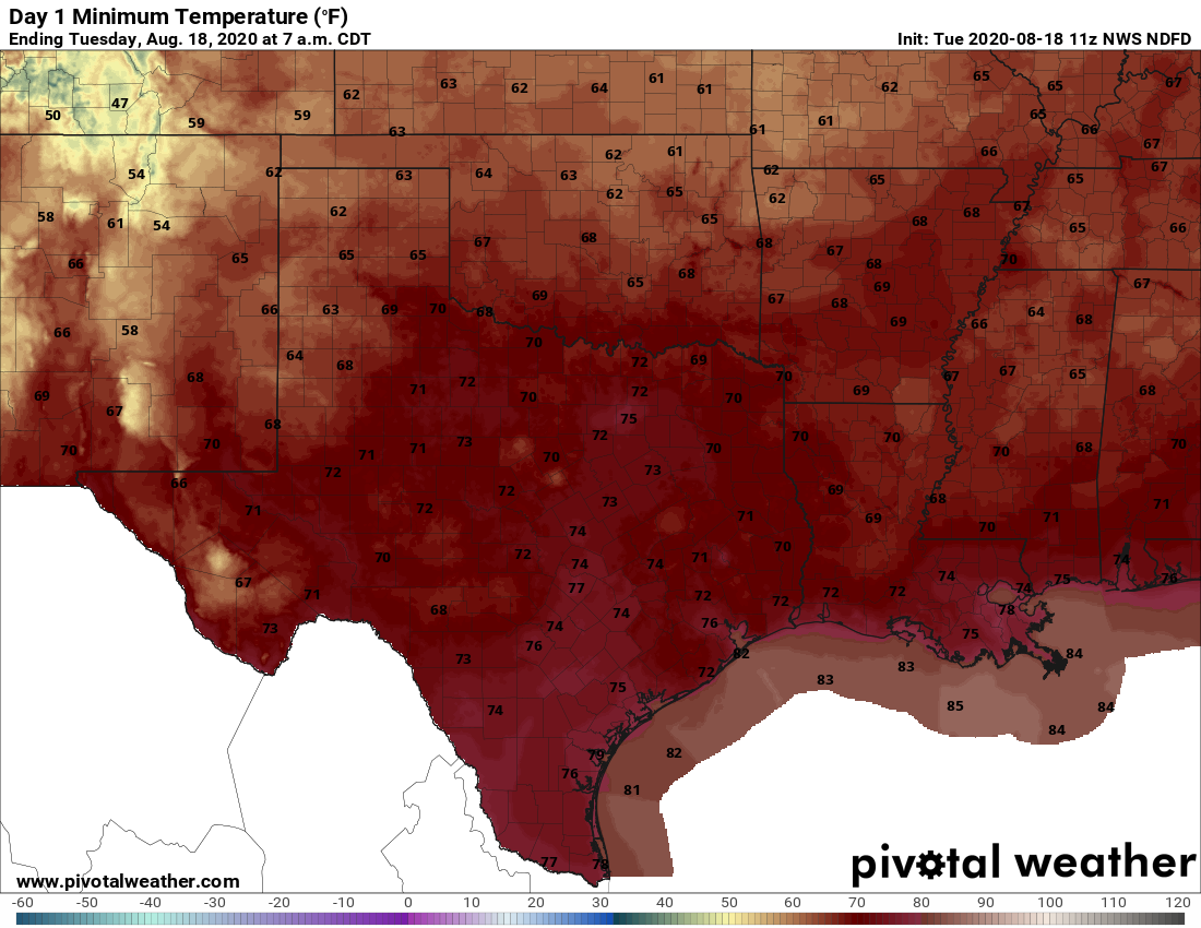
Low temperatures on Wednesday morning will be slightly cooler than we’ve been seeing for most of August. (Pivotal Weather)

Tuesday

Expect hot and sunny conditions to prevail, with highs pushing into the upper 90s to 100 degrees this afternoon as drier air helps with warming. Despite the drier air, models are picking up a slug of moisture in the lower atmosphere that may help to generate some scattered showers primarily on the western half of the metro area later today. This should be pushed away by this evening as additional dry air continues to move in, both at the surface and above. This should set the stage for a slightly cooler night, with lows dropping into the mid-70s across much of the city. The coast, alas, is still going to see pretty normal humidity for this time of year.

Wednesday

This will be a hot and sunny day, with drier air in evidence. Expect highs in the upper 90s, with sunny skies and light winds out of the north. Temperatures should again moderate reasonably quickly as the sun sets, and drier help helps.

See full post

Yes, an August “front” has moved into Houston

Good morning. The Houston region saw its first real taste of rainfall in two weeks early on Monday as a line of storms pushed from north to south through the area. It was hit or miss in the metro area, with some parts of the region picking up as much as 1.5 inches, and others seeing lightning, but no real rainfall. The storms heralded the arrival of a front that will eventually bring some drier air into the region—which we’ll feel this in the morning and evening.

Monday

Some rain chances will linger into this morning, but as drier air moves in we should see gradually diminished precipitation throughout the day. By this afternoon skies should be partly to mostly sunny, and we can expect highs to reach the upper 90s. Winds will be light, but out of the north at 5 to 10 mph. Low temperatures will be a degree or two cooler tonight, but the real effect will be in the “feels like” department, not the actual mercury. This effect will be more pronounced north of I-10 than along the coast.

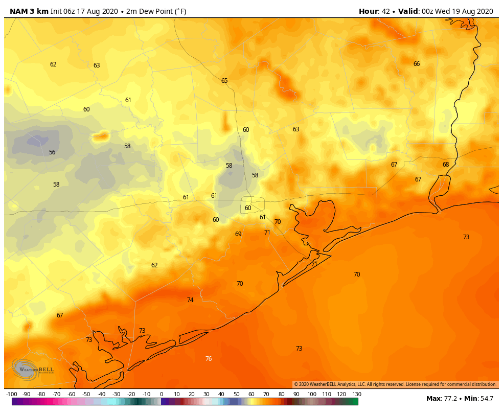
NAM model forecast for dew points at 7pm CT Tuesday. (Weather Bell)

Tuesday

As more dry air filters into the region we’ll see a hot and sunny day. Temperatures will push into the upper 90s, and probably touch 100 degrees for inland areas. If you’re thinking, this sure doesn’t feel like a front, well, you’re right. But this is how cool fronts in August go. There won’t be much impact to temperatures, but evenings and mornings should feel somewhat drier. Instead of dew points of around 70 degrees, which is very sticky and muggy, dew points around sunrise and around sunset may be be about 10 degrees lower away from the immediate coast. A dew point of 60 degrees is definitely not fall-like, but it’s also definitely not “dog’s breath” weather like we normally get in the summer, either. Small victories, people.

See full post

Late Sunday storms may provide some relief for the Houston area

Back on Friday, I wrote in our weekend forecast discussion that “if the chance of a shower is about 10 percent Friday and Saturday, maybe it inches up to 15 or 20 percent Sunday.” We pride ourselves on honesty here at Space City Weather, and that will end up likely proving inaccurate. The reality is that compared to Friday, our Monday front is a bit faster and has a burst of upper level support in the atmosphere this afternoon which should allow storms to blossom today.

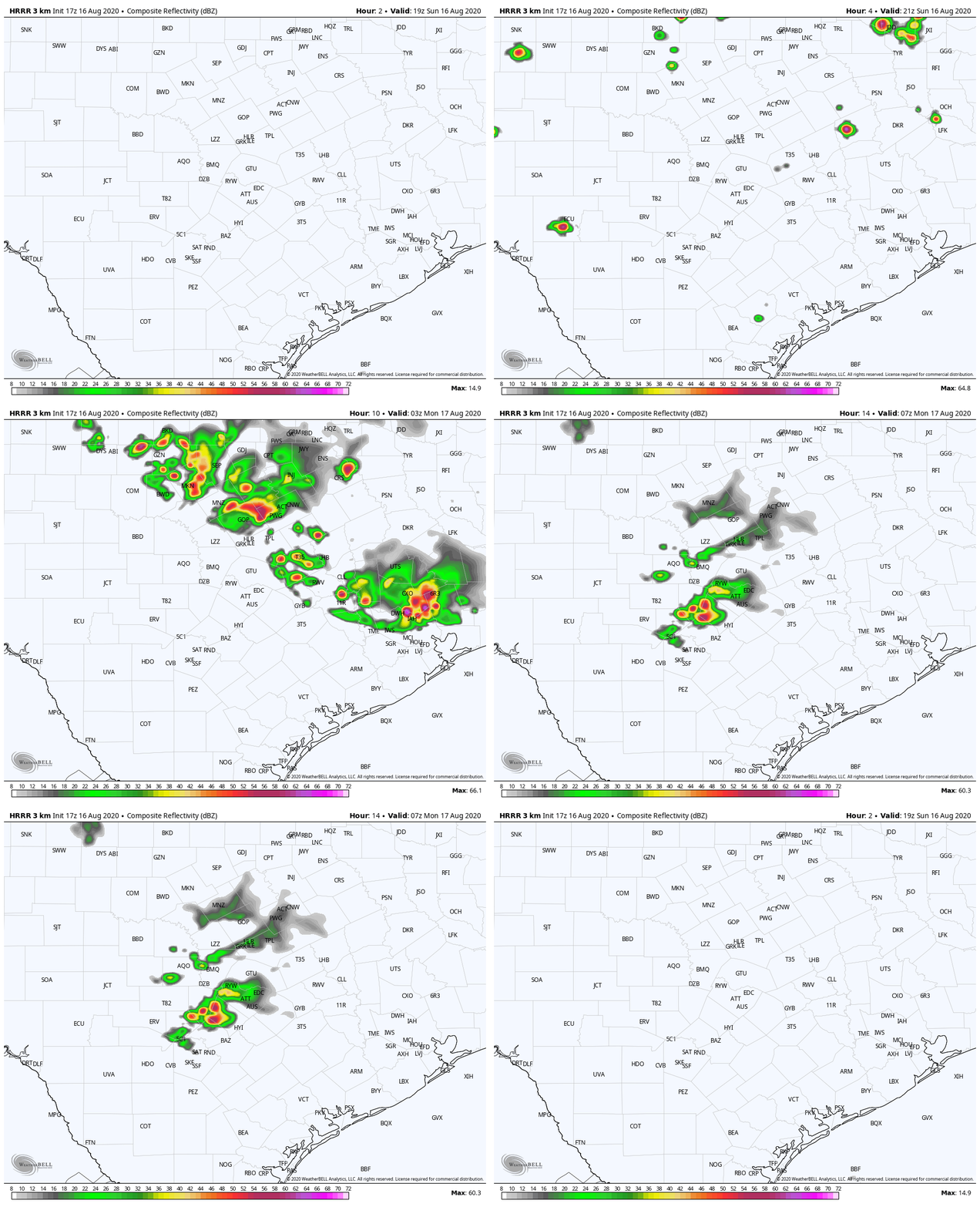
Radar is quiet as of this writing, but as an upper level disturbance interacts with the ample heat and humidity over our area, it may be just the trigger needed for strong thunderstorms to develop north of Huntsville and Conroe by about 3 or 4 PM. We expect a complex of storms to develop up that way and drop into places like Conroe and The Woodlands between 7 and 9 PM or so.

Here is the HRRR model simulation of radar between 2 PM Sunday and 2 AM Monday, and you can see storms generally dropping southward through the area this evening. (Weather Bell)

After that, things do become a little more uncertain. Most modeling does bring those storms into the I-10 corridor and possibly points south after 8 to 9 PM or so. We’ll see if the storms can survive the trip, but the bottom line is a likely dry afternoon for Houston and points south, with storm risks increasing later in the evening.

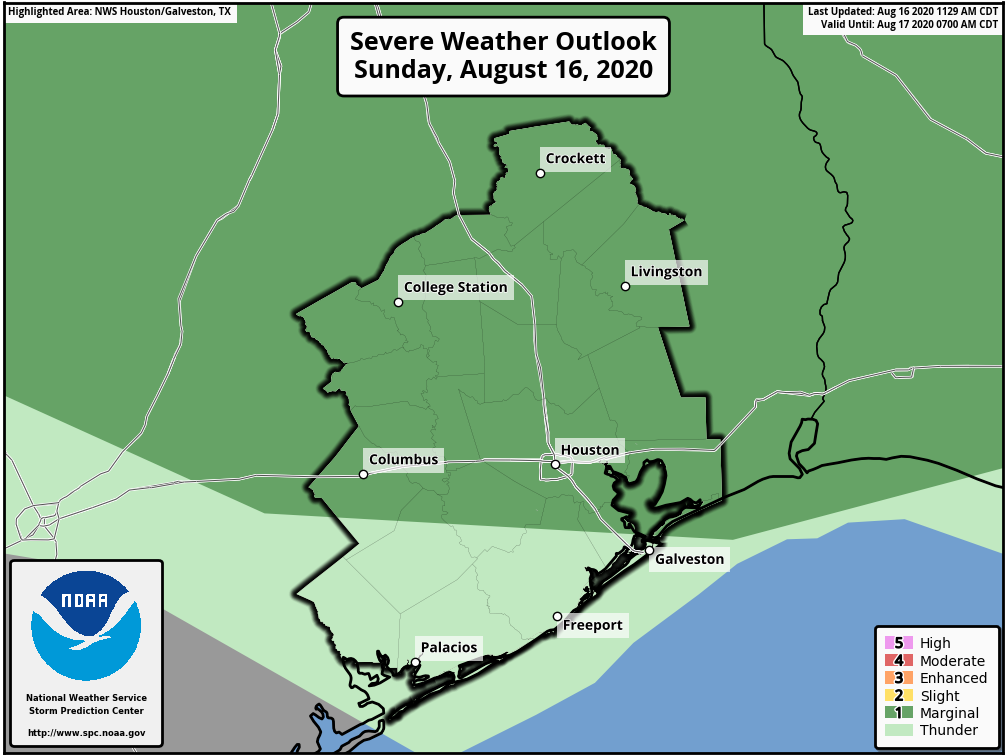
Some storms could be strong to severe with damaging winds being the main concern and hail a secondary concern. (NOAA)

This does not look like a high-end severe weather outbreak, but storms could certainly become strong to severe as they drop through the region. We are in a “marginal” risk (1/5) of severe weather. Hail is a possibility, but as is often the case in these sorts of setups, strong winds may be the more common problem. With the storms moving at a pretty healthy clip, look for gusty winds ahead of the rain this evening, especially north of I-10.

Storms should dissipate or move offshore overnight, leaving us mostly quiet to start Monday. We can’t rule out more showers and storms tomorrow. The cold front should arrive later tomorrow, ushering in slightly less humid air for midweek, which will be most noticed at night via slightly cooler nighttime lows. Eric will have more on that in the morning and an update on the tropics, which he has already touched on today.

As we enter the second half of August, deep tropics heating up

Over the last week a pair of non-consequential tropical systems have formed over the Atlantic—Tropical Storm Josephine, which is weakening at sea, and Kyle, which has already dissipated. However as a more favorable pattern for rising air moves into the deep Atlantic tropics we can expect to see storms firing up in the main development region between the west coast of Africa and the Caribbean Sea. This indicates we likely will see stronger hurricanes begin to develop in the coming weeks.

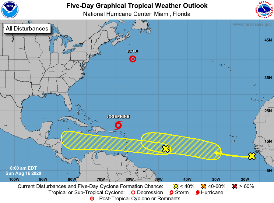
To that end, the National Hurricane Center has begun tracking two areas of interest that are moving generally westward across the Atlantic Ocean, toward the Caribbean Sea.

7am CT Sunday tropical outlook. (National Hurricane Center)

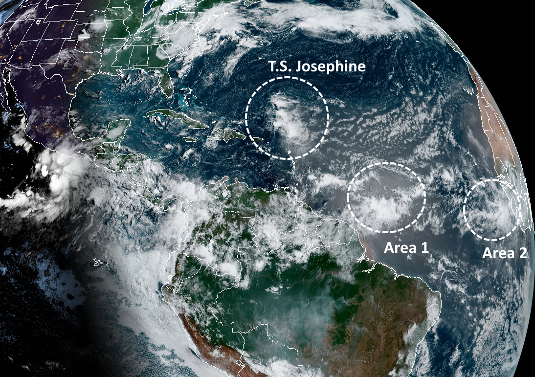
If we take a look at the satellite image this morning, we can see that both of these tropical waves are not yet close to becoming organized. And looking at some global model forecasts, neither of these are slam-dunk systems in the sense that they’re guaranteed to eventually develop into tropical storms or hurricanes.

Annotated satellite image from 8am CT Sunday. (NOAA)

However, it does seem likely that at least one of these systems, or another wave yet to move off Africa, will find the right conditions over the Atlantic, move into the Caribbean Sea, and eventually threaten the Gulf of Mexico. That is certainly what we’ll be watching for over the next few weeks. We’ve been telling you for awhile that the latter half of August and September will be likely busy in the tropics. Now, that time is at hand.