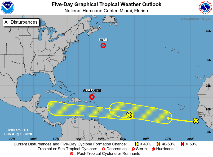
Over the last week a pair of non-consequential tropical systems have formed over the Atlantic—Tropical Storm Josephine, which is weakening at sea, and Kyle, which has already dissipated. However as a more favorable pattern for rising air moves into the deep Atlantic tropics we can expect to see storms firing up in the main development region between the west coast of Africa and the Caribbean Sea. This indicates we likely will see stronger hurricanes begin to develop in the coming weeks.
To that end, the National Hurricane Center has begun tracking two areas of interest that are moving generally westward across the Atlantic Ocean, toward the Caribbean Sea.
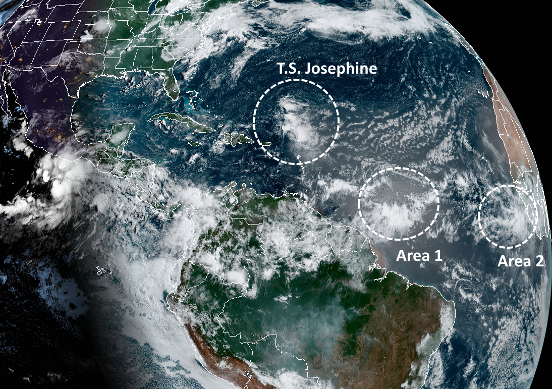
If we take a look at the satellite image this morning, we can see that both of these tropical waves are not yet close to becoming organized. And looking at some global model forecasts, neither of these are slam-dunk systems in the sense that they’re guaranteed to eventually develop into tropical storms or hurricanes.
However, it does seem likely that at least one of these systems, or another wave yet to move off Africa, will find the right conditions over the Atlantic, move into the Caribbean Sea, and eventually threaten the Gulf of Mexico. That is certainly what we’ll be watching for over the next few weeks. We’ve been telling you for awhile that the latter half of August and September will be likely busy in the tropics. Now, that time is at hand.

Can we please have about 2″-3″ of widespread rain and that’s it please?
Thanks Eric, not good news, but news that is good to know.
Thank you for being here — on a Sunday, and whenever we need to know something. Only, sigh, now my Spidey Senses Pucker Factor is starting to engage…
Prepare for and expect the worst, hope for the best. Every year we repeat this process with no end in sight. I’ll keep watching the the weather guys. Not always right, but far better at predicting the weather than I am.
“No Hype”
…[hypothetical hurricanes]…
“Now, that time is at hand”
How is this melodrama not the same as every TV weatherman?
@Mike: Because they’re saying it now, when conditions are most favorable for it to happen…not in late May or early June. I suppose it’s how you read it—-I read it factually, not in the voice of an over-caffeinated TV weather person.
Because it’s the truth. We are now in the 6 or so week stretch where we have the highest chances of getting hit by a hurricane. Time to watch the tropics with both eyes.
In other words: do you have your hurricane supplies prepped and tucked in bottom of closet? If so, relax. If not, go calmly prep (food, batteries, scrips, petfood, water, tp, etc). Then, relax and go about your days. Keep an eye on Space City Weather. All will be well.
If a serious matter is on the horizon, you will read of its probability and see the patterning for yourself. Shared by our trusty bloggers here. Many of us have appreciated this team since our harrowing days of Harvey!
No ptsd here. Just a peaceful awareness of the weather in our humid, tis the season town.
Good grief Katherine. No “evacuate Katy” jokes? No bellyaching about prognosticators? Calm, rational thoughts delivered in a succinct fashion. Whater trying to do? Change our entire approach?