Good morning. Temperatures have generally fallen into the low 40s across much of the metro area, and we’ll now see a gradual warming trend for most of the work week. Rain chances won’t return until about Friday, with our next front. Finally, you may notice we’ve made some modest site design changes—these are the tip of the iceberg in terms of more significant upgrades under the hood. See here for more details.
Monday
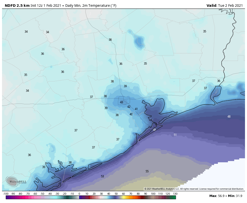
Today will bring nice, winter-like weather to the region, with temperatures rising to about 60 degrees under sunny skies. Winds will be light, out of the northwest, at 5 to 10 mph. With clear skies and light winds, we should see optimal conditions for cooling overnight, with lows near 40 degrees for much of Houston, and 30s in outlying areas away from the coast.
Tuesday
The high pressure that dominated our weather on Sunday and Monday will slide off to the east on Tuesday, allowing for winds to shift to come from the east and then southeast later in the day. Conditions will still be fairly cool during the day, however, with highs in the low 60s for most to go along with sunny skies. Lows Tuesday night will be 5 to 10 degrees warmer with the more moderate flow.
Wednesday and Thursday
As winds start to blow from the south our temperatures and humidity levels will be on the rise. Highs Wednesday will likely reach 70, with the mid-70s on Thursday. Increasing moisture levels will also support the formation of some clouds. Nights will be warmer, in the upper 50s to lows 60s for most.
Friday
We should see the arrival of our next front late on Thursday night, or Friday morning, likely sometime around sunrise. This may generate some light showers, but right now we’re not expecting accumulations to be measured in more than tenths of an inch—or less. Skies should clear some in the wake of the front, with highs somewhere in the 60s.
Saturday and Sunday
It looks like a reinforcing front may push through on Saturday, so we can’t rule out a slight chance of rain at this time. However, for the most part, we can expect partly sunny skies with highs in the 60s on Saturday, and highs in the 50s with lots of sunshine on Sunday. It’s possible that by next Sunday night we may see lows dropping into the 30s, but at this point it’s difficult to nail down precisely how cold the air mass will be.
