Dreary for Houston the next few days, but warm

After the misery of last week, I think we can all agree that boring isn’t necessarily a bad thing, right? Well, the weather will be just that over the next few days, unless you find occasional fog, light showers, and warmer than normal temperatures exciting. And, hey, there’s nothing wrong with that if you do!

Today

Visibility is the main story this morning with a patchwork of mist and sea fog out there. Galveston is reporting a half-mile as of 5 A.M., while Ellington Field reports 10 miles of visibility and Katy/Brookshire reports 2 miles.

It’s a foggy morning on the Strand in Galveston. (Galveston.com)

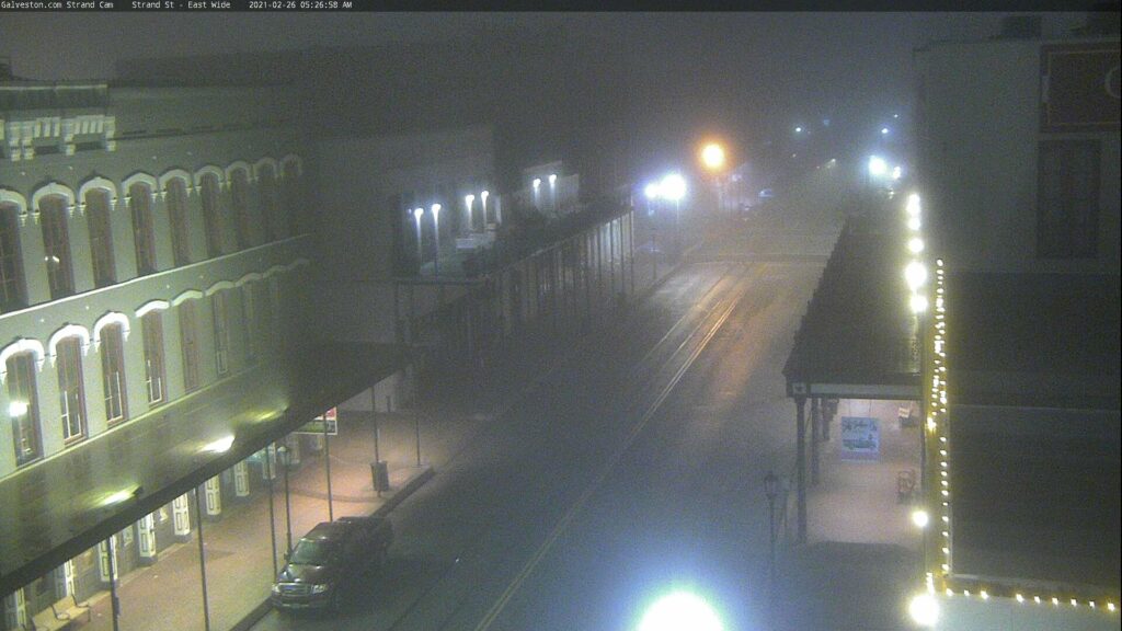
Fog will probably persist near the coast for much of the day, though as is often the case with sea fog, it will likely wax and wane but never completely disappear.

There is a front draped across the northwest part of the area. It should grind to a halt over the Houston metro this morning before lifting back northwest tonight. A few showers will be possible around the area today, but as far as temperatures go, today is a bit challenging.

Temperatures as of 5:30 AM show a sharp dividing line northwest of Houston between 40s and 50s and 60s to near 70 degrees. This boundary will continue southeast and stall somewhere over Houston later this morning. (WeatherBell)

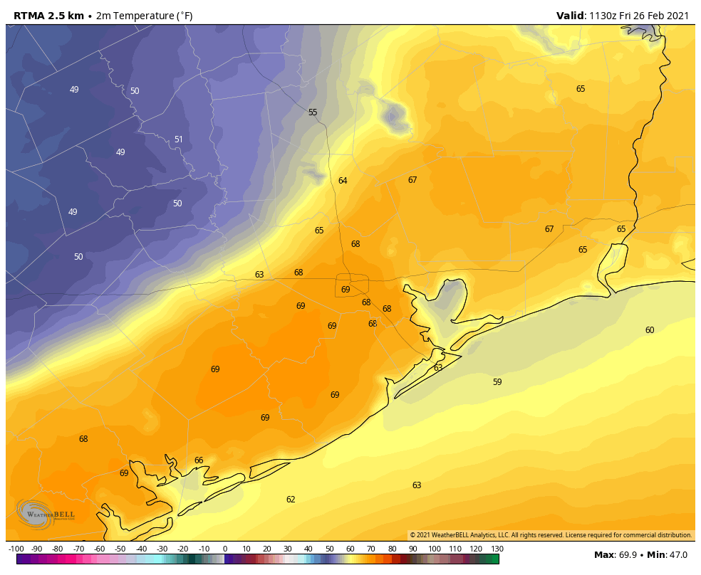
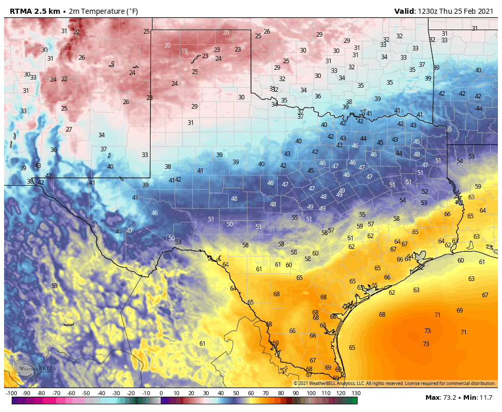
Temperatures behind the front will be a good 15 to 20 degrees cooler than temperatures ahead of the front. In the image above, you can see ample 50s and even some 40s this morning off to the north and west of the Houston area. Immediately ahead of the front it’s already close to 70 degrees. So depending on where that stalls today, it may mean the difference between shorts or hoodie weather. That dividing line will probably be close to US-59, but a 5 to 10 mile shift could mean a *big* difference in temperatures for a lot of people in Houston today.

Saturday & Sunday

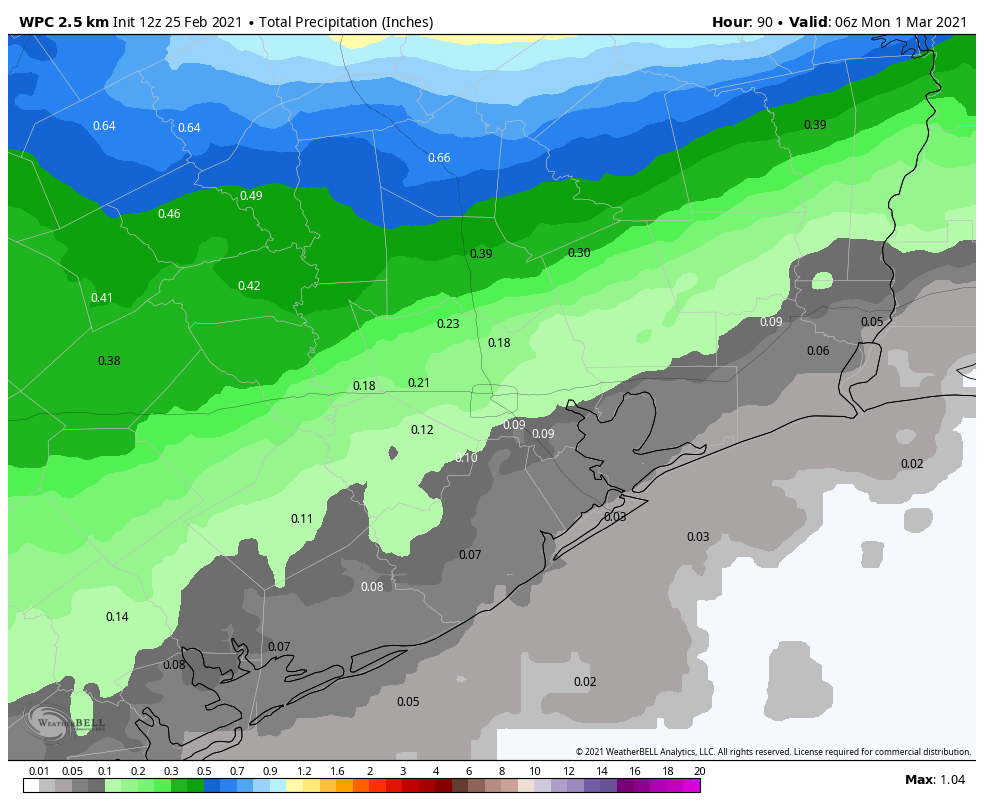
As noted above, that front retreats to the north tonight, so for the most part, the weekend days look pretty similar for Houston: We’ll have more clouds than sun. We’ll have periods of dense fog, especially at the coast but possibly spreading inland at night and in the morning also. We could see a few showers or even a thunderstorm. The best odds for that will be north of I-10, where we could see a quarter-inch or so of rainfall through the weekend. Areas south of I-10 will see less. Morning lows should be in the 60s for most folks this weekend. High temperatures on both days will top off in the 70s in most places.

Monday

On Monday, a weak front moves back closer to our area, which should allow for some showers and storms to be scattered about. The front may be able to nudge past the area, which would allow for cooler, less humid weather to take hold for a bit, but that’s not etched in stone, and if you have plans on Monday you will want to check back with us then for info on any temperature changes or increased rain chances. For now, expect highs near 70 and temps perhaps dropping into the 60s and 50s by later in the day.

Rest of next week

We should see that front make a final push east of the area at some point Tuesday, followed by a stronger push of cooler, drier air Thursday. This will allow fog to dissipate and get us some nicer weather for a few days. No serious cold will follow, but temperatures will likely back into the 60s for highs and 40s for lows. More on this for you Monday.

So, is winter over now for Houston?

It was only about six weeks ago that some readers asked whether winter was over. This question came after a week of very spring-like weather in early January. Our advice at the time: “decidedly not.” Now that we are a little deeper into February, with March just around the corner, it is fair to revisit the question. And this time, our answer is a cautious “yes.”

We’ll loosely define winter as the period when there is a 30 percent chance, or less chance, of a freeze for the remainder of the season. For some locations in Houston, we’ve already passed that. For others, we’re quickly coming upon it. Based on data from NOAA, here is the date after which, historically, there is a 30 percent chance, or less, of a freeze occurring:

  • Galveston Island: February 2
  • Houston Hobby Airport: February 24
  • Sugar Land: Feb. 28
  • Sealy: March 1
  • Houston Bush IAH: March 13

Looking through the first week of March, it appears there will be several nights in the 40s. But right now there is scant evidence of another widespread freeze in the Houston metro area. So if you live south of Interstate 10, I’d feel very confident in planting for the spring. I’d even feel moderately confident doing so north of the freeway, although I might cross a few fingers and toes.

There is quite the difference in temperatures across Texas on Thursday morning. (Weather Bell)

Thursday

It’s gray and very warm across much of the region this morning, with low temperatures generally in the mid-60s. A weak front is pushing into Houston, and will likely stall near Interstate 10. Therefore, inland areas may see highs in the 60s, while closer to the coast you’re in the 70s today, with plenty of humidity. There will be some scattered rain chances, but anything that falls will be light. Lows tonight will drop into the 60s for areas ahead of the front, while some inland locations may see the 50s.

Friday

A secondary push of drier and cooler air will follow on Friday, and this may reach a little further into the Houston area. Temperatures are a total crapshoot therefore. As a best guess, if you live inland of Interstate 69, you may be in the 60s, but closer to the coast we’re probably looking at 70s and plenty of humidity. Very scattered, very light rain showers will be possible again.

Saturday and Sunday

The story of the weekend will be continued mostly cloudy skies and highs in the 70s pretty much area wide as the fronts wash out. Saturday night will be especially warm, only dropping into the upper 60s. The possibility of some scattered showers will remain, and on Sunday evening we may need to watch out for a few stray thunderstorms. Humidity will be in evidence throughout the weekend as well as the possibility of morning fog.

Rain accumulations through the weekend will be less than impressive for most. (Weather Bell)

Next week

After another warm day Monday, a front should arrive on Monday night and this one should push all the way into the Gulf of Mexico. We still have some questions about how long the cooler, drier air will stick around, but I think it’s safe to say that most of next week should be back into nights in the 50s, or possibly 40s, which is more typical for this time of year.

Goodbye sunshine (and winter), and hello clouds

Houston enjoyed a block of four solidly sunny, splendid days from Saturday through Tuesday in the wake of last week’s Arctic freeze. But now the sunshine party is over, with clouds and humidity taking its place. This is likely to remain the case for the next week or so. In the image below, an ensemble forecast for cloud cover, white denotes clouds and darker colors sunshine.

This ensemble forecast for Houston shows a near total lack of sunshine until next Tuesday, or later. (Weather Bell)

Wednesday

Lows this morning are starting out at about 60 degrees—a remarkable contrast to just eight days ago when the low was 13 degrees. Welcome to Houston weather.

Winds are now blowing from the south or southwest, and this will bring in additional moisture and humidity throughout the day. However, any rain showers will be very light, and very scattered. For the most part it will just be mostly cloudy skies, with temperatures warming into the upper 70s to 80 degrees. Lows tonight will again only drop to around 60 for much of the area, and the development of sea fog is very likely along the coast.

Thursday

A weak (and dying) cold front will sag into Houston after midnight, likely pushing to around the Interstate 10 corridor. This will bring better rain chances, but I still expect anything that falls to be light in nature, with accumulations of a tenth of an inch, or two.  This will lead to highs on Thursday in the 60s, with somewhat drier air for inland areas, and lower 70s closer to the coast, with more humidity. Lows Thursday night will depend on where you lie in regard to the front, and our best guess is shown on the map below.

Lows will range from the 40s to 60s across the region on Friday morning. (Weather Bell)

Friday, Saturday, and Sunday

After the potential for some partly sunny skies on Friday afternoon, the weekend period looks to see continued warm and gray for the Houston region, with highs in the 70s, lows in the 60s, and a 20 to 30 percent chance of rain each day. So this will be the very definition of mild weather for Houston. One negative is the (very) likely development of sea fog as this warmer air moves over still much cooler shelf waters.

Next week

Most of the forecast model guidance is on board with a stronger cool front arriving later on Monday, or Monday night, which should usher Houston back into weather conditions more closely resembling late winter or early spring. Confidence in the front passage is not absolute, but I think next week will probably see daily highs around 70 degrees, lows in the 50s, and more sunshine.

Last cold morning for awhile—plenty of humidity and clouds ahead

It’s a rather chilly morning across the region, with temperatures falling from the mid-30s far north of Houston to the upper 40s right along the coast. However, these will be the last chilly temperatures that Houston experiences for awhile, and today will also probably be our last mostly sunny day until next week.

Houston won’t see temperatures in the 30s and 40s again, like this morning, for at least a week. (Weather Bell)

Tuesday

Some light sea fog will burn off fairly soon after sunrise, and temperatures will rise fairly quickly through the morning. High temperatures should reach the mid- to upper-70s across Houston with mostly sunny skies. Light winds will become more pronounced out of the south tonight, and temperatures will only drop into the upper 50s for most. These winds may help to work against the development of fog on Wednesday morning.

Wednesday

Increasing moisture levels will lead to a day of at least partly, if not mostly cloudy skies. Light, very scattered showers will be possible, but for the most part I think we’ll just see gray skies. High temperatures will likely reach the mid-70s. Overnight, a weak cold front will approach Texas, but most of the high-resolution modeling suggests it will stall out along Interstate 10, or just north of there. As a result, fog may be a problem for coastal areas for the rest of the week.

Thursday and Friday

Conditions toward the end of the week will depend upon which side of the front you find yourself. Highs along the coast will likely be in the 70s, and in the 60s for areas further inland. There will be decent rain chances on both days, but accumulations overall should be slight, measured in tenths of an inch.

This dewpoint forecast for Thursday morning shows the NAM model forecast for the extent of the weak cold front. (Weather Bell)

Saturday and Sunday

As the front washes out, expect a warmer weekend for pretty much all of Houston—highs in the 70s, lows in the 60s, mostly cloudy skies and plenty of humidity. Perhaps a third of the area will see rain, again most likely in the form of light showers.

Next week

Our next chance of a front that makes it all the way to the coast comes about a week from today, and we should return to more normal conditions for this time of year by then.

Another arctic front?

There appear to be rumors spreading of another Arctic Outbreak moving into the greater Houston area during the first week of March. I’ve been asked about this multiple times on Twitter and in emails, so it must be circulating somewhere. I haven’t bothered to look. This rumor is not grounded in fact, however. While Houston may see some low temperatures in the 40s during the first week of March, I’d bet against anything lower. And I can definitively say we’re not going to see a repeat of what we saw earlier this month, with record lows and widespread snow and ice.