Storms west of Houston today, with clouds mostly for the city

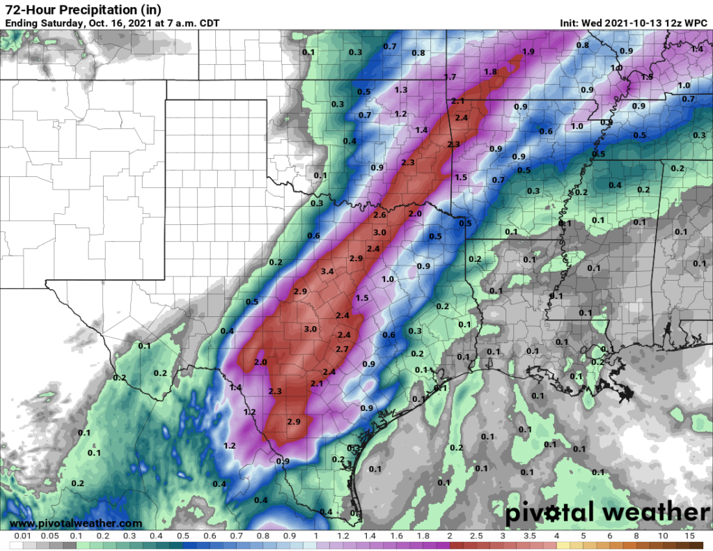
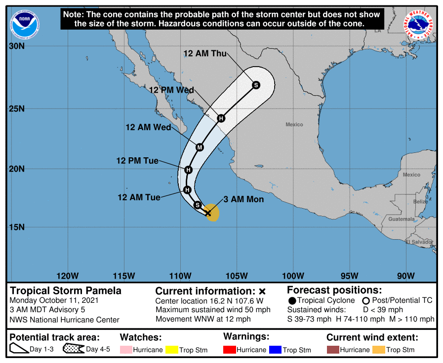
Good morning. The remains of Hurricane Pamela—a system that moved into Mexico and then Texas from the Pacific Ocean—have brought moderate to heavy rainfall over central Texas. As these storms move toward us, western parts of the Houston region may see shower activity later this morning. Otherwise, we’ve got two more very warm days before a much-anticipated cold front arrives later on Friday.

Rains associated with Pamela’s remants are slowly moving east, but they’re also weakening. (RadarScope)

Thursday

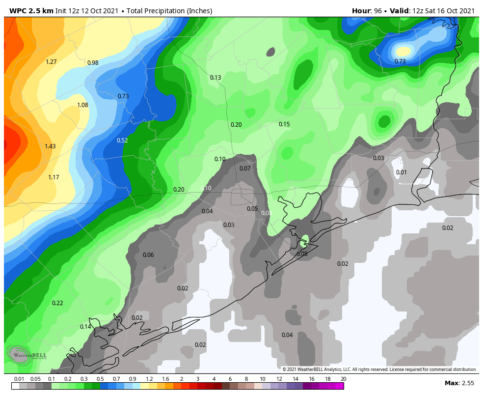
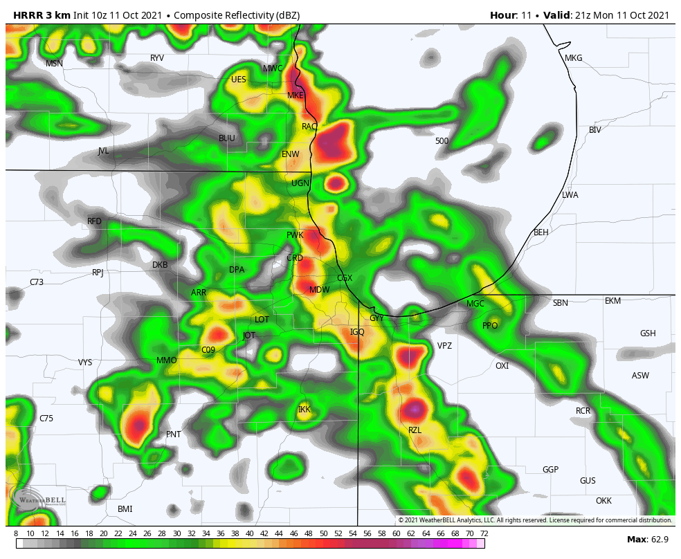
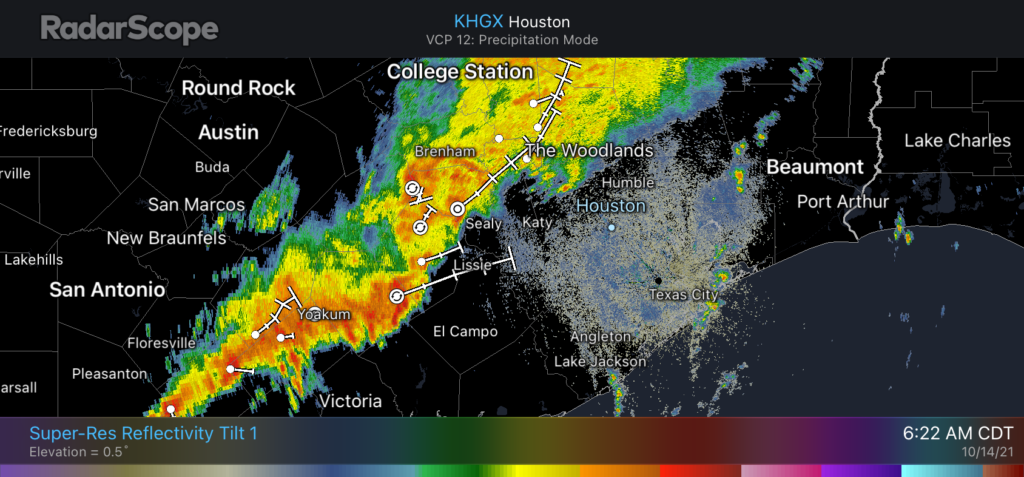
Radar this morning is lit up with showers from south central Texas through Brenham and College Station. These storms are moving slowly eastward this morning, and at the same time they’re also weakening somewhat. Based on short-term modeling, the biggest threat today for rain accumulations of 1 to 2 inches, or more, are areas such as Sealy and Rosenberg. Some lighter showers may progress into central Houston, but mostly the city will probably just see clouds. Rain chances should end altogether this afternoon. Highs will be in the upper 80s today, with sticky conditions tonight in the mid-70s.

Friday

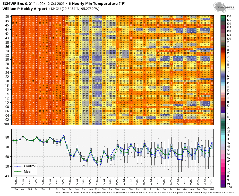
This is the day a cold front will move into Houston, but before it does we’ll see partly sunny skies and a southwesterly flow that will support very warm temperatures. Highs will likely reach the low 90s across Houston, and if I had to guess, I’d say this probably will be the last 90-degree day of 2021. The front itself should push through during the late afternoon or early evening hours, and it’s possible a broken line of storms will accompany the frontal passage. Colder and drier air moves in behind the front, with lows dropping into the upper 50s on Friday night for all but the coast.

Sunday morning’s low temperature forecast. (Weather Bell)

Saturday and Sunday

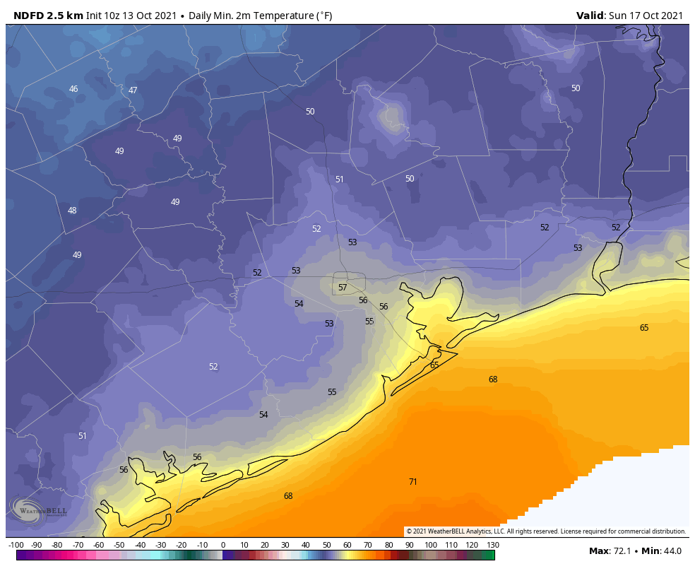
The weekend outlook remains grand, with highs in the 70s, lows in the 50s and ample sunshine. Saturday night should be the coldest of the week with inland temperatures dropping to the upper 40s for some, with 50s for the rest of the area except Galveston. Sunny skies abound.

Next week

We’ll see a gradual warming trend next week, with highs likely reaching the mid-80s by Wednesday or Thursday, and overnight lows in the 60s. The next front will probably push through around Thursday, or so, and may bring some modest rain chances with it. We’ll see.

Winter Outlook

Matt and I are working on an outlook for winter conditions in our region, and plan to release it next Wednesday.

Three more days of summer left until a striking fall front arrives Friday

Houston’s forecast calls for three hot days before a reasonably strong cold front sweeps into the area on Friday, likely during the afternoon or early evening hours. After that we’re going to see an absolutely stellar fall weekend. We’re also tracking the possibility of heavy rainfall on Thursday due to Hurricane Pamela, in the Eastern Pacific Ocean, but that threat should remain well to our west.

Wednesday

Today will be partly sunny, and hot. Winds will be out of the south at 10 to 15 mph, and highs will likely reach the low 90s for much of the region. Rain chances are near zero. If you’re a person who likes summer in Houston, you’ll want to soak up all this day has to offer. There will be plenty of humidity as well, of course. Overnight lows will be sticky, in the upper 70s.

Rainfall threat from the remnants of Pamela this week. (Pivotal Weather)

Thursday

Hurricane Pamela will make landfall in Mexico today and, traveling to the northeast, approach the Big Bend area early on Thursday. This will bring the potential for heavy rainfall into the state on Thursday, but we think the bulk of this activity will be in Central Texas, along the Interstate 35 corridor, where 2 to 4 inches of rain may fall. For the Houston area, I think most areas will see on the order of a tenth of an inch or two of rainfall, but we can rule out some isolated spots of heavier rainfall. This will otherwise be a mostly cloudy, humid day with highs in the upper 80s.

Friday

Are you sick and tired of summer? Well, relief is on the way. Friday should be a mostly sunny day, with highs near 90 degrees. But later on a front with a fairly striking gradient of temperatures and dewpoints will push through on Friday. Best guess for timing is that the front will reach the Interstate 69/Highway 59 corridor in central Houston around 4 to 6 pm, and the coast around sunset or shortly thereafter. We may see a broken line of showers with the front, but overall, rainfall accumulations do not look too impressive.

Saturday and Sunday

Saturday should see at times breezy conditions in the wake of the front, with northerly winds possibly gusting to about 20 mph. Winds will die down later during the afternoon. Skies will be sunny, and with the influx of cooler air high temperatures will probably max out in the mid-70s. Saturday night should be the coolest of the period, possibly dropping into the upper 40s for far inland areas, with 50s for most of the region. Sunday will again be in the superb 70s.

Forecast low temperatures for Sunday morning. (Weather Bell)

An onshore flow resumes by Monday or so, but highs will probably only recover to the low 80s by the mid of next week.

The end of summer, for Houston, is finally well and truly at hand

We’re not there yet, but we’re close. Houston faces four more days of summer-like weather before a strong cold front arrives. And then we should reach the time of the year when fronts arrive with some regularity. There will still be warm days, of course, and periods of humid nights. But 90 degree days? I think after Friday we’re done with those for 2021. There are no guarantees in weather, of course, but if you’re ready for the time of year when most days are in the 70s or low 80s, we’re almost there. It’s not summer. It’s not winter. It’s the in-between time in Houston, and it’s pretty darn glorious.

This European ensemble forecast for low temperatures for the next two weeks shows why our pattern is about to change after Friday. (Weather Bell)

Tuesday

Most of the region is seeing a sticky morning, and with a mix of sunshine and clouds later today highs should warm to near 90 degrees. The atmosphere will be just disturbed enough to allow for the development of isolated to scattered showers this afternoon, which would be short lived. Winds will be out of the south at about 10 mph. Tuesday night will be mostly cloudy, with lows in mid-70s.

In Chicago, weather for today’s make-up of Game 4 between the Astros and White Sox looks good, with partly sunny skies and a high of around 70 degrees. Time to close out the series!

Wednesday

A hot day, with mostly sunny skies and highs near 90 degrees. Winds will be out of the south, to go along with rain chances of around 10 percent or less.

NOAA rain accumulation forecast for now through Friday. (Weather Bell)

Thursday and Friday

These will be muggy, warm days with highs of around 90 degrees. Skies will be partly to mostly sunny, with perhaps a 30 percent chance of rain each day. The aforementioned cold front is due to arrive on Friday evening-ish, likely pushing well off the coast by midnight, or early Saturday morning. At this point I do not expect an organized line of storms with the front.

Saturday, Sunday, and beyond

The weekend looks fabulous, with days in the 70s, nights in the 50s, and partly to mostly sunny skies. A slow warm-up trend begins by around next Tuesday or Wednesday, but we’re likely going back to the low 80s for highs, with lows in the 60s. After Friday, rain chances appear to be low to non-existent for awhile.

After early morning storms, Houston’s weather to remain warm and humid this week

Good morning Houston. The storms that rumbled through this morning before sunrise heralded the arrival of a weak front that, unfortunately, won’t provide too much of a lasting impact on our heat and humidity. However, our confidence is high that another, more significant front will arrive on Friday to usher in fall-like weather. Next weekend looks superb.

Monday

In the wake of the weak front, inland areas should see clearing skies and somewhat drier air this afternoon and evening, with high temperatures reaching the mid- to upper-80s. Closer to the coast, clouds will linger as the front essentially passes through and expires. Winds, for the most part, will be out of the northwest today at 5 to 10 mph. Low temperatures tonight, except for far inland areas, will be in the 70s.

Astros weather, Game 4

The Astros face the White Sox in game four of the American League Division Series today. Game time is set for 2:37 pm CT, and the forecast is iffy. The Windy City will live up to its name today as a front passes through the region. Wind gusts will reach about 30 mph, and showers and thunderstorms are very possible from about 3 pm to 9 pm today. Play ball? Hopefully.

One model’s forecast for storms in the Chicago region at 4 pm CT on Monday. (Weather Bell)

Tuesday, Wednesday, and Thursday

Back in Houston, the region will see warm and muggy weather through the middle of the week. These days will see partly sunny skies, highs in the upper 80s to 90 degrees, to go along with low rain chances of about 20 to 30 percent daily. Overnight lows will be sticky, in the mid-70s.

Friday

Tropical Storm Pamela has now formed in the Pacific Ocean, off the coast of Mexico, and the system will affect our weather toward the end of this week as it curves back into Mexico and its remnants approach Texas. The tropical system may increase rain chances in Houston later on Thursday and Friday, and should also help drag a stronger front through the state and off the coast. As a result I think we’ll see some decent rain chances on Friday and Friday night as the front pushes through. Daytime highs will likely be in the upper 80s, with overnight lows falling to around 60 degrees.

Tropical Storm Pamela should influence Houston’s weather late this week. (NOAA)

Saturday and Sunday

In the wake fo the front, the weekend looks splendid. Look for highs in the 70s, with lots of sunshine, and lows in the 50s on Sunday and Monday mornings.