Why yes, it has been an extraordinarily wet start to 2024

Summary: In this post we discuss the very wet start to 2024 in Houston. As for the forecast, our skies will turn sunnier later today, and remain so for a few days, with cooler nights. We’ll then warm up through Saturday, with a smattering of rain chances to end the work week, and better odds with a front later this weekend.

Winter rains

We are now a little more than a month into the new year, and I don’t know about anyone else, but my backyard is a swamp. Through this weekend, Houston’s official station at Bush Intercontinental Airport has recorded 10.50 inches of rainfall. In the city’s records, which date back more than 140 years, we have only surpassed that total on two different occasions: 1891 (13.12″) and 1991 (11.73″).

Accumulated rainfall by day for each year since 1950 in Houston. (Space City Weather)

Matt put together the chart above which shows accumulated rainfall, by day, for each year in Houston since 1950. (The chart only includes data for the last 75 years for the sake of visibility). This year is shown in dark black. The year which sticks out like a sore thumb, of course, is 2017 when we were drenched by Hurricane Harvey.

This year’s rainfall is part of a fairly typical pattern for an El Niño winter, which tends to cause wetter conditions due to the placement of the jet stream. The pattern has produced an enormous amount of rainfall over California in particular this winter, which Matt has explained more deeply on The Eyewall.

Monday

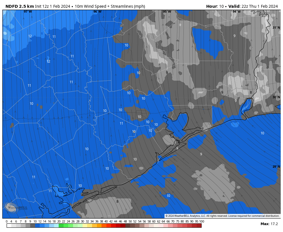
Winds are continuing to blow across the metro area, with gusts up to 30 mph in some areas during the last hour. This northerly flow should start to ease a bit later this afternoon before the winds die down tonight. A few light showers are falling this morning, but they should end soon. With clearing skies this afternoon, highs should reach the mid-60s. Low temperatures tonight will drop into the mid-40s in Houston, with cooler conditions for areas further inland.
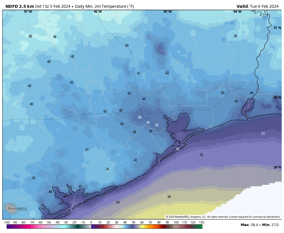
Tuesday

This will be a fine, sunny day. Expect light winds, low humidity, and highs in the mid- to upper-60s. Lows on Tuesday night will drop into the mid-40s.

Tuesday morning should be the coldest of the week. (Weather Bell)

Wednesday

With the return of an the onshore flow on Tuesday night, we’ll see a fairly pronounced southerly breeze on Wednesday. This should bring increasing cloud cover during the afternoon hours, with highs topping out at around 70 degrees. Lows on Wednesday night will only drop to around 60 degrees.

Thursday and Friday

The combination of increasing moisture in the atmosphere and a front stalling north of Houston should result in some cloudy and warmer days to end the work week. I think highs will get into the mid-70s, with fairly humid air. Some scattered showers are possible, although I would peg daily chances only at about 30 percent, with slight accumulations.

Saturday and Sunday

Saturday should be warm again, with highs perhaps in the mid-70s, and cloudy skies. After that I don’t have great confidence in the details. At some point a front is likely to move through with some attendant rain showers. My best guess for the timing of this is Sunday morning, but that’s somewhat of a crapshoot at this point. Sunday’s temperatures will be dependent on the timing of the front, so they could be in the 60s or the 70s. I don’t anticipate an enormous amount of rain with the front, perhaps something on the order of a few tenths of an inch in the Houston metro area with the possibility of higher totals north of the city. We’ll see.

Next week

Next week looks cooler, with highs in the 60s, and lows perhaps in the 40s or 50s. But after that I don’t have much confidence in whether we’re dry, or some showers hang around early in the week. We’ll have to iron that out in a future forecast.

Rain and storms overnight give way to a decent Saturday afternoon and a windy Sunday

Summary: Dense fog this morning will give way to some clearing. Rain arrives tonight, heavy at times after midnight and early Saturday morning. Thunder and lightning are likely, and a couple storms could be strong to severe. After an inch or two of rain and some ponding, we’ll see much nicer weather Saturday afternoon, followed by a windy Sunday. Some cooler weather arrives early next week.

Also, we’re going through one of those phases like in December where we have had enough high clouds to occasionally allow for spectacular sunrises and sunsets.

You can always email us or message us photos on Instagram or Twitter or whatnot!

Today

We’ve got a generally nice, calm day ahead. There is some dense fog this morning, so through about 9 AM or so, you may need to contend with that. Tomball visibility is a quarter-mile as I write this, as is Conroe, Wharton, and Colorado County. So give yourself a minute or two extra getting out the door. Otherwise, we’ll see sun and clouds with highs in the low to mid-70s today and a bit of humidity. Clouds become a little more common later, and some showers may begin as early as sunset.

Tonight and Saturday

Look for rain to become a little more persistent or heavier after midnight tonight. Periods of rain and embedded thunderstorms will continue overnight into Saturday morning, and most of it will actually be done before Noon tomorrow. We may even see a return to sunshine tomorrow afternoon.

Anywhere from an inch or two should fall on average across the area overnight and Saturday morning. No serious flooding is expected, but watch for ponding on roads tomorrow morning. (Pivotal Weather)

In terms of rain totals, most will see 1 to 2 inches on average. The Matagorda Bay and Corpus Christi areas will probably see less than that. But this will be another healthy rainmaker for most of the region. We don’t expect much in the way of severe weather right now, but a storm or two could become strong to severe early Saturday. The main issue would be strong winds briefly in those storms. We’ll probably have a fair bit of lightning and thunder though.

Low temps tonight will dip into the low-60s, with highs tomorrow in the 70s. Overall, your morning plans will be dicey tomorrow, but the afternoon looks perfectly fine we think.

Sunday and Monday

Both Sunday and Monday should see a good deal of sunshine, though a few extra clouds may pepper the sky Monday. The big thing you’ll notice are winds and cooler temperatures. Highs will be in the 60s on Sunday and lower-60s Monday, with lows in the 40s and 50s. So we take a step back cooler here. But the wind will be whipping a bit on Sunday. Look for west to northwest winds of 15 to 25 mph and gusts to 30 mph or a bit stronger. Monday should be calmer, though there will be lingering wind over the water.

Tuesday morning will have a little chill in the air with 40s in most spots. (Pivotal Weather)

Rest of next week

After a cool start to the week, we’ll warm back up later next week with temps back into the 70s by Wednesday or Thursday. Our next chance at rain probably arrives next Thursday or Friday. It does appear that a generally wet pattern is expected heading into the second week of the forecast.

It is expected to be generally wetter than normal heading into mid-February, but it’s too soon to say exactly how that will play out. (NOAA)

Exactly what it means is TBD, as these are probabilistic maps, which say that the forecast leans above normal. But in general, it looks like next Friday or Saturday-ish will be our next decent chance at rain. We continue to get questions about mid-month cold chances. As of now, we don’t think anything significant will impact Texas, but we’ll keep watching.

Dewpoints starting to rise ahead of Saturday storm chances in Houston

Summary: After a few days of gorgeous weather Houston’s pattern has begun to change with a more southerly flow. By late Friday night this is likely to produce some showers and thunderstorms, which will likely peak in activity on Saturday morning. Then we should see sunny and cooler weather through the middle of next week.

I also want to thank everyone for their kind words about our sponsorship agreement with Reliant, and the slight tweaks in our site design. Essentially we’ve changed the font for headlines, and updated the header image at the top of the page. For those who don’t know, I essentially created Space City Weather on a Friday night in October 2015, in a few hours, ahead of some storms. So the (now dated) header image was rushed. I grabbed a NASA image of the Space Shuttle carrier aircraft flying over the Houston skyline, cropped it, added some text, and called it done. The new design looks more professional and updates the “space” iconography to the International Space Station. I loved the Shuttle, but it did retire 12 years ago. Our friends and neighbors are flying on the station at this very moment, so it embodies Space City.

A southerly flow is now firmly in place for the next couple of days. (Weather Bell)

Thursday

After some patchy fog lifts this morning we’re going to see a partly sunny day. Temperatures will again be mild, reaching about 70 degrees. As mentioned above, the winds will be from the south at 5 to 10 mph, and this will start to raise humidity levels a bit. But with dewpoints in the 50s it will still feel reasonably dry. Lows tonight will drop into the mid-50s.

Friday

Temperatures will again rise to around 70 degrees, or just above. Skies will be partly sunny. It will be a little more humid than Thursday, and a little more breezy. But still nice. While I can’t entirely rule out some light showers on Friday evening, I think the rain will hold off for the most part until after midnight. So any Friday evening activities you have look good to go at this point.

Saturday

An upper level disturbance, along with the next cold front, will begin affecting our weather early on Saturday. While we’re not fully in the realm of high resolution modeling yet, my sense is that we’ll see on-and off showers and thunderstorms overnight, with a line of storms pushing through some time on Saturday morning. After this line of storms we may see a few lingering showers into the afternoon hours.

How strong will the storms be? As there will be a fair amount of shear, I can see the potential for some damaging winds. The other concern is heavy rainfall. It still looks like most of the area will see 1 to 3 inches of rainfall, but the good news is that the storms are likely to be fairly progressive in moving from west to east. So I don’t see a whole lot of training. The potential for heavy rainfall is generally greater to the east of Houston.

Excessive rainfall chances for Saturday. (NOAA)

Drier air will start to filter into Houston on Saturday afternoon, so we should see at least some partly sunny skies later in the day. Temperatures will likely be in the upper 60s. Lows on Saturday night will drop to around 50 degrees in Houston, with cooler conditions for outlying areas.

Sunday

Sunday looks sunny and pleasant, with highs in the upper 60s—but there’s a catch. We’re going to see an additional push of cooler and drier air, and this will result in a windy day, with gusts up to about 30 mph from the north. These winds will persist overnight, when temperatures drop into the 40s, and Monday morning.

Next week

We’ll see sunny and cooler conditions, with nights in the 40s, through the middle of the week. After that daytime temperatures will warm into the low 70s, probably, into the weekend. Conditions look mild throughout, with a slight chance of rain returning by next Saturday or Sunday.