Good morning. A cold front has moved through the Houston region overnight, and if you live along and south of Interstate 10 you probably felt it as lots of lightning came along for the ride. Areas further inland saw less fireworks and little to no rainfall. We’ll now see a couple of days with some drier air before a warmer and more humid pattern returns.
Tuesday
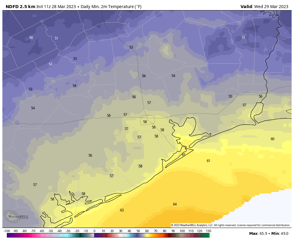
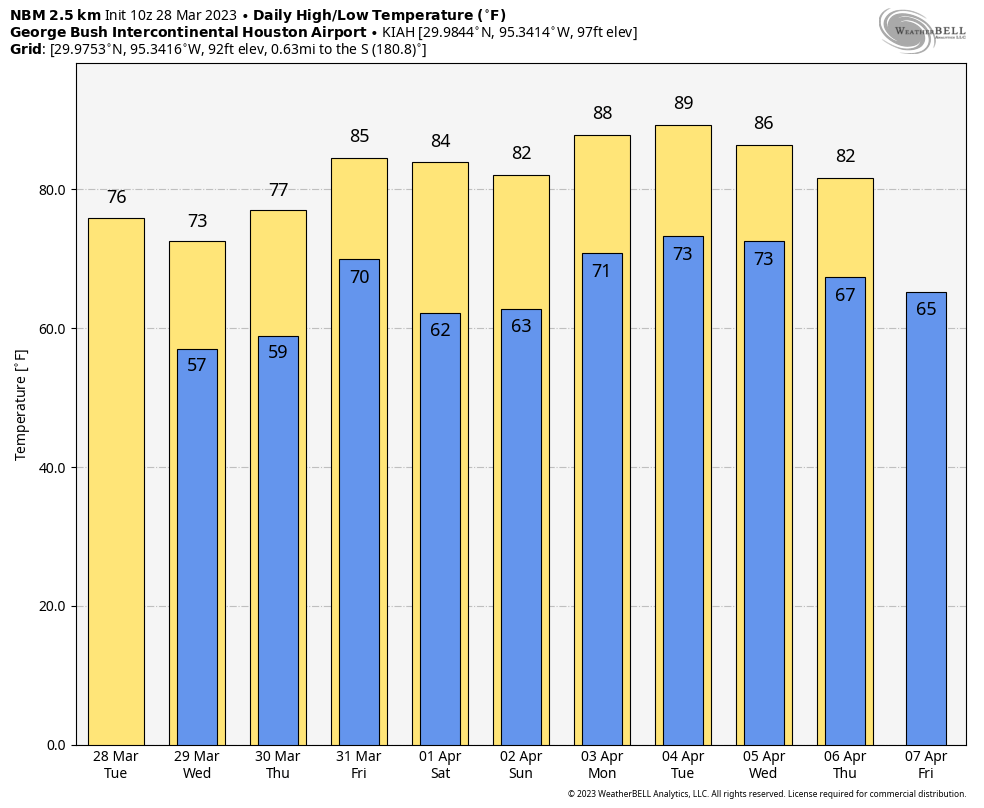
A few lingering showers will clear out this morning, and we should see partly sunny skies by this afternoon. Winds will be fairly brisk, out of the north at 15 to 20 mph with higher gusts. Highs today will reach the mid-70s. Temperatures tonight should be the coolest of the week, dropping into the 50s for most areas except along the coast.
Wednesday
This day will start out with some clouds, but skies should turn mostly sunny during the afternoon with highs in the low 70s. Winds will veer back to come from the Gulf of Mexico, that this should nudge overnight temperatures up slightly, into the low 60s for Houston. A few, scattered showers are possible later on Wednesday as this onshore flow returns.
Thursday
This will be a breezy, humid day with mostly cloudy skies as high temperatures push up to near 80 degrees. Winds could gust as high as 25 or 30 mph out of the south. There will again be a slight chance of afternoon and evening showers. Lows Thursday night will only drop low 70s.
Friday
Expect another breezy and humid day, this time with highs in the low 80s.
Saturday and Sunday
The details for this weekend’s forecast remain a bit iffy, but generally you can expect a (very) weak front to move into the area on Saturday morning, perhaps with a few scattered showers. The front won’t provide too much oomph, so we’re probably looking at partly to mostly cloudy skies both weekend days, with highs in the 80s, and lows in the upper 60s.
Next week
Frankly, most of next week looks warm, with highs in the mid- to upper-80s. Some areas may well touch, dare I say it, 90 degrees? It looks like some sort of front will work its way into the area by Thursday of Friday next week, which should finally cool us down and bring another splash of rainfall. That’s far enough in the future to be fairly fuzzy, however.


Fuzzy, iffy… we dont know for sure. Total mess out there. We had a “healthy chance of rain” this weekend and I didnt get a drop. Looks like 2022 all over again with the forecasts lol
Gee, I didn’t realize the site was doing a personalized forecast for your exact address.
We got rain on Saturday and again Sunday morning.
lol i like this guy
Living in Sienna. Although we got warnings on the TV about severe thunderstorms late last night and again at about 2:30, we didn’t really see anything. No rain, no bad winds, and no lightning that I remember seeing. We did get like 0.01″ of rain about 4:30 am, according to a PWS very near to my house. But the radar last night showed some pretty nasty stuff along the coast and going to the ENE.
We got a short episode of thunder, lightning, and rain late last night. It was lovely. We’re east of downtown
Agree. The lack of rain in the metro area is like a new normal around here. Always helpful to know why? Can’t blame La Niña anymore so what is with this. (at least north of I10). Not much to see on Twitter. Everybody focused on severe weather in La and further east. Help!
Capping inversion. There is an atmospheric cap over Houston metro keeping all of the rain and storms away.
I think we are still seeing the lingering effects of la niña. The past 4 years (including this year, I mean) February and March have been quite dry. But yesterday the issue is the old front stayed by the coast and so inland areas had less moisture to work with. April is supposed to be wetter…
Ok TL I’ll hold you to it!
Baytown near N Alexander (Bus 146) got hammered last night around midnight with lightning, some light(ish) rain, and hail. It was pretty intense and beautiful. Thank goodness I keep my car in the garage! 🤣
Golf ball size hail at my house last night and intense storms!!
The Westbury/Meyerland corridor had an earlier-than-expected, half-hour round of heavy rain around 10:30 last night but nothing from the round that was forecast to arrive later in the overnight hours.
The storm that rolled through Brazoria county last night looked like a supercell storm on the radar. It had the classic comma shape. Not sure if it could be classified as one though just because it looked like one.