After a mostly dry month of May, which had led to mounting drought concerns, most of the region has turned considerably wetter this this week. The following rainfall map for the last seven days shows a range of rain totals from 0.10 inch for a few coastal regions to upwards of 8 inches of rainfall for some parts of northwest Houston. If you’ve missed out, we’ll have a few more rain chances through Saturday before we turn quite hot and dry for awhile.

Thursday
Conditions Thursday should be a lot like those of Wednesday—with decent coverage of light to moderate rain showers, and a few heavy ones, throughout the daytime hours. Some areas will see some gray skies and hear thunder, but get no rain, while others see half an inch, or so. When it’s not raining, expect partly sunny skies and a high near 90 degrees.

Friday and Saturday
I anticipate this pattern will continue for a couple of more days, with decreasing precipitation, sunnier skies, and slightly higher temperatures in the low 90s. However, as we head into Memorial Day weekend there will still be enough moisture to squeeze out a few showers. None of these should last too long, however.
Sunday and most of next week
Next week we’re going to see full-on summer conditions. High pressure will come to dominate our weather, and most of next week will probably see mostly sunny days, high temperatures in the mid- to upper-90s, and warm nights in the mid-70s. The calendar may say June, but the weather will be screaming August.
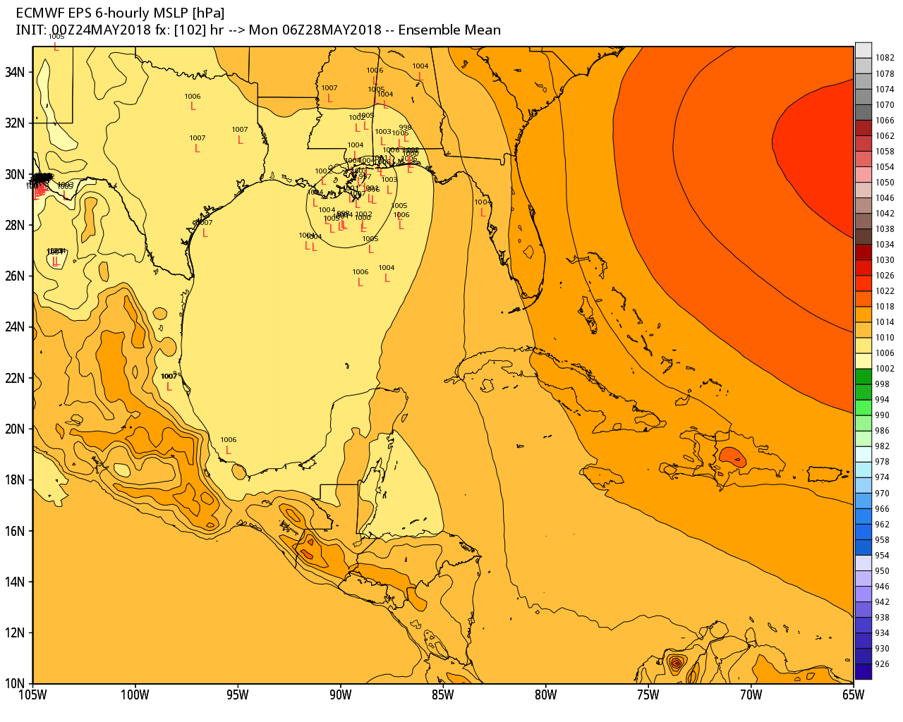
Tropics
The National Hurricane Center predicts a high likelihood (80 percent) of a tropical depression or storm moving toward the northern Gulf Coast this weekend (the map below shows the European model forecast for low pressure centers early Monday).
This will probably not be a particularly well organized system, and most of the precipitation will be on the right-hand side of the storm. The bottom line is that the eastern Gulf of Mexico will see ample rainfall from this weekend and onward, while Texas will bake.
I was just thinking… you guys could get rich if you figured out how to make it rain just enough and often enough to keep our yards from dying but not so much that it grows – meaning we don’t have to cut all summer.
You could sell it as a subscription service.
Just a thought.
Eric, Matt,
What impacts do you foresee resulting from the cooling problems with GOES-17, as reported in Ars Technica?
I really hope the GFS is just overestimating the 2-meter air temperature predictions for the next few weeks but it has pretty consistently showing highs above 100 lasting for over a week across much of Texas (not as bad in our area, but still bad)
Right now the visible sat seems to show 90L taking a WNW drift across the Yucatan. Wouldn’t be surprised to see an eventual West Louisiana track for whatever it becomes.
Why are we getting August all mixed up in our May? I’m not ready for this!!!!
“…will be screaming August.”…I’m ok with this as long as it doesn’t include tropical activity like last August…