The Houston region will remain in a wetter-than-normal pattern through the weekend before conditions dry out some, and our weather turns more August-like; which is to say hotter and a bit sunnier, without the relief of afternoon showers.
Thursday
Rain chances aren’t ideal today as some drier air has moved into the area, but there still should be activity later this morning and through the afternoon hours scattered across the area. Chances are probably slightly better (40 percent) for the eastern half of Houston versus the western half (30 percent), but at this point we’re splitting hairs. High temperatures today should generally be in the low 90s, although as we saw yesterday it can get hotter in locations where there aren’t a lot of clouds. For example, Wednesday’s high temperature was 96 degrees at Bush Intercontinental Airport.

Friday and Saturday
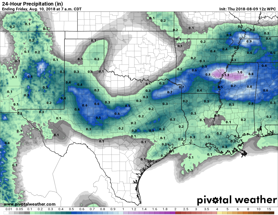
These still look like the wettest days in at least the next week or so as a stalling front creates favorable conditions for rainfall across the Houston area. Both days probably will produce about a 50 percent chance of rainfall, and I think most of the region will probably pick up between 0.25 and 0.75 inches of rain through the weekend. That’s not to say some of the stronger thunderstorms won’t bring more than that—they probably will. If you have outdoor plans on Saturday we’re still going to see partly sunny skies, so you may get lucky. But I definitely wouldn’t count on it.
Sunday
As high pressure starts to build over the Houston area, at this point my guess is that Sunday will be drier than Saturday, with perhaps most of the area seeing mostly sunny skies and a warmer day, with highs in the mid-90s. Can’t rule out a chance of rainfall, however.

Monday and beyond
The most likely scenario for next week is that modestly higher pressures will shut off most of the potential for rainfall. Thus, most probably, we’ll see mostly sunny days with high temperatures in the mid-90s for the coming week, and maybe even a tad bit higher than that. This pattern is not yet locked into stone, however.
On one hand: ugh, high pressure bringing “warmer than normal” weather in mid-august is brutal.
On the other hand: yay, high pressure providing extra shielding for the area if a system develops in the gulf!
Just curious…
Is there any known correlation between hurricane activity in the Pacific vs the Atlantic?
Does one affect the other?
Now if they could only get my office out of the mid- to upper 60s………………
Feels silly wearing a jacket in mid-August.
Does that also mean your office will be low-to-mid 80s in January>