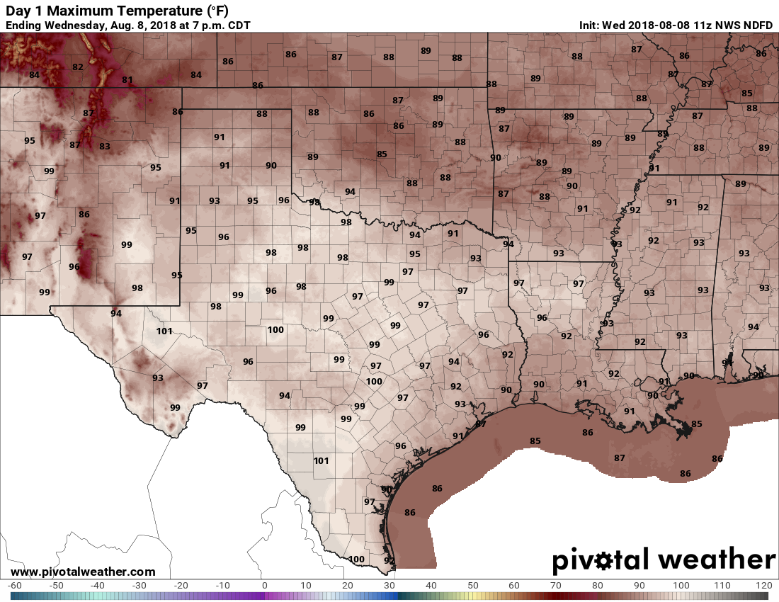
Good morning. Houston remains in slightly-cooler-than normal pattern for early August, which is most welcome considering that this typically is the region’s warmest time of year. I don’t see a return to 100-degree days any time soon, but next week does look like it will be a little warmer, with slightly less cloud cover.
Wednesday and Thursday
These will be summery days, but with just enough cloud cover to take the edge off of high temperatures. Rain coverage will be lower than we saw on Monday and Tuesday, but there still could be a few showers today streaming in from the coast. Mostly, however, we’ll just see partly sunny skies with highs in the low- to mid-90s on both Wednesday and Thursday. Don’t get me wrong, these will still be hot days, but they should be below the criteria set for heat advisory days, and for August this weather is pretty, uhhh, temperate.
Friday and Saturday
After a cold front stalls north of the Houston region late this week, a couple of upper-level systems may move into the area that should prompt air at the surface to rise, and in turn this will increase our rain chances. This should push the likelihood of rain on both days to about 50 percent—with slightly better odds east of Houston, and slightly worse to the west. High temperatures on Friday and Saturday will depend on the extent of cloud cover and rain. A few areas may stay in the upper 80s, while sunnier locales jump up into the mid-90s.

Sunday
At this point, Sunday should see slightly lower rain chances than Friday and Saturday. If you’re planning outdoor activities you can expect mostly sunny skies, with highs in the low- to mid-90s. But you’ll want to be prepared for the possibility of a quick shower or two.
Next week
Right now the models are trending a bit drier and warmer next week as high pressure may begin to exert more influence on our weather. Highs probably will rise into the mid-90s as we see more typical August-like weather.
Tropics
Tropical Storm Debby formed yesterday in the northern Atlantic Ocean, and it is no threat to land. Further south, in the area of tropics that potentially threaten the Gulf of Mexico, conditions remain very calm for this time of year.
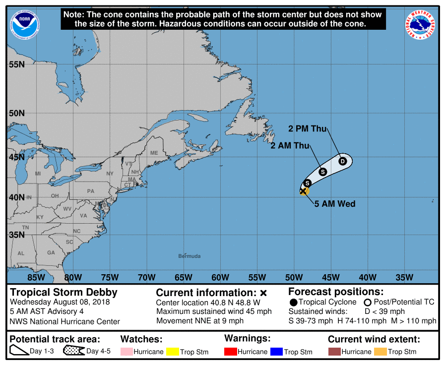
Models show almost no chance of anything forming within the next week, at least. This is great news as we get into what typically is the heart of hurricane season.
What do the models think about rain along the coast? Looks like GFS had rain coming up from the gulf.
That is how showers will develop, to the extent they develop today.
Hi, Eric! Later Saturday afternoon and evening out in Cypress was just incredible – about 83 degrees, lower humidity and a genuinely cool southerly breeze. We thought that it was October. I know that summer storms can have an odd cooling effect, but even though we got maybe 10 minutes of a wimpy drizzle, it sure transformed the rest of the day. It wasn’t a front, but it behaved a lot that way. What exactly happens in situations like that to rather significantly cool and dry out in the air without the presence of a real front?
I like this sort of weather news. Let’s have more of this. 🙂 I have a trip coming up very soon and don’t need my flight interrupted by a hurricane/flood. The one storm that’s out there looks to be a fish storm.
Better yet, let’s have October ASAP!
Believe it or not, or beloved city government felt obligated to annouce on NextDoor that Debby is not a threat to Houston.
How stupid have the people in this city become anyway for the city to need to tell them that a storm east of Nova Scotia and heading NE is a no threat to Houston???
I retract that, I don’t think I want to hear the answer.
Such a news alert shows why the City of Houston, when using “legal accounting,” is financially bankrupt
Not to jinx us but a relatively boring, not so hot summer? I’ll take it.
4:45pm Wednesday, the Chronicle website is in full hype mode. “Strong Storms Threaten Houston!”
Since this wetter pattern developed last week, a dry “bubble” has established from downtown to the west Sam Houston toll road area. Storms from the south either die at Hwy 59 or split east / west. I know it is very microscale but do you or the team have any thoughts as to what may be the cause?
You guys absolutely nailed the forecast this week in terms of “chance of moisture from Gulf heading inland, scattered rainfall.” Exactly what happened including today when we were at the USS Texas / San Jacinto, and watched a thunderstorm roll thru from south to north (we got under cover on the Texas when we first heard thunder)
Nice job!