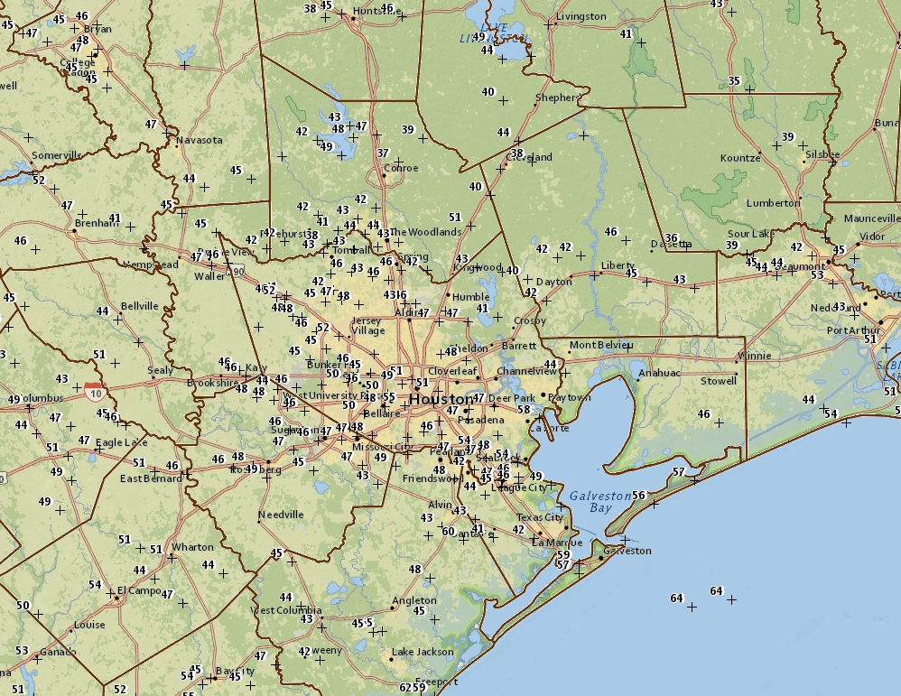
Houston won’t reach record lows this morning (38 degrees, set in 1983), but for mid-April it is quite cold out, with upper 30s north of the city in places like Conroe and Cleveland, and mid- to upper-40s across most of the rest of the region except for coastal areas. I feel confident in writing that this will be our coldest spell of weather—Sunday and Monday mornings—for at least six months. We’ll return to more seasonal conditions for the rest of this week.
Monday
A fine, fine day with only very light winds, sunny skies, and high temperatures in the upper 70s. Later this afternoon winds will swing to come out of the south, representing the beginning of an onshore flow, but we’ll still see a cool-ish night tonight, with lows in the upper 50s for inland areas, and lower 60s along the coast.
Tuesday and Wednesday
These days will be a bit warmer, and more humid as atmospheric moisture levels rise. The southerly winds could be gusty at times. I’d expect high temperatures in the low 80s, with warmer nights in the mid- to upper 60s. I think we’re still going to see partly to mostly sunny skies. A weak cool front will push into Houston on Wednesday, and probably move just off the coast. While we can’t 100 percent rule out any showers with this front, I think a capping inversion will prevent most people from seeing any rainfall.

Thursday and Friday
Temperatures on these days are going to be difficult to call, because the aforementioned front may stall at the coast, move offshore, and/or move back inland to end the work week. As a result, I think the most likely outcome for Thursday and Friday is partly sunny skies, with highs in the 70s for inland areas, and lower 80s closer to the coast. But where that dividing line is, I cannot say.
Saturday and Sunday
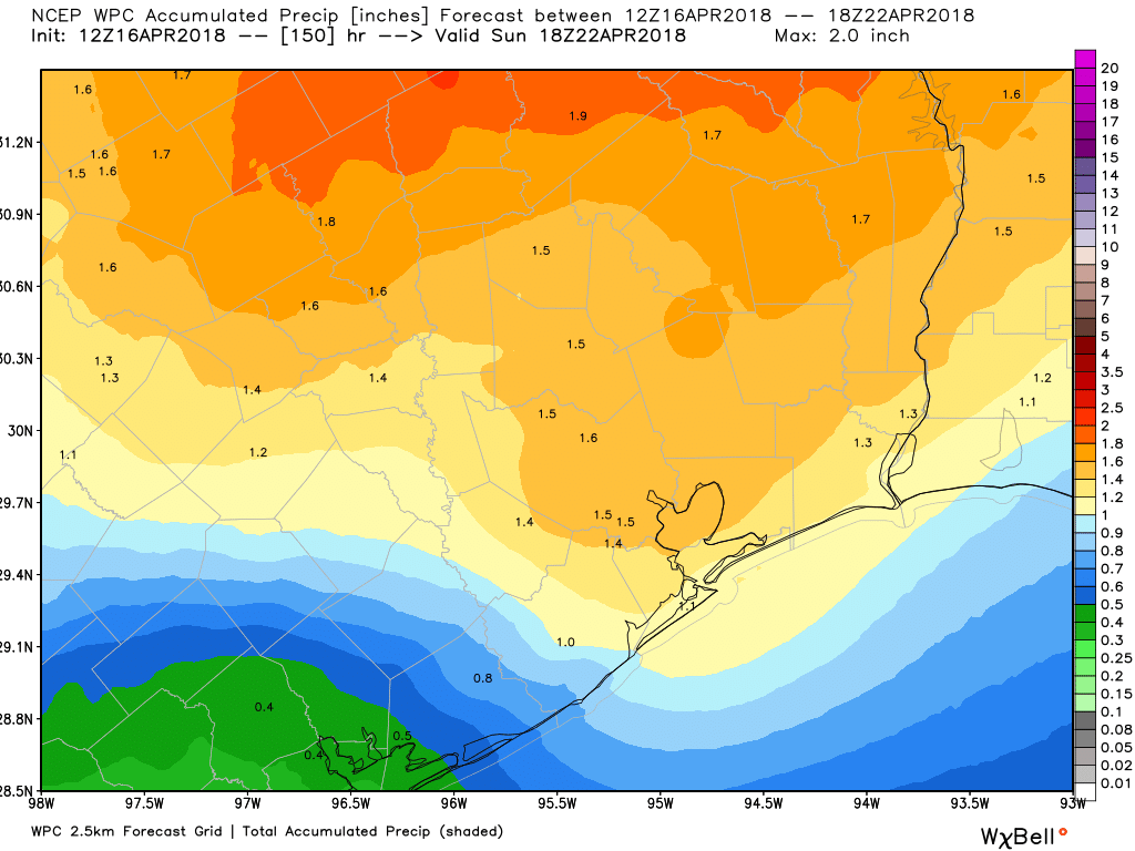
A stronger cold front should move into the region on Saturday, and this one will eventually move offshore. However, the big question with this system’s passage is the amount of rainfall, and potential for storms to develop on Saturday, and Saturday evening. Right now there’s not a whole lot of clarity with the forecast, and I could see anywhere from a smattering of rain with the front to a healthy 2 or 3 inches, and the possibility of some stronger thunderstorms. The bottom line is that if you have outdoor plans on Saturday, you’ll want to watch the forecast closely. Highs probably will be in the upper 70s.
The good news is that Sunday looks quite a bit nicer, with sunny skies and highs in the mid- to upper-70s in the wake of the front.
Congrats on supplying us with wonderful weekend weather!
One question though – where did that “dirty” rain come from Saturday before noon? A brief shower usually does not leave my car (and lots of others) covered with fine dirt.
It did help business at the car washes, though.
Too soon to start tracking for the MS 150 weekend?
What were the rainfall totals for the area after the Friday night/Saturday storms moved through? It sure made a lot of noise, but I’d have to guess the Katy area didn’t see a huge amount of rain. Always expect to see the totals mentioned in any forecast after a rain.
Thanks.
I got 1/2″ around Ellington overnight, plus another 0.15″ of “dirty rain” Saturday morning.
I’ve got a flight out of Hobby Sat at 5:30 am that I have to be on do you think I should reschedule for Fri night due to the storm/front?