After what can only really be described as absolute perfection on Monday, Houston’s weather will turn a little windier, a little warmer, a little more humid, and by the end of the week more stormier. Still, all things considered with summer looming, this should be a pretty fine spring week.
Tuesday
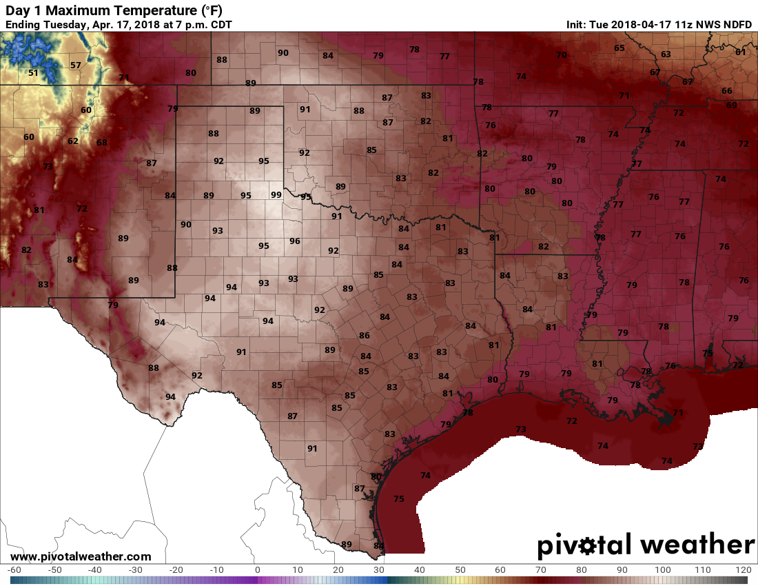
Following a chilly start, with low temperatures in the upper 50s, the mercury will rebound pretty quickly and we’ll see highs in the low 80s. The onshore flow has really reestablished itself, and that will manifest itself with gusty southerly winds later today. Skies will remain sunny. Overnight lows probably will only dip into the mid-60s for most of Houston, as humidity levels remain pretty high.
Wednesday
Due to an approaching (weak) cold front, and rising moisture levels from the onshore flow, lot of clouds will return to the region on Wednesday. We may also see some scattered showers, but any accumulations should be pretty slight—maybe enough to get the street wet but not a whole lot more. Highs will be around 80 degrees. The front should reach Houston later on Wednesday, and ever so slowly sag down toward the coast during the evening or overnight hours. It won’t have much oomph.

Thursday and Friday
If the front makes it off the coast, which seems likely, Thursday should be a pretty nice day across Houston. We should see lower humidity levels, along with highs in the upper 70s, and partly sunny skies. As the front won’t have much of a push, overnight lows probably will only fall to around 60 degrees in Houston, with warmer conditions south, and cooler north. As the onshore flow pushes back into the region on Friday, expect clouds to return, with highs in the mid-70s.
Saturday and Sunday
Well, I’ll be straight with you. The weekend forecast is pretty meh for us now that an upper level system and associated cold front appear to have slowed down. The net effect of this is that both Saturday and Sunday will have mixed conditions.
I expect Saturday to start out cloudy, with highs in the mid-70s. At some point, probably during the afternoon hours but I have low confidence in timing, showers may begin to spread over the region. The best chances for heavier showers and thunderstorms—we’re tracking the potential for more severe weather, but there’s nothing conclusive to say yet—will probably come between sunset Saturday and sunrise on Sunday. Probably. Anyway, if you have plans later on Saturday or Saturday night, you’re going to have to watch the forecast.
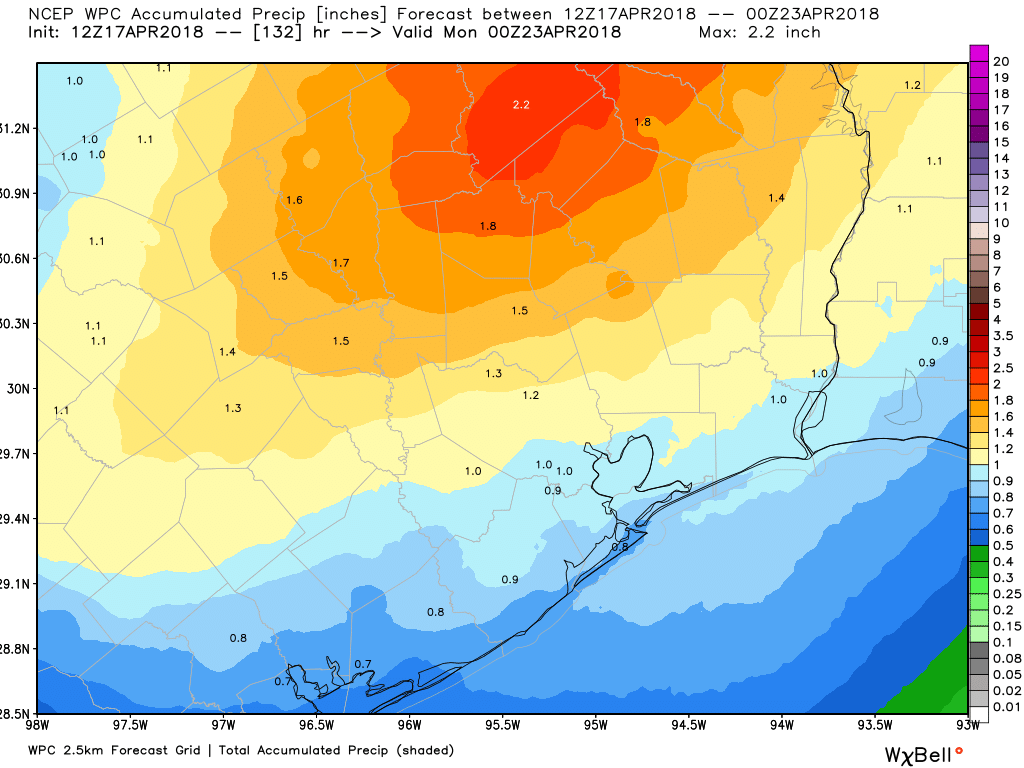
At this point I think the front will clear the coast sometime on Sunday morning, and this should lead to a breezy day in its wake—hopefully with showers ending, some clearing skies and maybe some sunshine during the afternoon or evening hours.
Next week
We should have some pretty nice weather during the first half of next week, with sunny skies, highs perhaps around 80 degrees, with lows in the 50s.
Please have an editor check your writing. For starters, please correct the phrase “more stormier.” Please write in proper English!
Oh my goodness. Eric and Matt provide a FREE, DAILY service for us all. This is not even their day job, and they are godsends in this severe-weather-prone city. Don’t be so nitpicky; or get your weather forecasts somewhere else. Eric has previously mentioned that he tries to get out the reports as early as possible, occasionally (so rarely) at the expense of the one-off grammatical error. Eric and Matt are beloved, and your comment is just offensive — and I’m sure not only to me!
The grammar police in full force. Calm down Christine. Everything will be fine.
@Christine – I think we all got what “more stormier:” implies. Also, for goodness sake, this is not the Oxford dictionary, it is a weather blog! Please offer your free editing skills for a free weather blog!
Go home you’re drunk. Or just really mean.