Good morning. Houston will continue to face winter-like weather through the weekend and into early next week. Of note: The forecast for Saturday looks particularly gloomy, with widespread showers, breezy conditions, and highs of perhaps only 50 degrees. We are increasingly confident that conditions will warm up next week ahead of the Thanksgiving holiday, but the details are rather messy.
Thursday
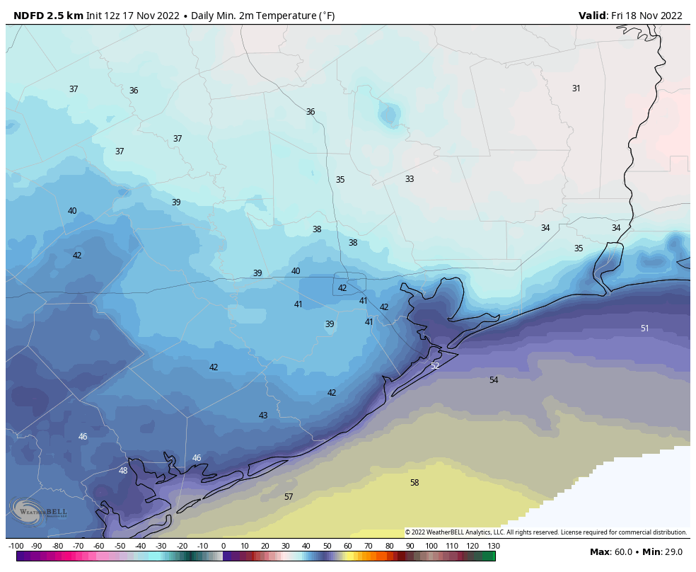
Temperatures are generally in the 40s this morning with leaden skies. Away from the coast, those clouds should thin out later today, leading to partly sunny skies this afternoon. Where conditions do clear, highs will push up to around 60 degrees, with light northeasterly winds. With partially clearing skies, low temperatures tonight will drop to around 40 degrees in Houston, with colder conditions inland.
Friday
We may see some more sunshine on Friday morning before clouds start to build during the late morning or afternoon hours. In the big picture, high pressure will be moving off to the east, to be replaced by an incoming cold front that will arrive later on Saturday. I expect highs to reach the mid- to upper-50s for much of the area, with a slight chance of light rain during the afternoon hours, and a slightly better chance Friday evening. Lows Friday night will drop into the mid-40s in Houston.
Saturday
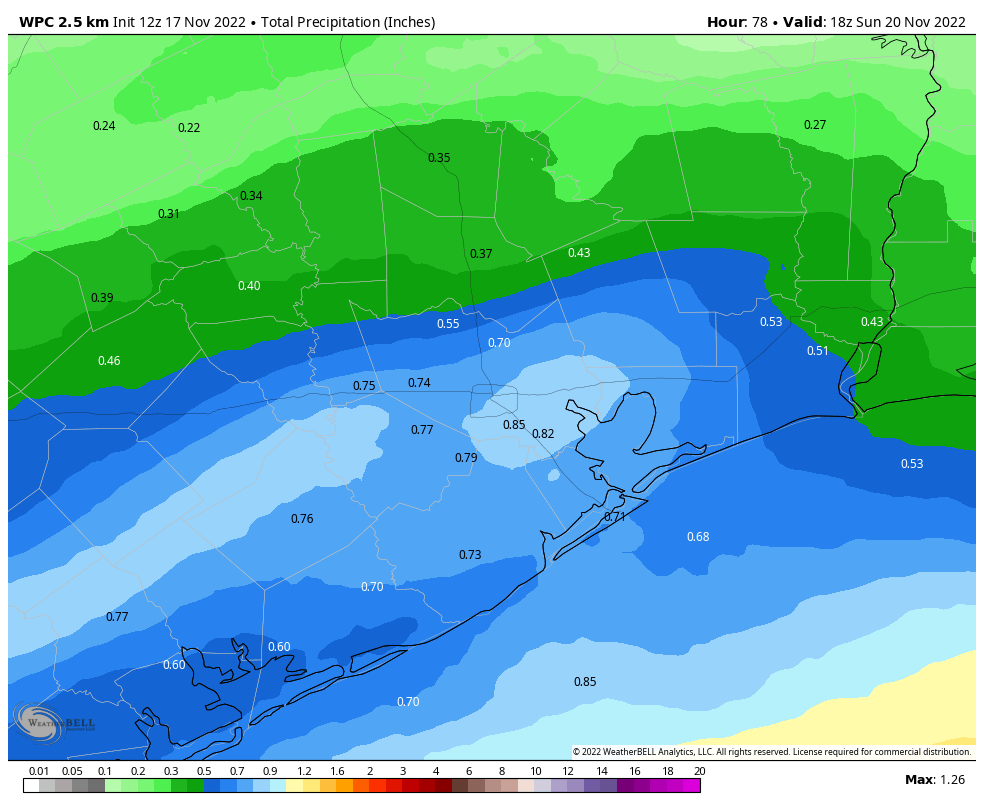
If you have outdoor plans on Saturday, I am sorry. As the front pushes into the Houston area it will combine with low pressure over the Gulf of Mexico to make for a wet, windy, and cold day. Highs on Saturday may struggle to reach 50 degrees for some locations, and we’re not going to see much, if any sunshine. Winds may gust up to 20 mph from the northeast, with even more blustery conditions along the coast. Most of the area will see between 0.5 and 1 inch of rain, with the bulk of it coming during the daytime on Saturday. Lows on Saturday night will drop into the low 40s.
Sunday
The second half of the weekend looks slightly better, with only very slight rain chances. Still, expect mostly cloudy skies and highs only in the mid-50s. Winds will remain out of the northeast, albeit slightly less blowy than on Saturday.
Next week
Monday should be another cold, gray day with highs in the 50s. Some rain chances return, with perhaps of 40 percent likelihood of some light precipitation. After Monday it looks like the familiar onshore flow will finally return to the area, warming temperatures toward 70 degrees by midweek. As for Thanksgiving and beyond, it will all depend on the evolution of the next cold front and its associated storm system. There remains little clarity in the models on when that will move through, and whether it will bring any significant shower activity as far south as Houston. For now I’d lead toward a warmer, and possibly wetter Thanksgiving holiday. But that forecast remains about as firm as grandma’s Jell-O salad, which no one ever eats.
Fundraiser
We’re well into our annual fundraiser, when you can buy merchandise or donate money to support the work we do here (select “make a donation only”). Your contributions pay for keeping Space City Weather running even during the busiest times, fund further development of our app, and support the amount of time Matt and I devote to watching and writing about the weather. Thank you so much.


I love y’all so much, thank you for everything y’all do!!! 🙂
Well, as my GrandDad use to say, “You’ll eat it and like it!”
I will take a couple of bites of the jello salad to make Grandma happy. (Then she’ll make one next year, though…)
Please don’t insult my Jello salad! It’s my favorite!! 😀 Happy turkey day, Matt and Eric! Grateful for you both!