In brief: Shower chances! They’re in Houston for a little bit, though most places will see little rain each day. Still, some less hot weather and additional downpours will be in the forecast through the weekend. After that? The heat is coming back.
Some slow-moving downpours impacted parts of the Houston area on Tuesday lingering into the evening hours in portions of northern Harris County. In fact, some areas saw nearly 3 inches of rain!
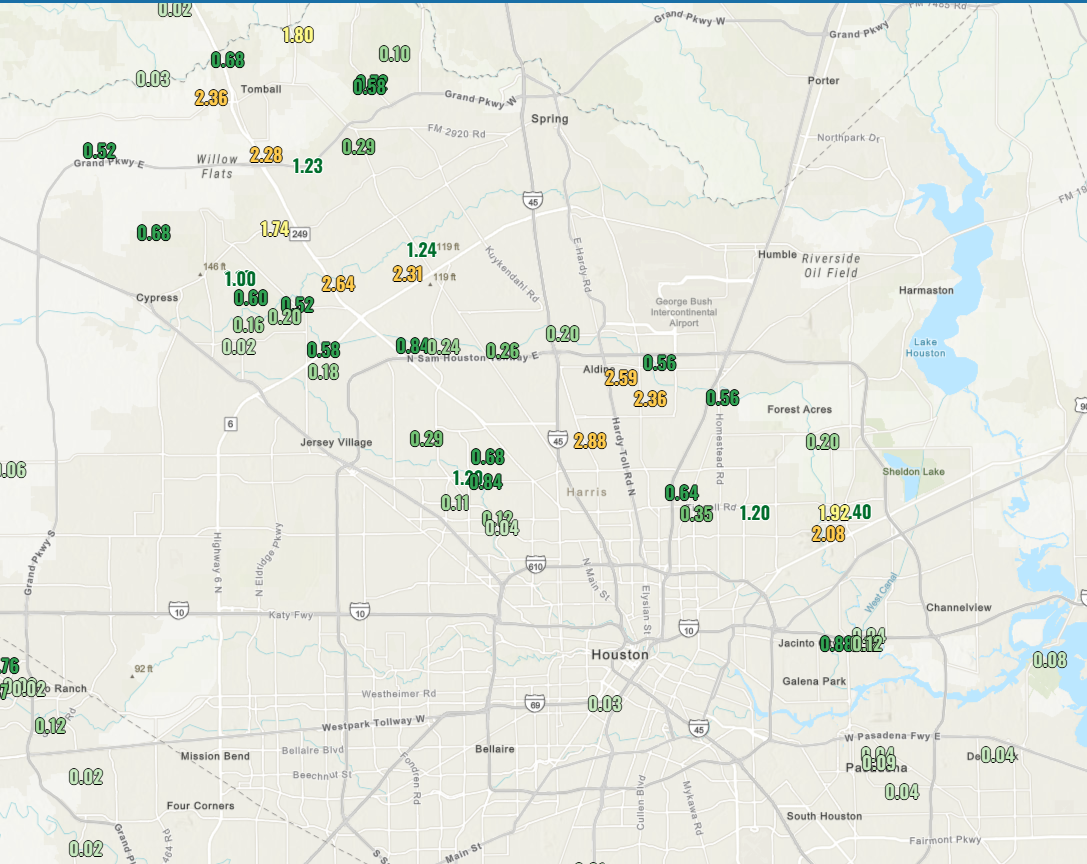
The big winner was a Harris County Flood Control gauge along Halls Bayou at Airline, with 2.88 inches. It was a narrow corridor, but it was hit good.
Onward.
Today and Thursday
99? 100? Does it even matter? It’s hot! Thankfully, as high pressure starts to loosen up a little bit, the area will see modestly “less hot” weather the next couple days. Look for upper-90s today, more like 98 or so than 99 to 100. And if you feel spicy, lop off another degree on Thursday. Rain chances will remain relatively low in terms of coverage, but like yesterday, there should be at least a few slow-moving downpours each afternoon.
Friday and Saturday
Much more of the same is expected to close the week and start the weekend. High temperatures will probably drop off another degree or two, closer to the mid-90s. Rain chances may dial up another 5 percent or so with pockets of afternoon downpours near the coast and bays and moving inland, more of a traditional sea breeze-driven type setup.
Sunday and Monday
Temperatures should “bottom out” here. Look for mid-90s and a continued chance of daily downpours. Monday may actually see the greatest coverage of daily showers over this stretch.
Rest of next week
This break looks short-lived. I would expect to see temperatures begin to increase again next week. Beginning Tuesday, high pressure begins to reload and reorient. It will probably anchor itself very near Houston or just to the north. If that happens, you can expect a multi-day stretch of temperatures flirting with 100 degrees in addition to very low rain chances. In fact, the area is highlighted on the day 8 to 14 hazards outlook for risk of “extreme heat,” which is really benchmarked at 100ish risk.
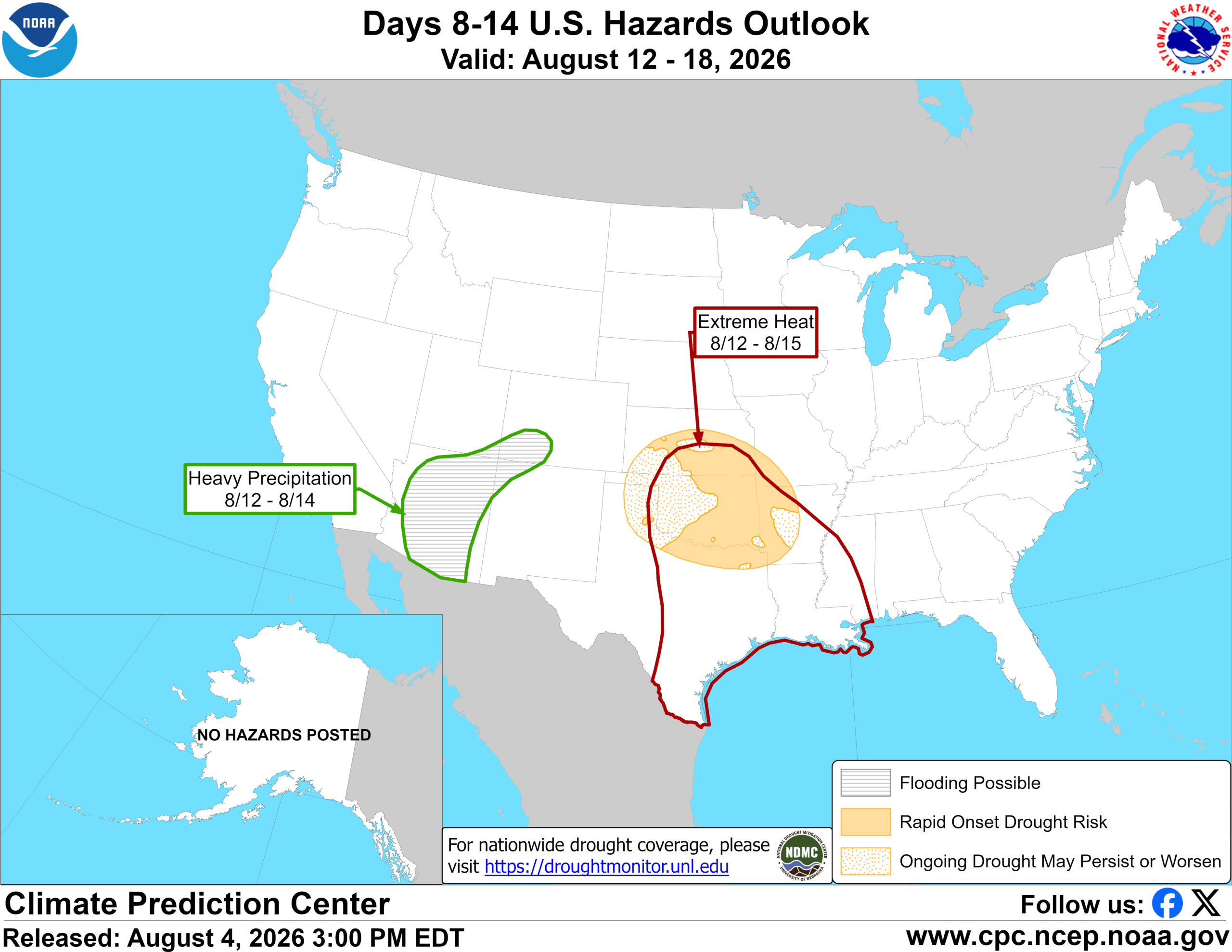
Temperatures should be back into the upper-90s by Wednesday to perhaps near 100 again by Thursday, and there they shall sit for more than a couple days. It appears that August is about to August in a very august manner.
