In brief: Sunday’s high temperatures came to within 1 degree of the city’s all time high. Relief is on the way with a cold front on Tuesday, and for now it appears as though this front will not be particularly disruptive to Election Day activities.
A steamy Sunday
Let’s be honest, the first day of November did not feel a lot like the first day of November. Sunday’s high temperature at Bush Intercontinental Airport reached 88 degrees beneath mostly sunny skies and high pressure. This brought Houston to within 1 degree of its all-time high for November 1, 89 degrees. The city has never recorded a 90-degree day in November.
We should see a few more clouds today, so most of the region, instead of reaching the mid- to upper-80s should see highs in the low- to mid-80s. Tuesday will be similarly warm and muggy before the arrival of a cold front. After this frontal passage, and another surge of drier air, Houston should experience fall-like weather through the weekend and into next week. Is anyone ready for it to start feeling like the holidays outside?
Monday
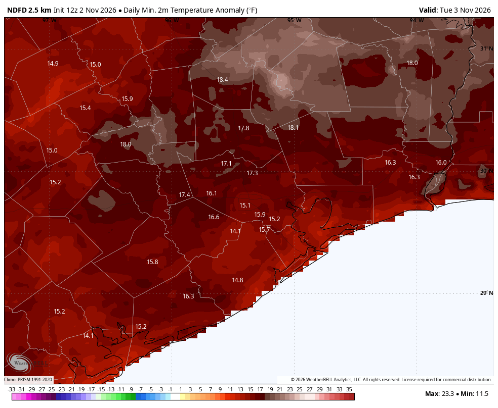
We are starting out muggy this morning, with temperatures well above normal. After some patchy fog clears away we should be left with partly sunny skies today. Highs will reach the low- to mid-80s across the region, with winds from the southeast at about 10 mph, perhaps gusting up to 20 mph this afternoon. Winds continue with anomalously warm temperatures tonight, only falling to around 70 degrees in Houston.
Election Day
Tuesday is Election Day for the U.S. Midterms. If you haven’t voted early already, what can you expect for polling place conditions? At this time we don’t expect the cold front to blow in with a single line of strong thunderstorms and severe weather, such as damaging winds. Rather, beginning during the mid- to later morning hours we should see a broken line, or broad area, of showers and thunderstorms sagging down into Houston from the northwest. These showers should persist into the early evening hours. In terms of accumulations most areas should pick up 0.25 to 0.75 inch of rain, so flooding does not look to be a concern. In short, while some rain is likely on Election Day, overall conditions do not look particularly disruptive. So get out and vote!
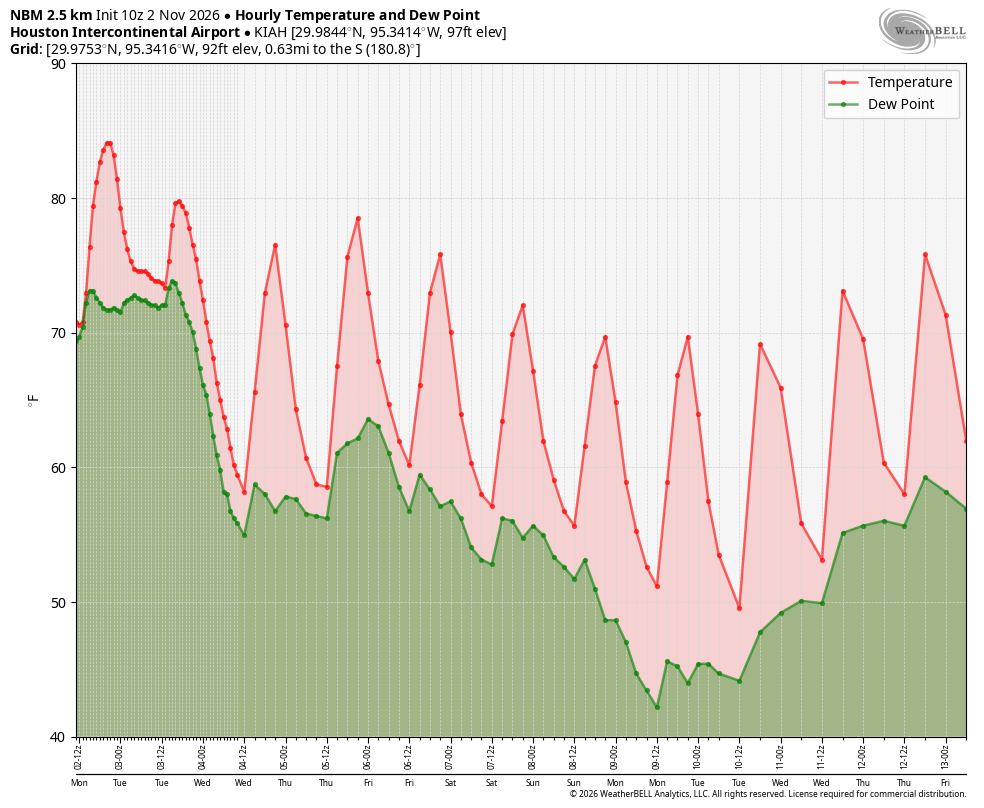
As for temperatures, I think a lot of the area will reach the lower 80s. Drier air will start to arrive later in the afternoon, with gusty winds from the northwest (gusts perhaps reaching up to about 25 mph). Lows by early Wednesday should drop into the upper 50s.
Wednesday, Thursday, and Friday
These should be partly to mostly sunny days with highs in the upper 70s and lows in the upper 50s in Houston. Low temperatures for inland regions could fall into the lower 50s. We’ll also see comfortable, lower humidity levels. Rain chances each day will be on the order of about 10 percent. It’s going to be really nice, y’all.
Saturday and Sunday
At this point I think we’ll probably see another front, of some sort, this weekend. This may lead to some slight rain chances on Saturday, but that definitely remains to be determined. Highs on Saturday should be in the 70s, with lows on Saturday night perhaps dropping down to around 50 degrees. Sunday looks to be mostly sunny, with highs in the lower 70s. We have an outside chance at a night in the 40s in Houston.
Next week
Most of next week should bring highs in the 70s and lows in the 50s. Did I mention it was going to start feeling like real fall weather around here soon?
