In brief: The remnants of Tropical Storm Edouard have traversed north of our region, but it has left a disturbed atmosphere in its wake. This should lead to healthy shower and thunderstorm chances in the coming days, and slightly cooler than normal temperatures.
Edouard gone, but an unsettled pattern remains
The remnants of Edouard have now moved over north Texas, with heavy rains lingering in places like Huntsville and Crockett this morning. While this system will continue to slowly progress north today, it will leave an unsettled pattern in its wake over Houston. This essentially means that there is plenty of atmospheric moisture and low pressure, conditions capable of producing showers and thunderstorms.
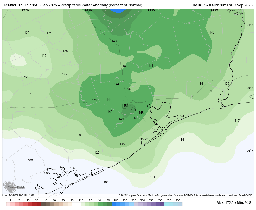
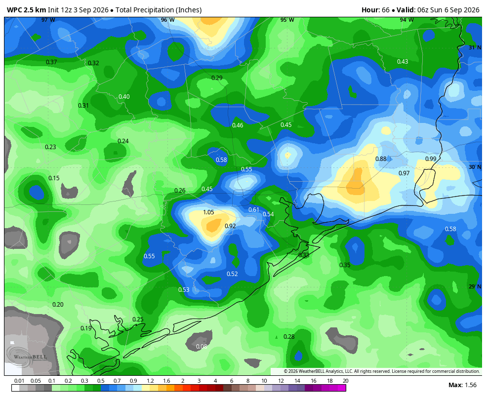
We saw the effect of this on Wednesday, when there were some fairly robust thunderstorms in northern Harris and southern Montgomery counties, including in The Woodlands. This pattern will persist into the weekend, bringing heathy rain chances to our region. Afternoon heat will provide the best opportunity for storms to form, but showers won’t occur exclusively during the afternoon and early evening hours. Over the next three days I expect most of Houston to pick up between 0.5 to 1 inch of rain, but of course there will be some areas that get more (beneath stronger cells) and some locations that miss out completely.
Thursday and Friday
Both of these days will see, as mentioned above, healthy chances of afternoon or early evening thunderstorms. I’d put chances at around 50 percent for most of the area. With mostly cloudy skies, we should see highs max out at around 90 degrees, or slightly above, for most locations. Rain chances should slacken overnight, but not completely go away. Overnight lows will fall into the upper 70s.
Saturday
This will be another day with ample moisture, so similar to Thursday and Friday I expect a healthy chance of afternoon showers and thunderstorms. Not everyone will get hit, of course, and the way it usually works in Houston is if you’re desperate for rain it’s dry, whereas two neighborhoods over it’s raining cats and dogs. Highs should peak in the low 90s.
Sunday and Monday
Sunday could go either way, as in it could see widespread showers and mostly cloudy skies, or we could start to see the influence of high pressure so conditions start to clear out and temperatures warm into the low- to mid-90s. I do expect that by Labor Day most of the region will be mostly sunny, with a lower likelihood of rain and weather that’s a bit warmer. Hopefully we can get you a more precise holiday weekend forecast in tomorrow’s post.
Next week
My general expectations for next week are a continued pattern in which we see partly to mostly sunny skies, highs in the lower 90s, and decent-to-good rain chances during the afternoon hours. We are unlikely to see a dominant ridge of high pressure develop again, as happened in August, so that should keep us open to the possibility of sea breeze showers.
