In brief: Houston’s storm pattern may tick up a little on Saturday as the Gulf opens the doors a little wider. But Sunday, Labor Day, and most of next week should feature very typical September weather for the Houston area.
Back to regularly scheduled summer in Houston, as we return to a more standard early September pattern of daily storm chances, moderate heat, and, of course, humidity. Let’s check in on how the region fared over the Tuesday-Wednesday-Thursday period for rainfall.
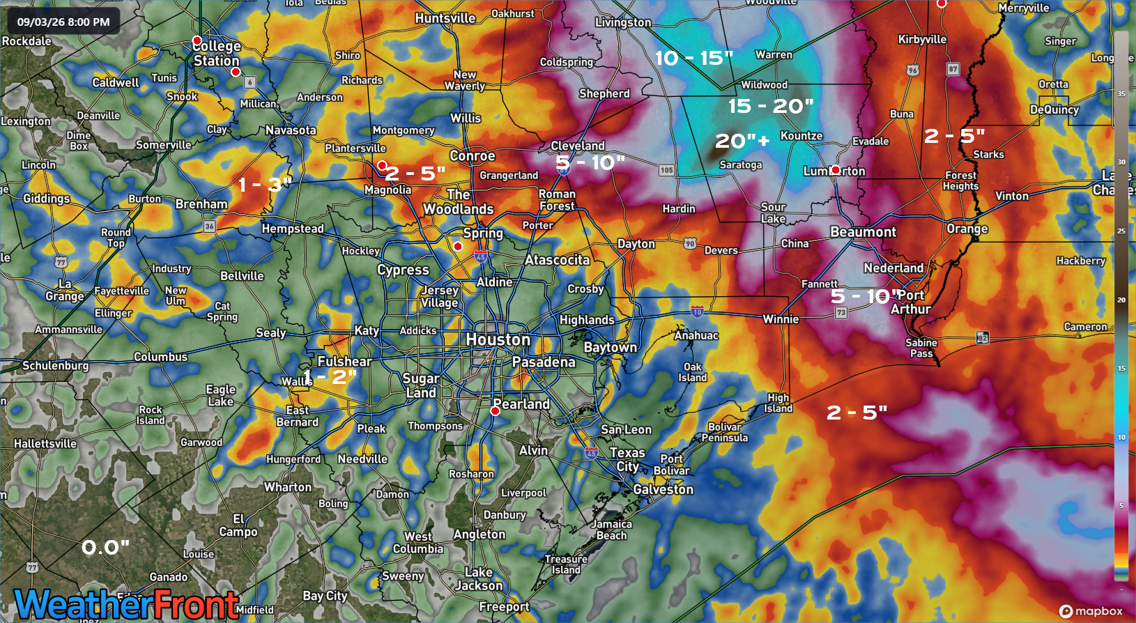
If you were lucky, you saw a cooling downpour or two. If you weren’t, well, we apologize. But most of the area at least saw a little rain, and while that may not erode developing drought concerns, hopefully some additional rains fall the next few days. But also note how close it was to being a much, much different story.
Today
We’ve already got a number of showers peppering the radar this morning. Most gauges have only seen a few hundredths of an inch of rain, but some spots should see more over the next few hours. We may see a bit of a lull around late morning and then more scattered showers and storms this afternoon. Highs should still manage to make the lower 90s this afternoon.
Saturday
Tomorrow will be a slightly more interesting day on the storm chance front. Edouard’s remnant “spin” will shift southwest of the area toward South Texas, which should open up a slightly stronger “fetch” off the Gulf. This, coupled with some upper level impulses probably upgrades our coverage of thunderstorms tomorrow afternoon. If today is isolated to scattered, tomorrow is more like scattered to numerous in terms of coverage. Or that’s what I think looking at things this morning.
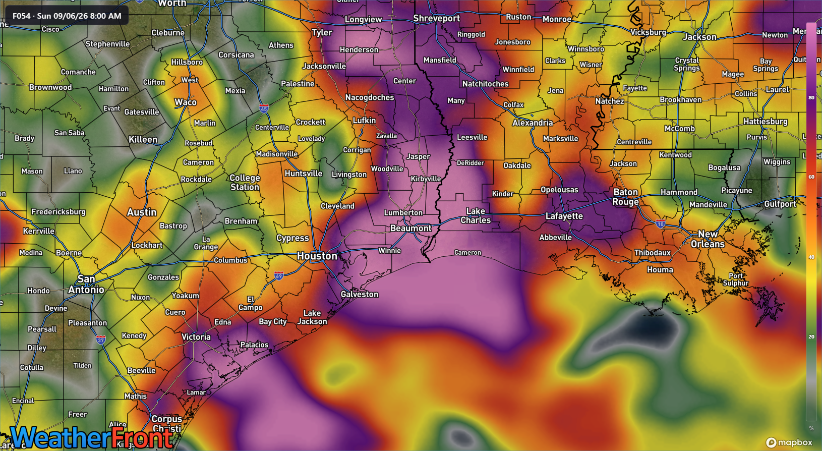
Any downpours will be capable of producing torrential rainfall, so watch for some localized street flooding. Highs may reach the low 90s, but if storms get going a little sooner, we may only get to around 90 degrees.
Sunday
Edouard’s remnants are gone gone on Sunday. This should allow us to dial back storm coverage a bit, back to the isolated to scattered bucket. Highs should be back in the low 90s.
Next week
I don’t foresee a ton of variability next week as it stands right now. Labor Day should be a lot like Sunday I think, with isolated to scattered afternoon thunderstorms. Tuesday, Wednesday, and Thursday look fairly similar. Each day should feature the requisite mixture of clouds and sun, with highs in the low to perhaps middle 90s.
The good news is that the tropics are on holiday right now, something I discussed over at The Eyewall last evening. Let’s keep it going.
