Houston has enjoyed some moderately cooler weather over the last week or so, and the official high temperature at Bush Intercontinental Airport has not risen to 95 degrees or above since June 9. Well, it’s about time to go back into the frying pan. Also, if you missed Matt’s tropical update on Tuesday, I encourage you to check it out, as it provides an overview of what we’re looking at over the next few weeks.
Wednesday
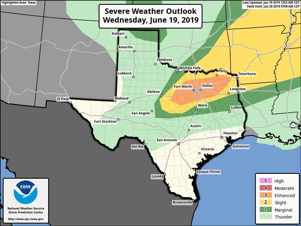
Highs today should be in the mid-90s with lots of sunshine. The atmosphere remains fairly moist, so it will be quite humid as well. Looking further afield, strong thunderstorms are possible in the Dallas-Fort Worth area later today or tonight, along with supercells that could produce tornadoes. Conditions are not perfect for such storms, but there’s an “enhanced” environment according to NOAA’s Storm Prediction Center. So if you’re traveling north today, bear that in mind.
This line of storms should sag south tonight, but forecast modeling indicates that it will peter out as it moves into counties well north of Houston, and likely die completely before reaching Montgomery County. Mostly, the Houston area can just expect a partly cloudy, warm night with low temperatures only falling to around degrees. That’s downright sultry.

Thursday and Friday
The story for the end of the work week is pretty straightforward, with partly to mostly sunny skies, and high temperatures in the mid- to upper-90s. Nights won’t cool down much. We can’t 100 percent rule out some very light showers near the coast, but yeah, I’d bet heavily against them.
Saturday, Sunday and Monday
By the weekend, high pressure should back off some, opening up the region to a bit better rain chances. I still don’t think that means much for Saturday, which should see partly sunny skies and highs in the low- to mid-90s. Rain chances are probably below 20 to 30 percent for most of Houston.
However, Sunday and Monday could be a different story, with more clouds, more atmospheric moisture, and a bit of an impetus for rising air due to the forecast upper-atmospheric pattern. We certainly don’t expect any seriously heavy rain, but more of 0.25 to 0.75 inches for parts of Houston. Temperatures should hold in the low 90s to start next week.
Tonight’s low temp needs to be plugged in to the post. Otherwise thanks for the update telling us summer is in full command now!
Ughust…. coming to a Jne near you.
Time to start wearing shorts to the office! Thanks Eric!