BREAKING: The clouds. Maybe. More on that below. If you’ve noticed that it’s been a lot drearier than normal this month, you have statistics available to back you up.
And yes, if you're wondering, it has been miserably dreary this month. It's been cloudy 83% of the time so far at 10 AM in Houston. Way above average right now. Via Iowa State IEM. pic.twitter.com/iWeUa3aEc5
— Matt Lanza (@mattlanza) February 7, 2018
This image is off of a cool site from Iowa State that has all sorts of climate and weather nuggets.I admittedly cherry picked an hour here, but other hours show some variation on this also. The link should show 3PM, which has had overcast skies reported every day this month so far. It’s been grey and dismal, and as much as I want to tell you we have a nice, lengthy stretch of good weather upcoming, we don’t.
Today & Friday
All that said, clouds have broken up some and we’ll have a half-decent day today. Satellite shows cloud cover mainly in the southeastern half of our area this morning.
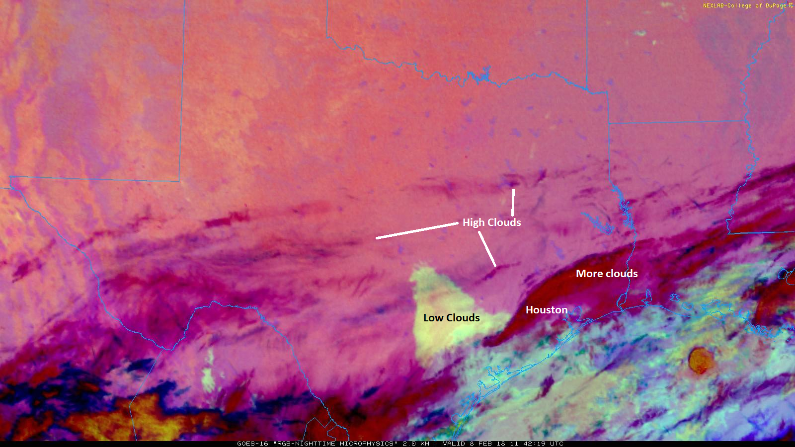
Based on the movement of the clouds, I suspect we’ll actually have more clearing today than I initially expected. We’ll call it partly cloudy to mostly sunny. Expect highs to top off in the upper 50s or so. Clouds will gradually thicken back up tonight and onshore flow will resume, allowing temperatures to not fall as much. We won’t get below the upper 40s this evening and may even rise a degree or two toward morning.
Onshore flow will continue to increase on Friday, pumping back in moisture and solidifying clouds overhead. It looks as though we’ll see showers also increase throughout the day, especially south of I-10. Expect temps to slowly, steadily warm on Friday into the mid-60s.

Weekend
Saturday’s forecast continues to be a tricky one. I was hoping we’d have better visibility on this by today. But multiple models are giving us varying answers on details. The underlying forecast is unchanged: Scattered showers and a chance of thunderstorms will be likely, along with areas of fog. But exact details are very much TBD still. I think we’ll see one round of showers Friday night as warmer air moves in. We’ll probably have a lull in the activity on Saturday morning before another round of showers and a chance of storms later Saturday into Saturday night.
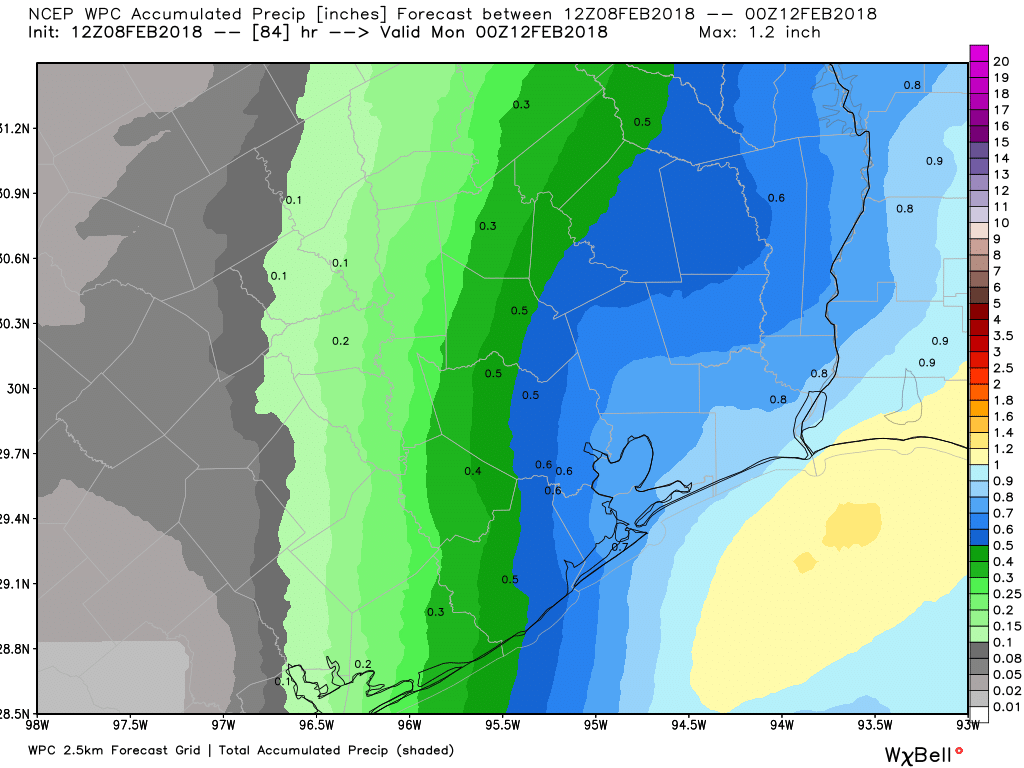
Temperatures will be warm despite the rain. Expect mid to upper-60s to perhaps near 70 degrees Saturday afternoon. That disturbance exits Saturday night, eventually replaced by a cold front that will push through then. Behind the front, expect Sunday to be a cool, damp day. Temperatures will likely top off in the mid or upper 50s, mainly in the morning. I wouldn’t be shocked if Sunday ends up a lot like yesterday: Chilly, raw, cloudy, though with perhaps fewer showers. We’ll see.
Next Week
As of right now, it appears we’ll do it again Monday through Wednesday. You should be used to the pattern by now. Monday would be a mix of clouds and sun with cool temps. Onshore flow resumes Tuesday. Shower chances tick up later in the day. Maybe another front tries to push through midweek, but that’s to be determined. Either way, it looks like shower chances are with us much of next week. We’ll hope for some improvement as we get closer. If it feels like a broken record, I don’t blame you.
I appreciate the humor! Thank you guys for always being a source of great weather and commentary. It does feel like a broken record right now…
“The link should show 3PM, which has had overcast skies reported every day this month so far. It’s been grey and dismal, and as much as I want to tell you we have a nice, lengthy stretch of good weather upcoming, we don’t.”
🙂 This “proves” my 100% unscientific conclusion yesterday that we all have been teleported to Seattle, where winter consists of drizzle, fog and clouds, i.e., “dismal.” Having visited there in May-June when the sun finally reappears, the residents look like zombies — very pale skin, blank expressions. Let’s just hope that we’re not facing a dreaded “zombie apocalypse” here. 🙂
If you think this is dreary, please don’t move to the Great Lakes States, where you don’t see the sun in the winter unless it’s going below zero in the evening.
44 Degress and thunderstorms? That’s nothing…. try a good round of thundersnow.
I know very well what “thunder snow” is, having experienced it in St. Louis in one of 8 winters there (1981-82 if memory serves). A low pressure, almost Pacific tropical system charged across Mexico and our SW and collided with one of those infamous “Arctic Expresses.” We got thunder first, then freezing rain, then 26 inches of snow in 15-30 mph wind, then a week where the “high” never exceeded 10 F. Cold enough that there were pick-up hockey games in the park near St Louis Zoo. But unlike the Great Lakes area, it was very sunny at 10 F.
Having lived 5 winters in the Lakes, I can confirm. But I’d much rather have thundersnow than 30s/40s and rain/thunder. Regardless, for Houston standards, it’s been pretty terrible lately.